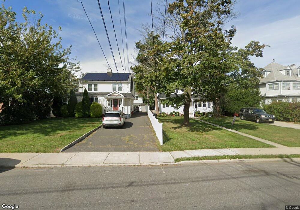
1 Sherman Ct Long Branch, NJ 07740
Estimated Value: $558,000 - $714,077
2
Beds
2
Baths
1,182
Sq Ft
$545/Sq Ft
Est. Value
About This Home
This home is located at 1 Sherman Ct, Long Branch, NJ 07740 and is currently estimated at $644,769, approximately $545 per square foot. 1 Sherman Ct is a home located in Monmouth County with nearby schools including Long Branch High School, Holy Trinity School, and Bet Yaakov of the Jersey Shore.
Ownership History
Date
Name
Owned For
Owner Type
Purchase Details
Closed on
Jun 10, 2009
Sold by
Wells Fargo Bank Na
Bought by
Brooks Jonathan and Krutisia Brooks Linda
Current Estimated Value
Purchase Details
Closed on
Feb 14, 2001
Sold by
Rodriquez Mary
Bought by
Mcsherry Michael and Mcsherry Bonnie
Home Financials for this Owner
Home Financials are based on the most recent Mortgage that was taken out on this home.
Original Mortgage
$125,460
Interest Rate
6.89%
Mortgage Type
VA
Create a Home Valuation Report for This Property
The Home Valuation Report is an in-depth analysis detailing your home's value as well as a comparison with similar homes in the area
Home Values in the Area
Average Home Value in this Area
Purchase History
| Date | Buyer | Sale Price | Title Company |
|---|---|---|---|
| Brooks Jonathan | $160,000 | Multiple | |
| Mcsherry Michael | $123,000 | -- |
Source: Public Records
Mortgage History
| Date | Status | Borrower | Loan Amount |
|---|---|---|---|
| Previous Owner | Mcsherry Michael | $125,460 |
Source: Public Records
Tax History Compared to Growth
Tax History
| Year | Tax Paid | Tax Assessment Tax Assessment Total Assessment is a certain percentage of the fair market value that is determined by local assessors to be the total taxable value of land and additions on the property. | Land | Improvement |
|---|---|---|---|---|
| 2025 | $8,484 | $582,600 | $395,900 | $186,700 |
| 2024 | $7,398 | $552,000 | $373,400 | $178,600 |
| 2023 | $7,398 | $476,400 | $305,900 | $170,500 |
| 2022 | $6,531 | $400,900 | $250,700 | $150,200 |
| 2021 | $6,531 | $326,400 | $185,900 | $140,500 |
| 2020 | $6,446 | $308,400 | $168,800 | $139,600 |
| 2019 | $6,346 | $301,900 | $168,800 | $133,100 |
| 2018 | $6,321 | $299,000 | $172,400 | $126,600 |
| 2017 | $5,965 | $289,400 | $165,200 | $124,200 |
| 2016 | $5,546 | $274,400 | $169,700 | $104,700 |
| 2015 | $4,060 | $182,300 | $57,300 | $125,000 |
| 2014 | $3,801 | $179,900 | $69,000 | $110,900 |
Source: Public Records
Map
Nearby Homes
- 12 Coral Place
- 464 2nd Ave
- 119 Avery Ave Unit H21
- 17 Tower Rd Unit D2
- 215 Cleveland Ave
- 12 Seashore Dr
- 14 Seashore Dr
- 8 Seashore Dr
- 377 Westwood Ave
- 11 Seashore Dr
- 14 Tower Rd
- 303 Westwood Ave
- 23 Woolley Ave
- 364 Westwood Ave Unit 39
- 364 Westwood Ave Unit 71
- 364 Westwood Ave Unit 21
- 237 3rd Ave Unit 1-4
- 392 Ocean Ave Unit 1302
- 392 Ocean Ave Unit 1608
- 392 Ocean Ave Unit 1203
- 376 Sherman Ct
- 378 Sherman Ct
- 386 Sherman Ct
- 388 Sherman Ct
- 372 Sherman Ct
- 384 Sherman Ct
- 384 Sairs Ave
- 384 Sairs Ave Unit 1
- 380 Sairs Ave
- 388 Sairs Ave
- 166 Bath Ave
- 392 Sairs Ave
- 154 Bath Ave
- 160 Bath Ave
- 146 N Bath Ave
- 400 Sairs Ave Unit 17
- 400 Sairs Ave Unit 7
- 184 Bath Ave
- 377 Indiana Ave
- 381 Indiana Ave