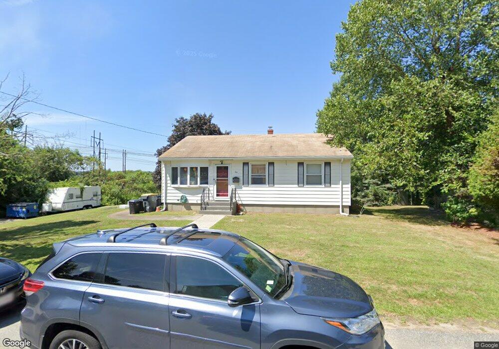
1 Slade St Somerset, MA 02725
Brayton Point NeighborhoodEstimated Value: $434,786 - $493,000
3
Beds
2
Baths
1,008
Sq Ft
$454/Sq Ft
Est. Value
About This Home
This home is located at 1 Slade St, Somerset, MA 02725 and is currently estimated at $457,447, approximately $453 per square foot. 1 Slade St is a home located in Bristol County with nearby schools including South Elementary School, Somerset Middle School, and St. Michael's School.
Ownership History
Date
Name
Owned For
Owner Type
Purchase Details
Closed on
Mar 1, 2004
Sold by
Ruth M Drury Irt and Andrade
Bought by
Callina Jason P
Current Estimated Value
Home Financials for this Owner
Home Financials are based on the most recent Mortgage that was taken out on this home.
Original Mortgage
$53,800
Outstanding Balance
$25,109
Interest Rate
5.65%
Estimated Equity
$432,338
Create a Home Valuation Report for This Property
The Home Valuation Report is an in-depth analysis detailing your home's value as well as a comparison with similar homes in the area
Home Values in the Area
Average Home Value in this Area
Purchase History
| Date | Buyer | Sale Price | Title Company |
|---|---|---|---|
| Callina Jason P | $269,000 | -- |
Source: Public Records
Mortgage History
| Date | Status | Borrower | Loan Amount |
|---|---|---|---|
| Open | Callina Jason P | $53,800 | |
| Open | Callina Jason P | $215,200 |
Source: Public Records
Tax History Compared to Growth
Tax History
| Year | Tax Paid | Tax Assessment Tax Assessment Total Assessment is a certain percentage of the fair market value that is determined by local assessors to be the total taxable value of land and additions on the property. | Land | Improvement |
|---|---|---|---|---|
| 2025 | $4,997 | $375,700 | $171,100 | $204,600 |
| 2024 | $4,693 | $366,900 | $171,100 | $195,800 |
| 2023 | $4,031 | $317,900 | $142,400 | $175,500 |
| 2022 | $3,721 | $280,000 | $122,800 | $157,200 |
| 2021 | $3,749 | $255,400 | $111,000 | $144,400 |
| 2020 | $3,700 | $243,100 | $111,100 | $132,000 |
| 2019 | $4,221 | $231,300 | $111,100 | $120,200 |
| 2018 | $3,674 | $216,600 | $106,000 | $110,600 |
| 2017 | $3,579 | $205,700 | $100,600 | $105,100 |
| 2016 | $3,602 | $205,700 | $100,600 | $105,100 |
| 2015 | $3,307 | $190,600 | $91,100 | $99,500 |
| 2014 | $4,695 | $194,400 | $91,100 | $103,300 |
Source: Public Records
Map
Nearby Homes
- 167 Mercier Ave
- 127 Sheraton Ave
- 132 Jackson Ave
- 462 Harbor View Blvd
- 19 Keller Ave
- 675 Lees River Ave
- 105 Cornhill Rd
- 197 Alberta Ave
- 19 Richard Rd
- 58 Randall Ave
- 60 Aetna St
- 30 Front St
- 24 Front St
- 8 2nd St
- 159 Wilder St
- 33 Rhinecliffe Rd
- 196 Coolidge St
- 1000 Riverside Ave
- 41 James Ave
- 750 Davol St Unit 1012