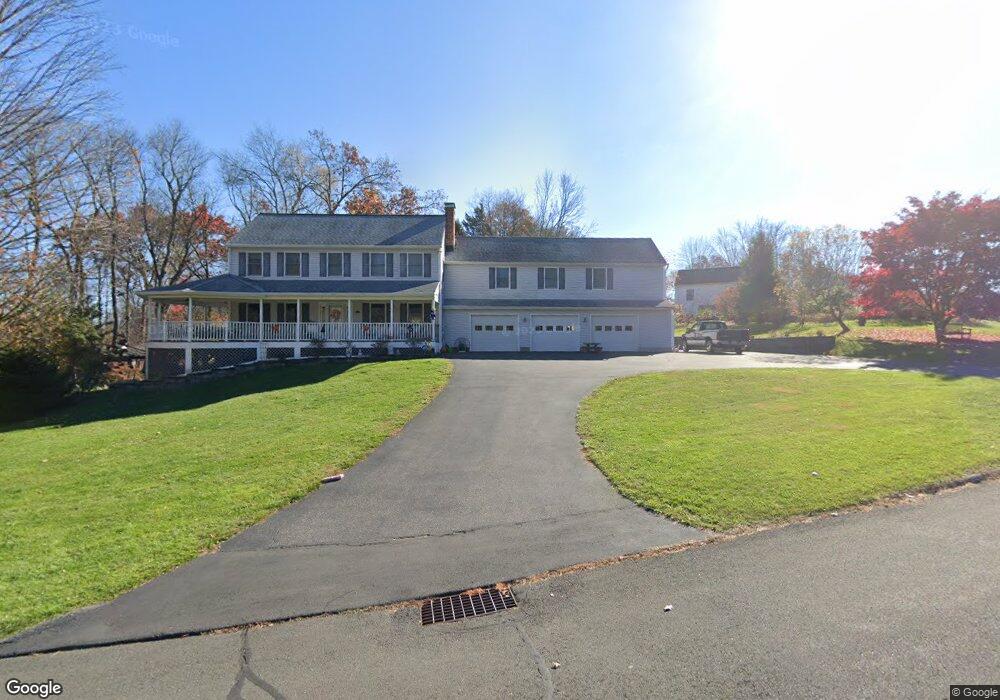
1 Spruce Dr Brookfield, CT 06804
Estimated Value: $697,000 - $814,000
4
Beds
3
Baths
2,400
Sq Ft
$322/Sq Ft
Est. Value
About This Home
This home is located at 1 Spruce Dr, Brookfield, CT 06804 and is currently estimated at $771,904, approximately $321 per square foot. 1 Spruce Dr is a home located in Fairfield County with nearby schools including Whisconier Middle School, Brookfield High School, and Montessori Community School at Brookfield.
Ownership History
Date
Name
Owned For
Owner Type
Purchase Details
Closed on
Jul 8, 2020
Sold by
Scully John E and Scully Barbara L
Bought by
Unluturk Sukru and Karadag-Unluturk Neval
Current Estimated Value
Home Financials for this Owner
Home Financials are based on the most recent Mortgage that was taken out on this home.
Original Mortgage
$438,750
Outstanding Balance
$389,054
Interest Rate
3.1%
Mortgage Type
Purchase Money Mortgage
Estimated Equity
$382,850
Purchase Details
Closed on
Sep 1, 1977
Bought by
Scully John E and Scully Barbara I
Create a Home Valuation Report for This Property
The Home Valuation Report is an in-depth analysis detailing your home's value as well as a comparison with similar homes in the area
Home Values in the Area
Average Home Value in this Area
Purchase History
| Date | Buyer | Sale Price | Title Company |
|---|---|---|---|
| Unluturk Sukru | $487,500 | None Available | |
| Unluturk Sukru | $487,500 | None Available | |
| Scully John E | -- | -- |
Source: Public Records
Mortgage History
| Date | Status | Borrower | Loan Amount |
|---|---|---|---|
| Open | Unluturk Sukru | $438,750 | |
| Closed | Unluturk Sukru | $438,750 | |
| Previous Owner | Scully John E | $180,000 |
Source: Public Records
Tax History
| Year | Tax Paid | Tax Assessment Tax Assessment Total Assessment is a certain percentage of the fair market value that is determined by local assessors to be the total taxable value of land and additions on the property. | Land | Improvement |
|---|---|---|---|---|
| 2025 | $11,540 | $398,900 | $97,830 | $301,070 |
| 2024 | $11,129 | $398,900 | $97,830 | $301,070 |
| 2023 | $10,714 | $398,900 | $97,830 | $301,070 |
| 2022 | $10,324 | $398,900 | $97,830 | $301,070 |
| 2021 | $9,764 | $324,370 | $108,700 | $215,670 |
| 2020 | $9,618 | $324,370 | $108,700 | $215,670 |
| 2019 | $9,452 | $324,370 | $108,700 | $215,670 |
| 2018 | $9,193 | $324,370 | $108,700 | $215,670 |
| 2017 | $8,852 | $324,370 | $108,700 | $215,670 |
| 2016 | $8,930 | $338,250 | $124,200 | $214,050 |
| 2015 | $8,693 | $338,250 | $124,200 | $214,050 |
| 2014 | $8,693 | $338,250 | $124,200 | $214,050 |
Source: Public Records
Map
Nearby Homes
- 7 Homestead Ln
- 16 Homestead Ln
- 28 Rollingwood Dr
- 2 Autumn's Way
- 11 Eden Ct Unit 11
- 4 Arlington Ct
- 12 Oak Crest Dr
- 8 Marilyn Rd
- 8 Hawleyville Rd
- 32 Redwood Dr
- 54 Redwood Dr
- 47 Copper Square Dr
- 1805 Cypress Dr
- 1902 Cypress Dr Unit 1902
- 75 Copper Square Dr
- 23 Farrell Rd
- 12 Fieldstone Ct Unit 12
- 8 Fieldstone Ct Unit 8
- 10 Fieldstone Ct Unit 10
- 135 Logging Trail Rd Unit 135
Your Personal Tour Guide
Ask me questions while you tour the home.