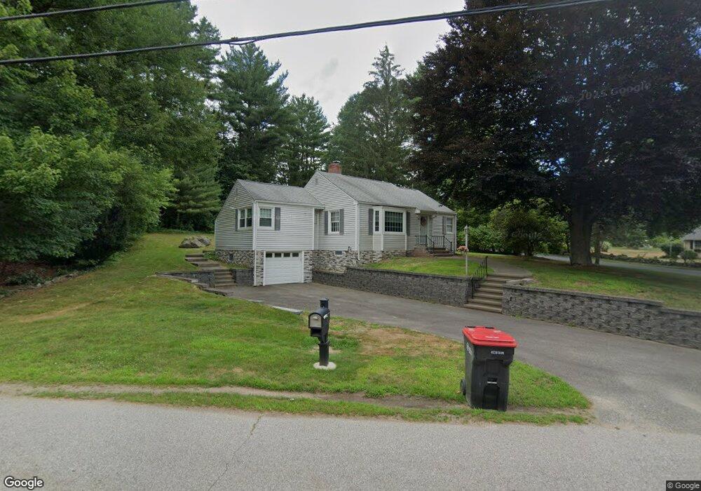
1 Spruce St Foxboro, MA 02035
Estimated Value: $538,000 - $668,000
1
Bed
2
Baths
1,200
Sq Ft
$484/Sq Ft
Est. Value
About This Home
This home is located at 1 Spruce St, Foxboro, MA 02035 and is currently estimated at $580,431, approximately $483 per square foot. 1 Spruce St is a home located in Norfolk County with nearby schools including Foxborough High School, Foxborough Regional Charter School, and Hands-On-Montessori School.
Ownership History
Date
Name
Owned For
Owner Type
Purchase Details
Closed on
Jan 10, 2025
Sold by
Viscardi Denise A
Bought by
Viscardi Denise A and Viscardi Michael P
Current Estimated Value
Purchase Details
Closed on
Feb 9, 2010
Sold by
Viscardi Denise A and Kettell Denise A
Bought by
Viscardi Denise A
Home Financials for this Owner
Home Financials are based on the most recent Mortgage that was taken out on this home.
Original Mortgage
$276,760
Interest Rate
5.05%
Mortgage Type
FHA
Purchase Details
Closed on
Oct 9, 1992
Sold by
Greer Stuart T and Greer Barbara T
Bought by
Kettell Richard J and Kettell Denise A
Create a Home Valuation Report for This Property
The Home Valuation Report is an in-depth analysis detailing your home's value as well as a comparison with similar homes in the area
Home Values in the Area
Average Home Value in this Area
Purchase History
| Date | Buyer | Sale Price | Title Company |
|---|---|---|---|
| Viscardi Denise A | -- | None Available | |
| Viscardi Denise A | -- | None Available | |
| Viscardi Denise A | -- | -- | |
| Viscardi Denise A | -- | -- | |
| Viscardi Denise A | -- | -- | |
| Kettell Richard J | $143,900 | -- |
Source: Public Records
Mortgage History
| Date | Status | Borrower | Loan Amount |
|---|---|---|---|
| Previous Owner | Viscardi Denise A | $276,760 | |
| Previous Owner | Kettell Richard J | $62,000 | |
| Previous Owner | Kettell Richard J | $14,800 |
Source: Public Records
Tax History Compared to Growth
Tax History
| Year | Tax Paid | Tax Assessment Tax Assessment Total Assessment is a certain percentage of the fair market value that is determined by local assessors to be the total taxable value of land and additions on the property. | Land | Improvement |
|---|---|---|---|---|
| 2025 | $5,924 | $448,100 | $250,000 | $198,100 |
| 2024 | $5,796 | $429,000 | $250,000 | $179,000 |
| 2023 | $5,452 | $383,700 | $238,100 | $145,600 |
| 2022 | $5,477 | $377,200 | $227,800 | $149,400 |
| 2021 | $5,199 | $352,700 | $207,100 | $145,600 |
| 2020 | $4,971 | $341,200 | $207,100 | $134,100 |
| 2019 | $4,797 | $326,300 | $197,200 | $129,100 |
| 2018 | $4,638 | $318,300 | $197,200 | $121,100 |
| 2017 | $4,444 | $295,500 | $184,300 | $111,200 |
| 2016 | $4,354 | $293,800 | $177,500 | $116,300 |
| 2015 | $4,082 | $268,700 | $149,800 | $118,900 |
| 2014 | $4,022 | $268,300 | $146,900 | $121,400 |
Source: Public Records
Map
Nearby Homes
- 406 South St
- 80 Mill St
- 16 Treasure Island Rd
- 9 Oak Dr
- 483 Thurston St
- 120 Hawes St
- 24 Maverick Dr
- 450 West St
- 356 Central St
- 12 Spring St
- 126 Washington St
- 130 Washington St
- 124 Washington St
- 158 Washington St
- 65 Pond St
- 11 Orchard Place Unit 11
- 14 Baker St
- 4 Buckskin Dr
- 24 Mechanic St
- 166 Chauncy St