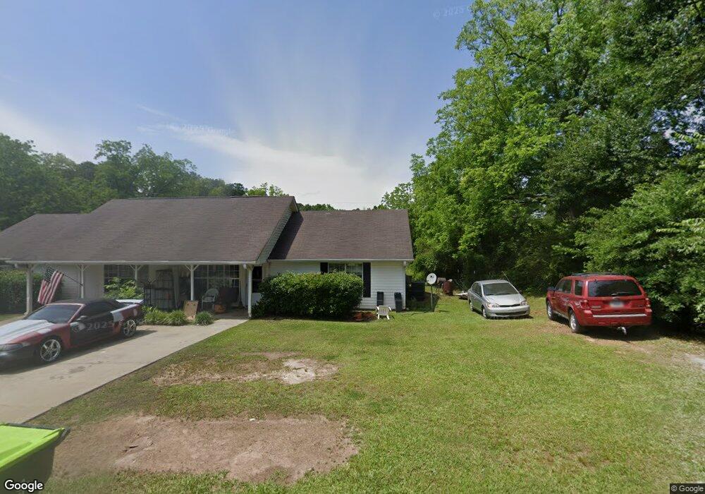
1 Stovall St Sharpsburg, GA 30277
Estimated Value: $253,000 - $308,000
4
Beds
4
Baths
2,052
Sq Ft
$139/Sq Ft
Est. Value
About This Home
This home is located at 1 Stovall St, Sharpsburg, GA 30277 and is currently estimated at $284,227, approximately $138 per square foot. 1 Stovall St is a home located in Coweta County with nearby schools including Poplar Road Elementary School, East Coweta Middle School, and East Coweta High School.
Ownership History
Date
Name
Owned For
Owner Type
Purchase Details
Closed on
Sep 22, 2016
Sold by
Shannon
Bought by
Dream Tree Llc
Current Estimated Value
Home Financials for this Owner
Home Financials are based on the most recent Mortgage that was taken out on this home.
Original Mortgage
$98,437
Outstanding Balance
$78,414
Interest Rate
3.43%
Mortgage Type
New Conventional
Estimated Equity
$205,813
Purchase Details
Closed on
Nov 29, 2011
Sold by
Town Of Sharpsburg
Bought by
Rushing Roger L
Purchase Details
Closed on
Apr 15, 1999
Sold by
Hyde Cheryl C and Hyde Larr
Bought by
Hyde Properties Inc
Create a Home Valuation Report for This Property
The Home Valuation Report is an in-depth analysis detailing your home's value as well as a comparison with similar homes in the area
Home Values in the Area
Average Home Value in this Area
Purchase History
| Date | Buyer | Sale Price | Title Company |
|---|---|---|---|
| Dream Tree Llc | -- | -- | |
| Wiles Shannon | $131,250 | -- | |
| Rushing Roger L | -- | -- | |
| Hyde Properties Inc | -- | -- |
Source: Public Records
Mortgage History
| Date | Status | Borrower | Loan Amount |
|---|---|---|---|
| Open | Wiles Shannon | $98,437 | |
| Closed | Dream Tree Llc | $98,437 |
Source: Public Records
Tax History Compared to Growth
Tax History
| Year | Tax Paid | Tax Assessment Tax Assessment Total Assessment is a certain percentage of the fair market value that is determined by local assessors to be the total taxable value of land and additions on the property. | Land | Improvement |
|---|---|---|---|---|
| 2025 | $2,558 | $101,353 | $5,180 | $96,173 |
| 2024 | $2,399 | $95,738 | $5,180 | $90,558 |
| 2023 | $2,399 | $76,349 | $5,180 | $71,169 |
| 2022 | $1,972 | $73,853 | $5,180 | $68,673 |
| 2021 | $1,823 | $62,852 | $5,180 | $57,672 |
| 2020 | $1,857 | $62,852 | $5,180 | $57,672 |
| 2019 | $1,704 | $52,199 | $4,000 | $48,199 |
| 2018 | $1,714 | $52,199 | $4,000 | $48,199 |
| 2017 | $1,716 | $52,199 | $4,000 | $48,199 |
| 2016 | $1,708 | $52,199 | $4,000 | $48,199 |
| 2015 | $1,684 | $52,199 | $4,000 | $48,199 |
| 2014 | $1,685 | $52,199 | $4,000 | $48,199 |
Source: Public Records
Map
Nearby Homes
- 138 Main St
- 1 Mcintosh Trail
- 0 Bob Smith Rd Unit 10562838
- 140 Halo Trace
- 196 Bob Smith Rd
- 250 Bob Smith Rd
- 296 Mcintosh Trail
- 28 Fawn Ct
- 483 Mcintosh Trail
- 180 Saint James Place
- Briarwood Plan at Twelve Parks 55+
- Sullivan Plan at Twelve Parks 55+
- 4 Unicoi Trail
- 12 Unicoi Trail
- Crestwood Plan at Twelve Parks 55+
- 98 Keown Loop
- Brunswick Plan at Twelve Parks 55+
- 244 Turin Rd
- 42 S Hunter St
- 8 Chiefs Trail
- 156 Terrentine Rd
- 5 Stovall St
- 170 Terrentine Rd
- 0 Durham Estates Unit Lot 4 8904932
- Lot 71 Silver Comet Trail
- 169 Terrentine Rd
- 172 Terrentine Rd
- 58 Main St
- 0 Lodgepole Pine Ct Unit 5 7428530
- 0 Big Horn Dr Unit 12 7427917
- 0 Big Horn Dr Unit 11 7427957
- 0 Lodgepole Pine Ct Unit 3 7428523
- 0 Big Horn Dr Unit 23 7427838
- 0 Big Horn Dr Unit 24 7427783
- 0 Big Horn Dr Unit 25 7427760
- 0 Lodgepole Pine Ct Unit 4 7428526
- 0 Big Horn Dr Unit 7 7427864
- 0 Lodgepole Pine Ct Unit 5
- 0 Big Horn Dr Unit 7
- 0 Big Horn Dr Unit 25