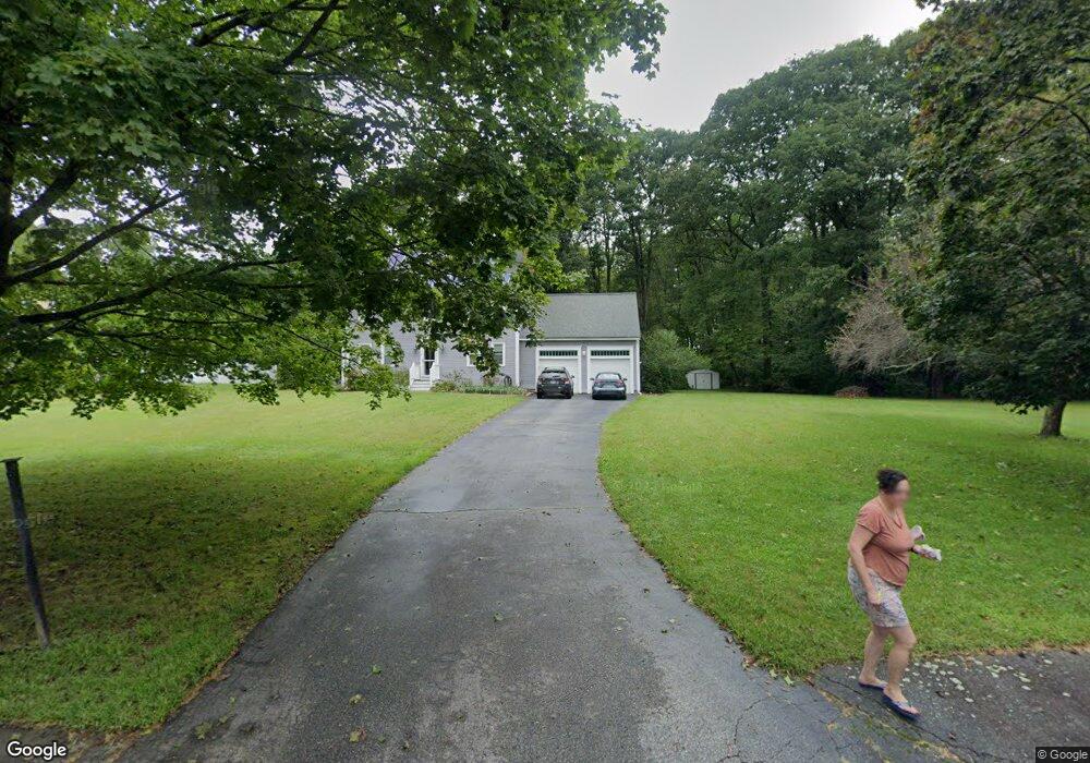
1 Sunrise Dr Southborough, MA 01772
Estimated Value: $867,400 - $1,030,000
4
Beds
3
Baths
2,186
Sq Ft
$429/Sq Ft
Est. Value
About This Home
This home is located at 1 Sunrise Dr, Southborough, MA 01772 and is currently estimated at $937,850, approximately $429 per square foot. 1 Sunrise Dr is a home located in Worcester County with nearby schools including Albert S. Woodward Memorial School, Margaret A. Neary School, and P. Brent Trottier Middle School.
Ownership History
Date
Name
Owned For
Owner Type
Purchase Details
Closed on
Aug 31, 2015
Sold by
Davis Michel L and Davis Scott A
Bought by
Davis Michel L
Current Estimated Value
Home Financials for this Owner
Home Financials are based on the most recent Mortgage that was taken out on this home.
Original Mortgage
$215,000
Outstanding Balance
$162,446
Interest Rate
3%
Mortgage Type
Adjustable Rate Mortgage/ARM
Estimated Equity
$775,404
Purchase Details
Closed on
Dec 1, 2004
Sold by
Levy Laurie A
Bought by
Davis Michel Lee and Davis Scott A
Purchase Details
Closed on
Apr 28, 2000
Sold by
Blackwood Clifton M and Blackwood Elizabeth K
Bought by
Levy Michael S and Levy Laurie A
Purchase Details
Closed on
May 23, 1997
Sold by
Bolstridge Richard T and Bolstridge Barbara F
Bought by
Blackwood Clifton M and Blackwood Elizabeth K
Purchase Details
Closed on
Mar 7, 1996
Sold by
Cononico Judith
Bought by
Bolstridge Richard and Bolstridge Barbara
Create a Home Valuation Report for This Property
The Home Valuation Report is an in-depth analysis detailing your home's value as well as a comparison with similar homes in the area
Home Values in the Area
Average Home Value in this Area
Purchase History
| Date | Buyer | Sale Price | Title Company |
|---|---|---|---|
| Davis Michel L | -- | -- | |
| Davis Michel Lee | $559,000 | -- | |
| Levy Michael S | $364,900 | -- | |
| Blackwood Clifton M | $277,000 | -- | |
| Bolstridge Richard | $245,000 | -- |
Source: Public Records
Mortgage History
| Date | Status | Borrower | Loan Amount |
|---|---|---|---|
| Open | Davis Michel L | $215,000 | |
| Previous Owner | Bolstridge Richard | $152,000 | |
| Previous Owner | Bolstridge Richard | $159,385 |
Source: Public Records
Tax History Compared to Growth
Tax History
| Year | Tax Paid | Tax Assessment Tax Assessment Total Assessment is a certain percentage of the fair market value that is determined by local assessors to be the total taxable value of land and additions on the property. | Land | Improvement |
|---|---|---|---|---|
| 2025 | $10,663 | $772,100 | $325,200 | $446,900 |
| 2024 | $10,053 | $722,700 | $315,100 | $407,600 |
| 2023 | $9,770 | $661,900 | $307,300 | $354,600 |
| 2022 | $9,284 | $570,300 | $263,300 | $307,000 |
| 2021 | $6,471 | $569,900 | $250,100 | $319,800 |
| 2020 | $9,148 | $549,100 | $240,100 | $309,000 |
| 2019 | $6,343 | $530,500 | $230,100 | $300,400 |
| 2018 | $8,414 | $521,300 | $230,100 | $291,200 |
| 2017 | $923 | $512,600 | $230,100 | $282,500 |
| 2016 | $8,060 | $509,500 | $220,300 | $289,200 |
| 2015 | $8,036 | $501,600 | $215,500 | $286,100 |
Source: Public Records
Map
Nearby Homes
- 81 Breakneck Hill Rd
- 3 Sunrise Dr
- 94 Breakneck Hill Rd
- 5 Sunrise Dr
- 77 Breakneck Hill Rd
- 92 Breakneck Hill Rd
- 98 Breakneck Hill Rd
- 2 Ashley Rd
- 100 Breakneck Hill Rd
- 75 Breakneck Hill Rd
- 6 Sunrise Dr
- 4 Ashley Rd
- 102 Breakneck Hill Rd
- 6 Ashley Rd
- 0 Lot 0 Woodland Rd Unit 50476157
- 7 Sunrise Dr
- 103 Woodland Rd
- 73 Breakneck Hill Rd
- 8 Davis Rd
- 101 Woodland Rd