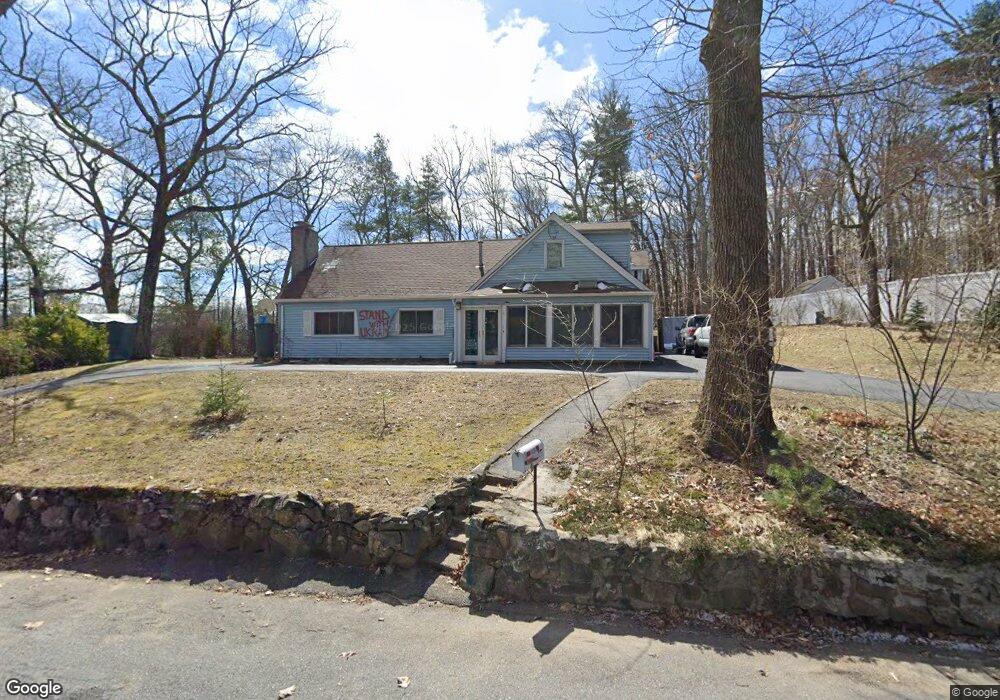
1 Taylor Rd Maynard, MA 01754
Estimated Value: $730,000 - $867,000
5
Beds
4
Baths
2,775
Sq Ft
$285/Sq Ft
Est. Value
About This Home
This home is located at 1 Taylor Rd, Maynard, MA 01754 and is currently estimated at $791,861, approximately $285 per square foot. 1 Taylor Rd is a home located in Middlesex County with nearby schools including Green Meadow School, Fowler School, and Maynard High School.
Ownership History
Date
Name
Owned For
Owner Type
Purchase Details
Closed on
Jun 8, 2017
Sold by
Delorenzo Jeffrey and Delorenzo Nicole
Bought by
Yablonsky Wayne
Current Estimated Value
Home Financials for this Owner
Home Financials are based on the most recent Mortgage that was taken out on this home.
Original Mortgage
$75,000
Outstanding Balance
$39,365
Interest Rate
4.03%
Mortgage Type
New Conventional
Estimated Equity
$752,496
Purchase Details
Closed on
Jun 28, 2012
Sold by
Dempsey Diane C
Bought by
Delorenzo Jeffrey and Dinardo Nicole
Home Financials for this Owner
Home Financials are based on the most recent Mortgage that was taken out on this home.
Original Mortgage
$213,560
Interest Rate
3.78%
Mortgage Type
New Conventional
Purchase Details
Closed on
Aug 24, 2007
Sold by
Athorn Charles M and Athorn Terry J
Bought by
Albota Elizabeth and Albota Marius A
Create a Home Valuation Report for This Property
The Home Valuation Report is an in-depth analysis detailing your home's value as well as a comparison with similar homes in the area
Home Values in the Area
Average Home Value in this Area
Purchase History
| Date | Buyer | Sale Price | Title Company |
|---|---|---|---|
| Yablonsky Wayne | $250,100 | -- | |
| Delorenzo Jeffrey | $217,500 | -- | |
| Albota Elizabeth | $391,000 | -- |
Source: Public Records
Mortgage History
| Date | Status | Borrower | Loan Amount |
|---|---|---|---|
| Open | Yablonsky Wayne | $75,000 | |
| Previous Owner | Delorenzo Jeffrey | $213,560 |
Source: Public Records
Tax History
| Year | Tax Paid | Tax Assessment Tax Assessment Total Assessment is a certain percentage of the fair market value that is determined by local assessors to be the total taxable value of land and additions on the property. | Land | Improvement |
|---|---|---|---|---|
| 2025 | $11,226 | $629,600 | $294,000 | $335,600 |
| 2024 | $10,535 | $589,200 | $280,000 | $309,200 |
| 2023 | $10,422 | $549,400 | $266,700 | $282,700 |
| 2022 | $10,397 | $506,700 | $224,000 | $282,700 |
| 2021 | $5,878 | $514,600 | $224,000 | $290,600 |
| 2020 | $3,661 | $493,300 | $202,700 | $290,600 |
| 2019 | $9,767 | $464,200 | $193,600 | $270,600 |
| 2018 | $9,124 | $403,000 | $176,000 | $227,000 |
| 2017 | $8,870 | $403,000 | $176,000 | $227,000 |
| 2016 | $8,564 | $403,000 | $176,000 | $227,000 |
| 2015 | $8,045 | $360,600 | $168,000 | $192,600 |
| 2014 | $7,920 | $355,300 | $162,700 | $192,600 |
Source: Public Records
Map
Nearby Homes
- 41 Taylor Rd
- 38 Fairfield St
- 13 Arthur St Unit 15
- 2 Wall Ct
- 31-33 Roosevelt St
- 5 Hayes St Unit 5
- 22 Douglas Ave Unit 2
- 22 Douglas Ave Unit 1
- 153 Summer St
- 62 Waltham St
- 6 Nancy Cir
- 3 Apple Ridge Rd Unit 2
- 1 Apple Ridge Unit 2
- 74 Pompositticut St
- 36 Brown St
- 70 Powder Mill Rd
- 63 Conant St
- 48 Chanticleer Rd
- 1 Carlton Dr
- 8 Snowberry Ln
Your Personal Tour Guide
Ask me questions while you tour the home.