Estimated Value: $1,544,000 - $1,945,000
5
Beds
4
Baths
5,027
Sq Ft
$354/Sq Ft
Est. Value
About This Home
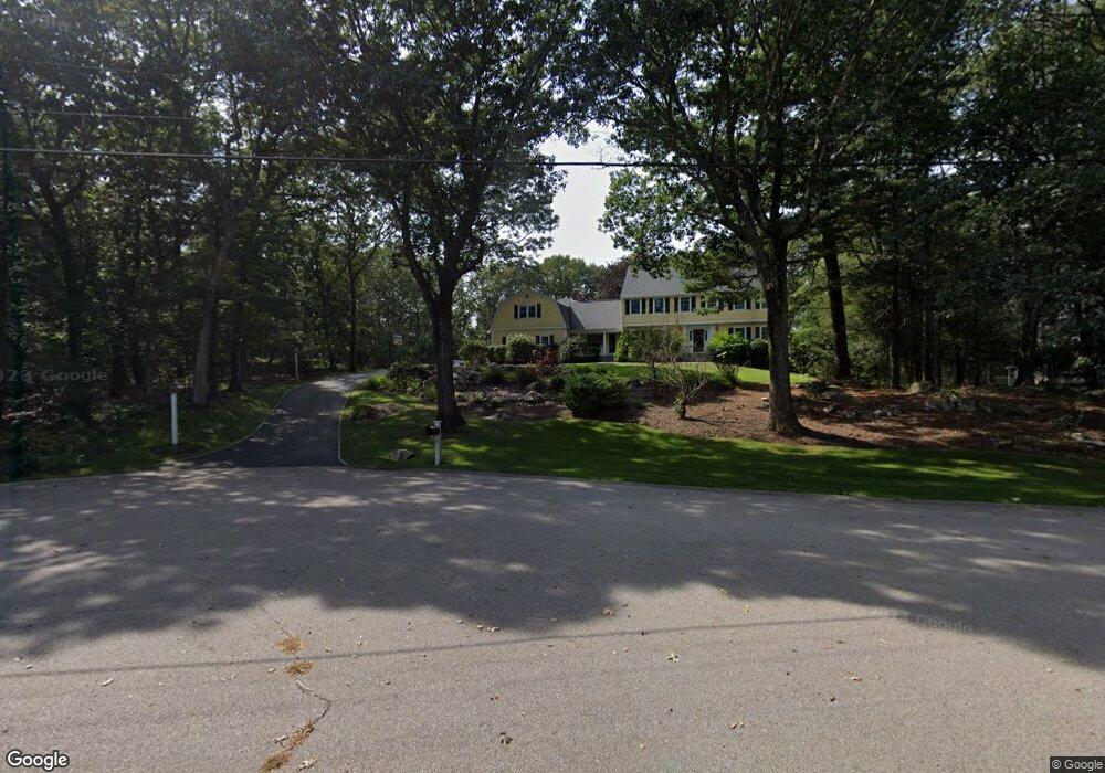
This home is located at 1 Tower Dr, Dover, MA 02030 and is currently estimated at $1,781,789, approximately $354 per square foot. 1 Tower Dr is a home located in Norfolk County with nearby schools including Chickering Elementary School, Dover-Sherborn Regional Middle School, and Dover-Sherborn Regional High School.
Ownership History
Date
Name
Owned For
Owner Type
Purchase Details
Closed on
May 17, 2002
Sold by
Teixeira Diogo B
Bought by
Boland Christopher and Boland Sheryl
Current Estimated Value
Home Financials for this Owner
Home Financials are based on the most recent Mortgage that was taken out on this home.
Original Mortgage
$100,000
Interest Rate
7.15%
Mortgage Type
Purchase Money Mortgage
Purchase Details
Closed on
Oct 28, 1991
Sold by
Claeboe Anita D
Bought by
Teiseira Diogo B
Create a Home Valuation Report for This Property
The Home Valuation Report is an in-depth analysis detailing your home's value as well as a comparison with similar homes in the area
Home Values in the Area
Average Home Value in this Area
Purchase History
| Date | Buyer | Sale Price | Title Company |
|---|---|---|---|
| Boland Christopher | $840,000 | -- | |
| Teiseira Diogo B | $450,000 | -- |
Source: Public Records
Mortgage History
| Date | Status | Borrower | Loan Amount |
|---|---|---|---|
| Open | Teiseira Diogo B | $344,000 | |
| Closed | Teiseira Diogo B | $294,000 | |
| Closed | Boland Christopher | $100,000 | |
| Previous Owner | Teiseira Diogo B | $500,000 |
Source: Public Records
Tax History
| Year | Tax Paid | Tax Assessment Tax Assessment Total Assessment is a certain percentage of the fair market value that is determined by local assessors to be the total taxable value of land and additions on the property. | Land | Improvement |
|---|---|---|---|---|
| 2025 | $17,020 | $1,510,200 | $668,700 | $841,500 |
| 2024 | $15,708 | $1,433,200 | $646,900 | $786,300 |
| 2023 | $15,250 | $1,251,000 | $568,300 | $682,700 |
| 2022 | $14,271 | $1,149,000 | $546,500 | $602,500 |
| 2021 | $14,535 | $1,127,600 | $546,500 | $581,100 |
| 2020 | $14,478 | $1,127,600 | $546,500 | $581,100 |
| 2019 | $14,580 | $1,127,600 | $546,500 | $581,100 |
| 2018 | $14,028 | $1,092,500 | $546,500 | $546,000 |
| 2017 | $13,900 | $1,065,100 | $503,000 | $562,100 |
| 2016 | $13,511 | $1,049,000 | $503,000 | $546,000 |
| 2015 | $13,018 | $1,025,000 | $479,000 | $546,000 |
Source: Public Records
Map
Nearby Homes
Your Personal Tour Guide
Ask me questions while you tour the home.