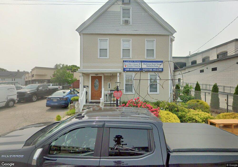
1 Union Place Dedham, MA 02026
Dedham Village NeighborhoodEstimated Value: $761,837
1
Bed
3
Baths
2,670
Sq Ft
$285/Sq Ft
Est. Value
About This Home
This home is located at 1 Union Place, Dedham, MA 02026 and is currently estimated at $761,837, approximately $285 per square foot. 1 Union Place is a home located in Norfolk County with nearby schools including Avery, Dedham Middle School, and Dedham High School.
Ownership History
Date
Name
Owned For
Owner Type
Purchase Details
Closed on
Jun 8, 2017
Sold by
Motherbrook Rt
Bought by
1 Union Place Rt
Current Estimated Value
Home Financials for this Owner
Home Financials are based on the most recent Mortgage that was taken out on this home.
Original Mortgage
$346,500
Outstanding Balance
$288,295
Interest Rate
4.03%
Mortgage Type
Commercial
Estimated Equity
$473,542
Purchase Details
Closed on
Nov 29, 2011
Sold by
Oconnor John M and Oconnor Doreen
Bought by
Oconnor John M
Create a Home Valuation Report for This Property
The Home Valuation Report is an in-depth analysis detailing your home's value as well as a comparison with similar homes in the area
Home Values in the Area
Average Home Value in this Area
Purchase History
| Date | Buyer | Sale Price | Title Company |
|---|---|---|---|
| 1 Union Place Rt | $462,000 | -- | |
| Oconnor John M | -- | -- |
Source: Public Records
Mortgage History
| Date | Status | Borrower | Loan Amount |
|---|---|---|---|
| Open | 1 Union Place Rt | $346,500 |
Source: Public Records
Tax History
| Year | Tax Paid | Tax Assessment Tax Assessment Total Assessment is a certain percentage of the fair market value that is determined by local assessors to be the total taxable value of land and additions on the property. | Land | Improvement |
|---|---|---|---|---|
| 2025 | -- | $673,100 | $351,000 | $322,100 |
| 2024 | -- | $637,100 | $333,000 | $304,100 |
| 2023 | $0 | $567,200 | $302,300 | $264,900 |
| 2022 | $0 | $517,800 | $281,800 | $236,000 |
| 2021 | $0 | $477,000 | $256,200 | $220,800 |
| 2020 | $0 | $446,100 | $251,200 | $194,900 |
| 2019 | $0 | $436,600 | $251,200 | $185,400 |
| 2018 | $0 | $433,000 | $251,200 | $181,800 |
| 2017 | $0 | $466,400 | $255,300 | $211,100 |
| 2016 | -- | $443,200 | $232,100 | $211,100 |
| 2015 | -- | $431,600 | $232,100 | $199,500 |
| 2014 | -- | $436,100 | $232,100 | $204,000 |
Source: Public Records
Map
Nearby Homes
- 441 Washington St Unit 301
- 46 Church St
- 55 Church St Unit 1
- 44 Court St
- 92 Old River Place
- 442 High St
- 42 Churchill Place
- 58 Jersey St
- 28 Linden Place
- 56 Mount Vernon St
- 600 East St
- 165 Highland St Unit 165
- 37 Horrigan Dr Unit 1
- 55 Maynard Rd
- 57 Horrigan Dr Unit 3
- 235 Curve St
- 66 Horrigan Dr Unit 25
- 80 Horrigan Dr Unit 24
- 107 Horrigan Dr Unit 12
- 111 Schiller Rd
- 525 Providence Hwy
- 515 Providence Hwy Unit 105
- 515 Providence Hwy Unit 201
- 515 Providence Hwy Unit 104
- 515 Providence Hwy Unit 101
- 515 Providence Hwy
- 10 Bryant St
- 545 Providence Hwy
- 530 Providence Hwy Unit 1
- 434 Washington St
- 547 Providence Hwy
- 35 Bryant St
- 420 Washington St
- 41 Dwight St
- 412 Washington St Unit 309
- 414 Washington St
- 4 Dorothy Ln
- 43 Dwight St
- 66 Eastern Ave
- 410 Washington St Unit 305
Your Personal Tour Guide
Ask me questions while you tour the home.