Estimated Value: $811,180 - $1,033,000
Studio
--
Bath
2,403
Sq Ft
$374/Sq Ft
Est. Value
About This Home
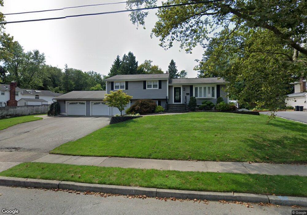
This home is located at 1 Viewpoint Rd, Wayne, NJ 07470 and is currently estimated at $898,795, approximately $374 per square foot. 1 Viewpoint Rd is a home located in Passaic County with nearby schools including James Fallon Elementary School, Anthony Wayne Middle School, and Wayne Hills High School.
Ownership History
Date
Name
Owned For
Owner Type
Purchase Details
Closed on
Mar 22, 2021
Sold by
Diagostini Tina and Diagostini John Patrick
Bought by
Diagostini Tina and Diagostini John Patrick
Current Estimated Value
Purchase Details
Closed on
Oct 18, 2002
Sold by
Stone James
Bought by
Diagostini John and Diagostini Tina
Home Financials for this Owner
Home Financials are based on the most recent Mortgage that was taken out on this home.
Original Mortgage
$424,000
Outstanding Balance
$176,848
Interest Rate
6.09%
Estimated Equity
$721,947
Purchase Details
Closed on
May 22, 1997
Sold by
Estate Of Aren Smith
Bought by
Stone Lynne
Home Financials for this Owner
Home Financials are based on the most recent Mortgage that was taken out on this home.
Original Mortgage
$180,000
Interest Rate
7.86%
Create a Home Valuation Report for This Property
The Home Valuation Report is an in-depth analysis detailing your home's value as well as a comparison with similar homes in the area
Home Values in the Area
Average Home Value in this Area
Purchase History
| Date | Buyer | Sale Price | Title Company |
|---|---|---|---|
| Diagostini Tina | -- | None Available | |
| Diagostini John | $530,000 | -- | |
| Stone Lynne | $259,000 | -- |
Source: Public Records
Mortgage History
| Date | Status | Borrower | Loan Amount |
|---|---|---|---|
| Open | Diagostini John | $424,000 | |
| Previous Owner | Stone Lynne | $180,000 |
Source: Public Records
Tax History
| Year | Tax Paid | Tax Assessment Tax Assessment Total Assessment is a certain percentage of the fair market value that is determined by local assessors to be the total taxable value of land and additions on the property. | Land | Improvement |
|---|---|---|---|---|
| 2025 | $16,447 | $276,600 | $120,700 | $155,900 |
| 2024 | $15,816 | $276,600 | $120,700 | $155,900 |
| 2022 | $15,639 | $276,600 | $120,700 | $155,900 |
| 2021 | $15,622 | $276,600 | $120,700 | $155,900 |
| 2020 | $15,553 | $276,600 | $120,700 | $155,900 |
| 2019 | $15,252 | $276,600 | $120,700 | $155,900 |
| 2018 | $15,116 | $276,600 | $120,700 | $155,900 |
| 2017 | $14,978 | $276,600 | $120,700 | $155,900 |
| 2016 | $14,768 | $276,600 | $120,700 | $155,900 |
| 2015 | $14,591 | $276,600 | $120,700 | $155,900 |
| 2014 | $14,179 | $276,600 | $120,700 | $155,900 |
Source: Public Records
Map
Nearby Homes
- 27 Viewpoint Rd
- 761 Valley Rd
- 90 Birchwood Terrace
- 33 Georgia Dr
- 17 Clifford Dr
- 9 Woodland Ct
- 116 Carol Place
- 30 Corvair Place
- 20 Dwight St
- 230 Macdonald Dr
- 18 Harwood Place
- 18 Stanford Place
- 1150 Valley Rd Unit 1B
- 11 Pilgrim Way
- 28 Knox Terrace
- 16 Lawrence Rd
- 22 Woodlot Rd
- 109 Four Seasons Dr
- 1316 Alps Rd
- 39A Atherton Ct Unit A
Your Personal Tour Guide
Ask me questions while you tour the home.