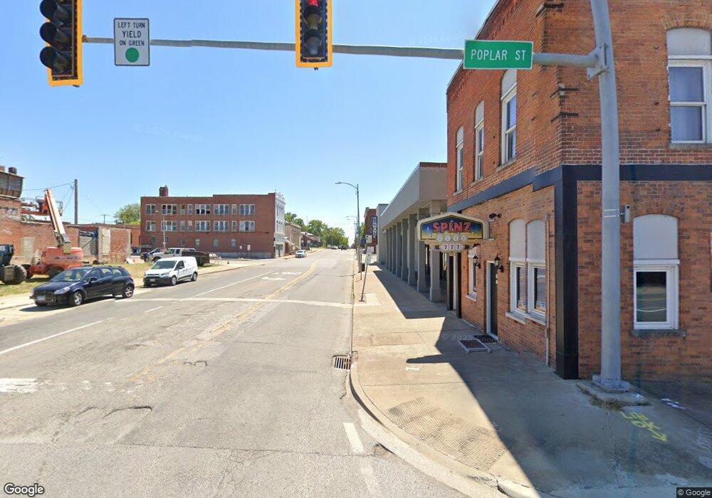
1 W Poplar St Harrisburg, IL 62946
--
Bed
--
Bath
--
Sq Ft
261
Sq Ft Lot
About This Home
This home is located at 1 W Poplar St, Harrisburg, IL 62946. 1 W Poplar St is a home located in Saline County with nearby schools including East Side Intermediate School, Harrisburg Middle School, and Harrisburg High School.
Ownership History
Date
Name
Owned For
Owner Type
Purchase Details
Closed on
Aug 26, 2025
Sold by
Hines Douglas E
Bought by
Martin David Allen and Martin Darla G
Purchase Details
Closed on
Jul 26, 2021
Sold by
Ennis Keith Keon
Bought by
City Of Harrisburg
Purchase Details
Closed on
Aug 21, 2020
Sold by
A31 Land Trust
Bought by
Ennis Keith Keon
Purchase Details
Closed on
Apr 13, 2020
Sold by
Saline County
Bought by
A31 Land Trust
Purchase Details
Closed on
Dec 19, 2019
Sold by
Ehlers Randall J
Bought by
County Of Saline
Purchase Details
Closed on
Oct 2, 2008
Sold by
Rister Landis and Rister Landa
Bought by
Ehlers Randall J
Create a Home Valuation Report for This Property
The Home Valuation Report is an in-depth analysis detailing your home's value as well as a comparison with similar homes in the area
Home Values in the Area
Average Home Value in this Area
Purchase History
| Date | Buyer | Sale Price | Title Company |
|---|---|---|---|
| Martin David Allen | -- | -- | |
| City Of Harrisburg | -- | Attorney | |
| Ennis Keith Keon | $999 | None Available | |
| A31 Land Trust | -- | Attorney | |
| County Of Saline | -- | Attorney | |
| Ehlers Randall J | $15,000 | None Available |
Source: Public Records
Tax History Compared to Growth
Tax History
| Year | Tax Paid | Tax Assessment Tax Assessment Total Assessment is a certain percentage of the fair market value that is determined by local assessors to be the total taxable value of land and additions on the property. | Land | Improvement |
|---|---|---|---|---|
| 2024 | -- | $59 | $59 | $0 |
| 2023 | -- | $145 | $45 | $100 |
| 2022 | -- | $145 | $45 | $100 |
| 2021 | $0 | $149 | $46 | $103 |
| 2020 | -- | $0 | $0 | $0 |
| 2019 | $1,364 | $0 | $0 | $0 |
| 2018 | $1,364 | $12,530 | $8,095 | $4,435 |
| 2017 | $1,343 | $12,530 | $8,095 | $4,435 |
| 2016 | $13 | $12,530 | $8,095 | $4,435 |
| 2015 | -- | $12,530 | $8,095 | $4,435 |
| 2014 | -- | $12,530 | $8,095 | $4,435 |
| 2013 | $1,243 | $12,530 | $8,095 | $4,435 |
| 2012 | $1,243 | $12,530 | $8,095 | $4,435 |
Source: Public Records
Map
Nearby Homes
- 205 S Shaw St
- 504 W South St
- 430 W Church St
- 827 W Raymond St
- 405 S Shaw St
- 305 W Church St
- 216 W Poplar St
- 202 W Poplar St
- 305 W Lincoln St
- 500 W Sloan St
- 210 W Lincoln St
- 520 S Mckinley St
- 614 W College St
- 215 S Jackson St
- 618 S Mckinley St
- 206 W Homer Ave
- 111 W Midkiff St
- 1120 Dorris Heights Rd
- 0000 S Commercial St
- 0 Ron Crank Dr Unit EB441387
- 824 W Poplar St
- 820 W Poplar St
- 823 W Poplar St
- 812 W Poplar St
- 827 W Poplar St
- 827 W Poplar St
- 810 W Poplar St
- 815 W Poplar St
- 809 W Poplar St
- 807 W Elm St
- 800 W Poplar St
- 825 W Pine St
- 11 S Herbert St
- 1011 W Poplar St
- 810 W Pine St
- 815 W Pine St
- 807 W Poplar St
- 840 W Church St
- 728 W Poplar St
- 700 W Poplar St