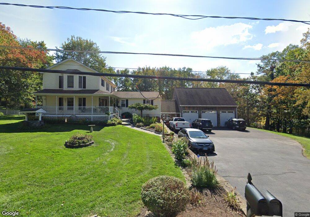
1 Wheeler Dr Danbury, CT 06811
Estimated Value: $682,266 - $832,000
5
Beds
5
Baths
2,887
Sq Ft
$261/Sq Ft
Est. Value
About This Home
This home is located at 1 Wheeler Dr, Danbury, CT 06811 and is currently estimated at $752,067, approximately $260 per square foot. 1 Wheeler Dr is a home located in Fairfield County with nearby schools including Pembroke Elementary School, Broadview Middle School, and Danbury High School.
Ownership History
Date
Name
Owned For
Owner Type
Purchase Details
Closed on
Oct 1, 2015
Sold by
Lajvort John
Bought by
Halas Dale E
Current Estimated Value
Purchase Details
Closed on
Dec 6, 2010
Sold by
Stottle Timothy J and Stottle Sherry L
Bought by
Lajvort John and Lajvort Maria
Home Financials for this Owner
Home Financials are based on the most recent Mortgage that was taken out on this home.
Original Mortgage
$414,226
Interest Rate
4.22%
Mortgage Type
Purchase Money Mortgage
Purchase Details
Closed on
Aug 19, 2009
Sold by
Stottle Timothy J and Stottle Sherry L
Bought by
Stottle John and Stottle Carol
Purchase Details
Closed on
Nov 8, 2007
Sold by
Tarsi Patricia L
Bought by
Stottle Timothy J and Stottle Sherry L
Create a Home Valuation Report for This Property
The Home Valuation Report is an in-depth analysis detailing your home's value as well as a comparison with similar homes in the area
Home Values in the Area
Average Home Value in this Area
Purchase History
| Date | Buyer | Sale Price | Title Company |
|---|---|---|---|
| Halas Dale E | $408,000 | -- | |
| Lavjort John | -- | -- | |
| Lajvort John | $425,000 | -- | |
| Stottle John | -- | -- | |
| Stottle Timothy J | $475,000 | -- |
Source: Public Records
Mortgage History
| Date | Status | Borrower | Loan Amount |
|---|---|---|---|
| Previous Owner | Stottle Timothy J | $414,226 | |
| Previous Owner | Stottle Timothy J | $106,500 | |
| Previous Owner | Stottle Timothy J | $388,000 |
Source: Public Records
Tax History
| Year | Tax Paid | Tax Assessment Tax Assessment Total Assessment is a certain percentage of the fair market value that is determined by local assessors to be the total taxable value of land and additions on the property. | Land | Improvement |
|---|---|---|---|---|
| 2025 | $9,899 | $396,130 | $72,940 | $323,190 |
| 2024 | $9,681 | $396,130 | $72,940 | $323,190 |
| 2023 | $9,242 | $396,130 | $72,940 | $323,190 |
| 2022 | $8,624 | $305,600 | $77,900 | $227,700 |
| 2021 | $8,435 | $305,600 | $77,900 | $227,700 |
| 2020 | $8,435 | $305,600 | $77,900 | $227,700 |
| 2019 | $8,435 | $305,600 | $77,900 | $227,700 |
| 2018 | $8,435 | $305,600 | $77,900 | $227,700 |
| 2017 | $8,268 | $285,600 | $74,200 | $211,400 |
| 2016 | $8,191 | $285,600 | $74,200 | $211,400 |
| 2015 | $8,071 | $285,600 | $74,200 | $211,400 |
| 2014 | $7,789 | $282,200 | $74,200 | $208,000 |
Source: Public Records
Map
Nearby Homes
- 14 Wilkes Rd
- 53 Pembroke Rd
- 5 Beardsley Rd
- 17 Hemlock Trail
- 3 Spring Ridge Ct
- 56 Pembroke Rd Unit 4
- 37 Eastview Dr
- 2 Kevin Dr
- 7 Bittersweet Dr
- 68 lot 2 State Route 37 Route
- 4 Candlewood Rd
- 10 Sunset Dr
- 1 Marker Rd
- 20 Smoke Hill Dr
- 6 Windward Dr
- 262 Great Plain Rd Unit 13
- 234 Great Plain Rd
- 11 Hillcrest Dr
- 3 Mary Ann Dr
- 4 Red Fox Ct
Your Personal Tour Guide
Ask me questions while you tour the home.