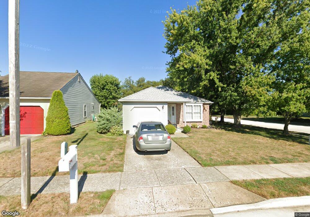
1 White Stone Ct Mount Laurel, NJ 08054
Estimated Value: $362,721 - $417,000
--
Bed
--
Bath
1,356
Sq Ft
$288/Sq Ft
Est. Value
About This Home
This home is located at 1 White Stone Ct, Mount Laurel, NJ 08054 and is currently estimated at $390,180, approximately $287 per square foot. 1 White Stone Ct is a home located in Burlington County with nearby schools including Hillside Elementary School, T.E. Harrington Middle School, and Mount Laurel Hartford School.
Ownership History
Date
Name
Owned For
Owner Type
Purchase Details
Closed on
Nov 4, 2005
Sold by
Derry Ellis L and Derry Margaret J
Bought by
Circus Richard and Circus Arlene
Current Estimated Value
Home Financials for this Owner
Home Financials are based on the most recent Mortgage that was taken out on this home.
Original Mortgage
$115,000
Outstanding Balance
$63,088
Interest Rate
6.06%
Mortgage Type
New Conventional
Estimated Equity
$327,092
Create a Home Valuation Report for This Property
The Home Valuation Report is an in-depth analysis detailing your home's value as well as a comparison with similar homes in the area
Home Values in the Area
Average Home Value in this Area
Purchase History
| Date | Buyer | Sale Price | Title Company |
|---|---|---|---|
| Circus Richard | $259,900 | Surety Title Corp |
Source: Public Records
Mortgage History
| Date | Status | Borrower | Loan Amount |
|---|---|---|---|
| Open | Circus Richard | $115,000 |
Source: Public Records
Tax History Compared to Growth
Tax History
| Year | Tax Paid | Tax Assessment Tax Assessment Total Assessment is a certain percentage of the fair market value that is determined by local assessors to be the total taxable value of land and additions on the property. | Land | Improvement |
|---|---|---|---|---|
| 2025 | $5,484 | $173,700 | $54,300 | $119,400 |
| 2024 | $5,277 | $173,700 | $54,300 | $119,400 |
| 2023 | $5,277 | $173,700 | $54,300 | $119,400 |
| 2022 | $5,260 | $173,700 | $54,300 | $119,400 |
| 2021 | $5,161 | $173,700 | $54,300 | $119,400 |
| 2020 | $5,060 | $173,700 | $54,300 | $119,400 |
| 2019 | $5,008 | $173,700 | $54,300 | $119,400 |
| 2018 | $4,970 | $173,700 | $54,300 | $119,400 |
| 2017 | $4,841 | $173,700 | $54,300 | $119,400 |
| 2016 | $4,768 | $173,700 | $54,300 | $119,400 |
| 2015 | $4,712 | $173,700 | $54,300 | $119,400 |
| 2014 | $4,666 | $173,700 | $54,300 | $119,400 |
Source: Public Records
Map
Nearby Homes
- 23 Emory Ln
- 1 Adner Dr
- 8 Raven Ct
- 12 Taconia Ct
- 23 E Oleander Dr
- 11 E Berwin Way
- 266 Saint David Dr
- 3 Village Ct
- 223 Saint David Dr
- 70B Sumac Ct Unit 70B
- 317 Saint David Dr
- 31 Quince Ct
- 1201A Ginger Ct
- 13 Marcy Ct
- 130B Birchfield Ct Unit 130B
- 123A Birchfield Ct Unit 123A
- 420 Elderberry Ct
- 422 Elderberry Ct
- 21 Zinnia Ct
- 102 Union Mill Terrace
- 3 White Stone Ct
- 5 White Stone Ct
- 2 Sheppards Ln
- 77 Falmouth Dr
- 75 Falmouth Dr
- 73 Falmouth Dr
- 7 White Stone Ct
- 2 White Stone Ct
- 38 Fairfax Dr
- 4 Sheppards Ln
- 4 White Stone Ct
- 71 Falmouth Dr
- 6 White Stone Ct
- 9 White Stone Ct
- 3 Sheppards Ln
- 36 Fairfax Dr
- 69 Falmouth Dr
- 6 Sheppards Ln
- 8 White Stone Ct
- 11 White Stone Ct