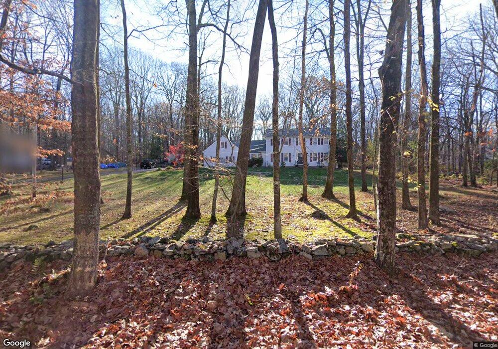
1 Wilderness West Rd Newtown, CT 06470
Estimated Value: $731,000 - $949,000
4
Beds
4
Baths
2,826
Sq Ft
$284/Sq Ft
Est. Value
About This Home
This home is located at 1 Wilderness West Rd, Newtown, CT 06470 and is currently estimated at $803,968, approximately $284 per square foot. 1 Wilderness West Rd is a home located in Fairfield County with nearby schools including Reed Intermediate School, Head O'Meadow Elementary School, and Newtown Middle School.
Ownership History
Date
Name
Owned For
Owner Type
Purchase Details
Closed on
Nov 20, 2013
Sold by
Manfredi Christopher
Bought by
Manfredi Julie
Current Estimated Value
Home Financials for this Owner
Home Financials are based on the most recent Mortgage that was taken out on this home.
Original Mortgage
$382,400
Outstanding Balance
$94,986
Interest Rate
3.35%
Estimated Equity
$708,982
Purchase Details
Closed on
Jun 23, 2004
Sold by
Simeone Pamela
Bought by
Manfredi Christopher and Manfredi Julie
Create a Home Valuation Report for This Property
The Home Valuation Report is an in-depth analysis detailing your home's value as well as a comparison with similar homes in the area
Home Values in the Area
Average Home Value in this Area
Purchase History
| Date | Buyer | Sale Price | Title Company |
|---|---|---|---|
| Manfredi Julie | -- | -- | |
| Manfredi Julie | -- | -- | |
| Manfredi Christopher | $481,000 | -- | |
| Manfredi Christopher | $481,000 | -- |
Source: Public Records
Mortgage History
| Date | Status | Borrower | Loan Amount |
|---|---|---|---|
| Open | Manfredi Christopher | $382,400 | |
| Closed | Manfredi Christopher | $382,400 |
Source: Public Records
Tax History Compared to Growth
Tax History
| Year | Tax Paid | Tax Assessment Tax Assessment Total Assessment is a certain percentage of the fair market value that is determined by local assessors to be the total taxable value of land and additions on the property. | Land | Improvement |
|---|---|---|---|---|
| 2025 | $12,052 | $419,360 | $139,000 | $280,360 |
| 2024 | $11,310 | $419,360 | $139,000 | $280,360 |
| 2023 | $11,004 | $419,360 | $139,000 | $280,360 |
| 2022 | $9,847 | $284,030 | $96,310 | $187,720 |
| 2021 | $9,842 | $284,030 | $96,310 | $187,720 |
| 2020 | $9,873 | $284,030 | $96,310 | $187,720 |
| 2019 | $9,876 | $284,030 | $96,310 | $187,720 |
| 2018 | $9,725 | $284,030 | $96,310 | $187,720 |
| 2017 | $10,376 | $306,340 | $111,650 | $194,690 |
| 2016 | $10,293 | $306,340 | $111,650 | $194,690 |
| 2015 | $10,131 | $306,340 | $111,650 | $194,690 |
| 2014 | $10,204 | $306,340 | $111,650 | $194,690 |
Source: Public Records
Map
Nearby Homes
- 199 Walnut Hill Rd
- 149 Mount Pleasant Rd
- 23 Taunton Ln
- 6 Violette Rd
- 123 Old Hawleyville Rd
- 183 Mount Pleasant Rd
- 603 Brookside Ct Unit 603
- 433 Brookside Ct Unit 433
- 62 Old Hawleyville Rd
- 10 Wedgewood Ct
- 521 Copper Square Dr
- 32 Redwood Dr
- 137 Rockwell Rd
- 3 Boulder Creek Rd
- 21 Adams Dr
- 25 Pound Sweet Hill
- 7 Mcneil Rd
- 7 Cross Brook Rd
- 68 Birch Hill Rd
- 16 Farrell Rd
- 15 Sturges Rd
- 3 Wilderness Rd W
- 3 Wilderness West Rd
- 0 Wilderness Rd W Unit 99074655
- 13 Sturges Rd
- 17 Sturges Rd
- 4 Wilderness West Rd
- 4 Wilderness Rd W
- 16 Sturges Rd
- 5 Wilderness West Rd
- 6 Bob Cat Ln
- 9 Sturges Rd
- 6 Wilderness West Rd
- 6 Wilderness West Rd
- 4 Bob Cat Ln
- 21 Sturges Rd
- 10 Bob Cat Ln
- 19 Sturges Rd
- 12 Sturges Rd
- 5 Sturges Rd