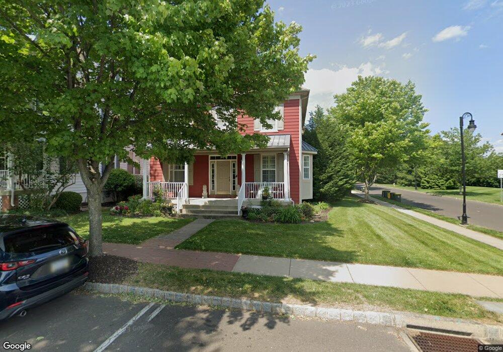
1 Woodbridge Dr Unit 26 Doylestown, PA 18901
Estimated Value: $645,689 - $790,000
3
Beds
4
Baths
2,700
Sq Ft
$261/Sq Ft
Est. Value
About This Home
This home is located at 1 Woodbridge Dr Unit 26, Doylestown, PA 18901 and is currently estimated at $705,172, approximately $261 per square foot. 1 Woodbridge Dr Unit 26 is a home located in Bucks County with nearby schools including Doyle El School, Lenape Middle School, and Central Bucks High School-West.
Ownership History
Date
Name
Owned For
Owner Type
Purchase Details
Closed on
Oct 14, 2011
Sold by
Kuhns David A and Kuhns Nancy L
Bought by
Bruce Lori
Current Estimated Value
Purchase Details
Closed on
Oct 7, 2004
Sold by
Mahoney Robert E
Bought by
Kuhns David A and Kuhns Nancy L
Home Financials for this Owner
Home Financials are based on the most recent Mortgage that was taken out on this home.
Original Mortgage
$70,000
Interest Rate
5.75%
Mortgage Type
Fannie Mae Freddie Mac
Purchase Details
Closed on
Apr 28, 2003
Sold by
Lantern Hill At Doylestown Lp
Bought by
Mahoney Robert E
Home Financials for this Owner
Home Financials are based on the most recent Mortgage that was taken out on this home.
Original Mortgage
$289,600
Interest Rate
6.12%
Mortgage Type
Purchase Money Mortgage
Create a Home Valuation Report for This Property
The Home Valuation Report is an in-depth analysis detailing your home's value as well as a comparison with similar homes in the area
Home Values in the Area
Average Home Value in this Area
Purchase History
| Date | Buyer | Sale Price | Title Company |
|---|---|---|---|
| Bruce Lori | $392,500 | None Available | |
| Kuhns David A | $445,000 | Fidelity National Title Insu | |
| Mahoney Robert E | $369,630 | -- |
Source: Public Records
Mortgage History
| Date | Status | Borrower | Loan Amount |
|---|---|---|---|
| Previous Owner | Kuhns David A | $70,000 | |
| Previous Owner | Mahoney Robert E | $289,600 |
Source: Public Records
Tax History Compared to Growth
Tax History
| Year | Tax Paid | Tax Assessment Tax Assessment Total Assessment is a certain percentage of the fair market value that is determined by local assessors to be the total taxable value of land and additions on the property. | Land | Improvement |
|---|---|---|---|---|
| 2025 | $6,660 | $36,970 | $5,040 | $31,930 |
| 2024 | $6,660 | $36,970 | $5,040 | $31,930 |
| 2023 | $6,345 | $36,970 | $5,040 | $31,930 |
| 2022 | $6,257 | $36,970 | $5,040 | $31,930 |
| 2021 | $6,188 | $36,970 | $5,040 | $31,930 |
| 2020 | $6,120 | $36,970 | $5,040 | $31,930 |
| 2019 | $6,053 | $36,970 | $5,040 | $31,930 |
| 2018 | $5,979 | $36,970 | $5,040 | $31,930 |
| 2017 | $5,916 | $36,970 | $5,040 | $31,930 |
| 2016 | $5,916 | $36,970 | $5,040 | $31,930 |
| 2015 | -- | $36,970 | $5,040 | $31,930 |
| 2014 | -- | $36,970 | $5,040 | $31,930 |
Source: Public Records
Map
Nearby Homes
- 418 North St
- 169 N Main St
- 333 Dorset Ct Unit 333
- 146 N Church St
- 90 Chapman Ave
- 215 N Franklin St
- 146 E Court St
- 20 E Court St
- 4 Barnes Ct
- 121 Cottage St
- 37 N Clinton St
- 69 E Oakland Ave
- 155 E Oakland Ave
- 114 Blackfriars Cir
- 1 Gatehouse Ln
- 100 Bishops Gate Ln Unit 67
- 4 Old Colonial Dr Unit 254
- 62 Constitution Ave
- 110 E Ashland St
- 339 E Ashland St
- 3 Woodbridge Dr Unit 27
- 5 Woodbridge Dr Unit 28
- 75 Woodbridge Dr Unit 35
- 73 Woodbridge Dr
- 7 Woodbridge Dr Unit 29
- 409 Lantern Dr Unit 25
- 71 Woodbridge Dr Unit 37
- 9 Woodbridge Dr Unit 34
- 407 Lantern Dr Unit 24
- 11 Woodbridge Dr Unit 33
- 69 Woodbridge Dr Unit 38
- 13 Woodbridge Dr Unit 32
- 67 Woodbridge Dr Unit 39
- 15 Woodbridge Dr Unit 31
- 65 Woodbridge Dr Unit 40
- 405 Lantern Dr Unit 23
- 403 Lantern Dr Unit 22
- 401 Lantern Dr Unit 21
- 19 Woodbridge Dr Unit 63
- 63 Woodbridge Dr Unit 41