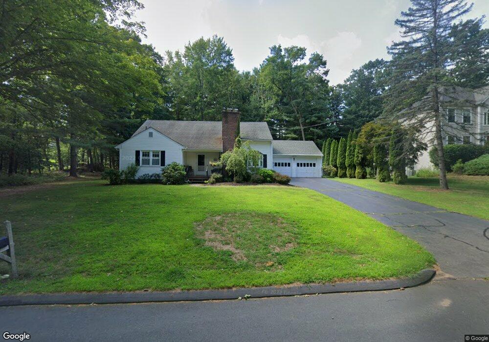
1 Woodside Cir Simsbury, CT 06070
Estimated Value: $460,337 - $536,000
4
Beds
2
Baths
2,161
Sq Ft
$230/Sq Ft
Est. Value
About This Home
This home is located at 1 Woodside Cir, Simsbury, CT 06070 and is currently estimated at $496,584, approximately $229 per square foot. 1 Woodside Cir is a home located in Hartford County with nearby schools including Central School, Henry James Memorial School, and Simsbury High School.
Ownership History
Date
Name
Owned For
Owner Type
Purchase Details
Closed on
May 11, 2016
Sold by
Ferraresso Judith M
Bought by
Ferraresso Judith M and Ferraresso Peter D
Current Estimated Value
Purchase Details
Closed on
Jul 19, 2011
Sold by
Ferraresso Peter D
Bought by
Ferraresso Judith M
Purchase Details
Closed on
Mar 31, 2005
Sold by
Rotondo Florence J
Bought by
Ferraresso Peter D and Ferraresso Judith M
Create a Home Valuation Report for This Property
The Home Valuation Report is an in-depth analysis detailing your home's value as well as a comparison with similar homes in the area
Home Values in the Area
Average Home Value in this Area
Purchase History
| Date | Buyer | Sale Price | Title Company |
|---|---|---|---|
| Ferraresso Judith M | -- | -- | |
| Ferraresso Judith M | -- | -- | |
| Ferraresso Peter D | $289,000 | -- |
Source: Public Records
Mortgage History
| Date | Status | Borrower | Loan Amount |
|---|---|---|---|
| Previous Owner | Ferraresso Peter D | $235,000 |
Source: Public Records
Tax History Compared to Growth
Tax History
| Year | Tax Paid | Tax Assessment Tax Assessment Total Assessment is a certain percentage of the fair market value that is determined by local assessors to be the total taxable value of land and additions on the property. | Land | Improvement |
|---|---|---|---|---|
| 2025 | $8,250 | $241,500 | $74,900 | $166,600 |
| 2024 | $8,044 | $241,500 | $74,900 | $166,600 |
| 2023 | $7,685 | $241,500 | $74,900 | $166,600 |
| 2022 | $6,590 | $170,580 | $75,410 | $95,170 |
| 2021 | $6,590 | $170,580 | $75,410 | $95,170 |
| 2020 | $6,327 | $170,580 | $75,410 | $95,170 |
| 2019 | $6,366 | $170,580 | $75,410 | $95,170 |
| 2018 | $6,412 | $170,580 | $75,410 | $95,170 |
| 2017 | $6,135 | $158,280 | $75,410 | $82,870 |
| 2016 | $5,875 | $158,280 | $75,410 | $82,870 |
| 2015 | $5,875 | $158,280 | $75,410 | $82,870 |
| 2014 | $5,879 | $158,280 | $75,410 | $82,870 |
Source: Public Records
Map
Nearby Homes
- 16 Stratton Forest Way
- 3 Stebbins Brook Ln
- 4 Stebbins Brook Ln
- 18 Meadowlark Rd
- 40 Firetown Rd Unit 39
- 1 West St Unit 206
- 15 Sand Hill Rd
- 48 Library Ln Unit 48
- 308 Hopmeadow St
- 301 Bushy Hill Rd
- 10 Sachems Trail
- 3 Cobtail Way
- 25 Barry Ln
- 3 Minister Brook Dr
- 9 Cobtail Way
- 8 Quorn Hunt Rd
- 15 Pinnacle Mountain Rd
- 8 Crane Place
- 395 Bushy Hill Rd
- 26 Winterset Ln
- 3 Woodside Cir
- 6 Woodside Cir
- 11 Woodside Cir
- 2 Woodside Cir
- 2 Forest Ln
- 14 Woodside Cir
- 15 Woodside Cir
- 10 Woodside Cir
- 2 Meeting House S
- 6 Forest Ln
- 6 Meeting House S
- 16 Woodside Cir
- 502 Powder Forest Way
- 2 Crosswoods Dr Unit 2
- 21 Woodside Cir
- 101 Bushy Hill Rd
- 500 Powder Forest Way
- 500 Powder Forest Way Unit 65
- 4 Meeting House S
- 2 Ashton Cir