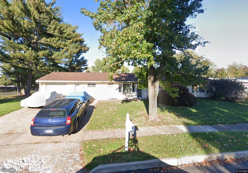
1 Yellowood Dr Levittown, PA 19057
Estimated Value: $333,000 - $361,103
4
Beds
1
Bath
1,468
Sq Ft
$236/Sq Ft
Est. Value
About This Home
This home is located at 1 Yellowood Dr, Levittown, PA 19057 and is currently estimated at $346,776, approximately $236 per square foot. 1 Yellowood Dr is a home located in Bucks County with nearby schools including Truman Senior High School, First Presbyterian Church School, and Hope Lutheran School.
Ownership History
Date
Name
Owned For
Owner Type
Purchase Details
Closed on
Jan 24, 2003
Sold by
Mitchell Michael D
Bought by
Swift Jamie J
Current Estimated Value
Home Financials for this Owner
Home Financials are based on the most recent Mortgage that was taken out on this home.
Original Mortgage
$141,660
Outstanding Balance
$63,636
Interest Rate
6.75%
Estimated Equity
$283,140
Purchase Details
Closed on
Feb 1, 1998
Sold by
Mitchell Michael D and Mitchell Kimberly A
Bought by
Mitchell Michael D
Home Financials for this Owner
Home Financials are based on the most recent Mortgage that was taken out on this home.
Original Mortgage
$94,000
Interest Rate
6.76%
Create a Home Valuation Report for This Property
The Home Valuation Report is an in-depth analysis detailing your home's value as well as a comparison with similar homes in the area
Home Values in the Area
Average Home Value in this Area
Purchase History
| Date | Buyer | Sale Price | Title Company |
|---|---|---|---|
| Swift Jamie J | $157,400 | -- | |
| Mitchell Michael D | -- | Lawyers Title Insurance Corp |
Source: Public Records
Mortgage History
| Date | Status | Borrower | Loan Amount |
|---|---|---|---|
| Open | Swift Jamie J | $141,660 | |
| Previous Owner | Mitchell Michael D | $94,000 |
Source: Public Records
Tax History Compared to Growth
Tax History
| Year | Tax Paid | Tax Assessment Tax Assessment Total Assessment is a certain percentage of the fair market value that is determined by local assessors to be the total taxable value of land and additions on the property. | Land | Improvement |
|---|---|---|---|---|
| 2025 | $5,217 | $19,210 | $4,880 | $14,330 |
| 2024 | $5,217 | $19,210 | $4,880 | $14,330 |
| 2023 | $5,178 | $19,210 | $4,880 | $14,330 |
| 2022 | $5,178 | $19,210 | $4,880 | $14,330 |
| 2021 | $5,178 | $19,210 | $4,880 | $14,330 |
| 2020 | $5,178 | $19,210 | $4,880 | $14,330 |
| 2019 | $5,159 | $19,210 | $4,880 | $14,330 |
| 2018 | $5,076 | $19,210 | $4,880 | $14,330 |
| 2017 | $4,999 | $19,210 | $4,880 | $14,330 |
| 2016 | $4,999 | $19,210 | $4,880 | $14,330 |
| 2015 | $3,877 | $19,210 | $4,880 | $14,330 |
| 2014 | $3,877 | $19,210 | $4,880 | $14,330 |
Source: Public Records
Map
Nearby Homes
- 150 Naomi Ct Unit 811
- 1019 Green Ln
- 2519 Woodlawn Dr
- 2205 Liberator St
- 5604 Fleetwing Dr
- 23 Misty Pine Rd
- 57 Middle Rd
- 50 Micahill Rd
- 3021 Bath Rd
- 145 Mill Dr
- 86 Wildflower Rd
- 101 Idlewild Rd
- 47 Plumbridge Dr
- 84 Whitewood Dr
- 19 Prunewood Rd
- 38 Plumtree Rd
- 35 Parkside Cir
- 212 Plumbridge Dr
- 62 Indian Creek Dr
- 5617 Beaver Dam Rd
- 5300 Mill Creek Rd
- 9 Yellowood Dr
- 242 Blue Ridge Dr
- 15 Yellowood Dr
- 238 Blue Ridge Dr
- 5306 Mill Creek Rd
- 244 Blue Ridge Dr
- 236 Blue Ridge Dr
- 19 Yellowood Dr
- 248 Blue Ridge Dr
- 9 Young Birch Rd
- 232 Blue Ridge Dr
- 252 Blue Ridge Dr
- 11 Young Birch Rd
- 5 Young Birch Rd
- 243 Blue Ridge Dr
- 237 Blue Ridge Dr
- 23 Yellowood Dr
- 256 Blue Ridge Dr
- 228 Blue Ridge Dr