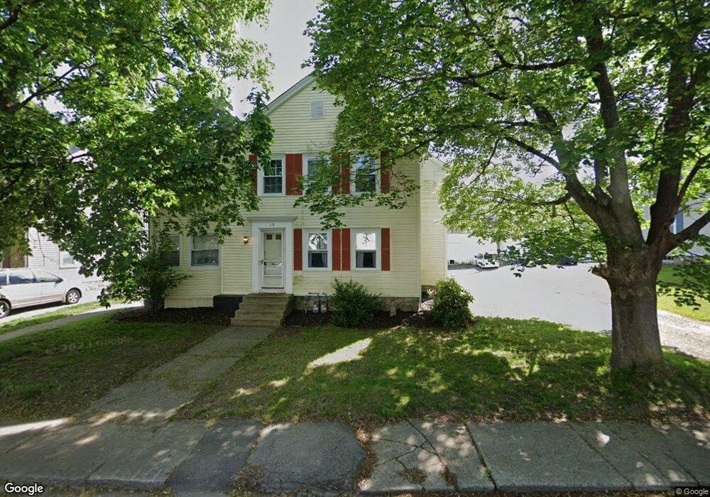
10-12 Leland Rd Whitinsville, MA 01588
Estimated Value: $541,587 - $672,000
6
Beds
2
Baths
3,088
Sq Ft
$203/Sq Ft
Est. Value
About This Home
This home is located at 10-12 Leland Rd, Whitinsville, MA 01588 and is currently estimated at $628,397, approximately $203 per square foot. 10-12 Leland Rd is a home located in Worcester County with nearby schools including Northbridge Elementary School, Northbridge Middle School, and Northbridge High School.
Ownership History
Date
Name
Owned For
Owner Type
Purchase Details
Closed on
Oct 24, 2017
Sold by
Clarke Brian A
Bought by
Clarke Brian A and Nickerson-Clarke Rachel L
Current Estimated Value
Purchase Details
Closed on
Oct 21, 2014
Sold by
Clarke Brian A and Clarke Darlene J
Bought by
Clarke Brian A
Home Financials for this Owner
Home Financials are based on the most recent Mortgage that was taken out on this home.
Original Mortgage
$241,147
Interest Rate
3.75%
Mortgage Type
FHA
Purchase Details
Closed on
Dec 11, 1998
Sold by
Kennedy Michael J
Bought by
Clarke Brian A and Clarke Darlene J
Home Financials for this Owner
Home Financials are based on the most recent Mortgage that was taken out on this home.
Original Mortgage
$154,350
Interest Rate
6.8%
Mortgage Type
Purchase Money Mortgage
Create a Home Valuation Report for This Property
The Home Valuation Report is an in-depth analysis detailing your home's value as well as a comparison with similar homes in the area
Home Values in the Area
Average Home Value in this Area
Purchase History
| Date | Buyer | Sale Price | Title Company |
|---|---|---|---|
| Clarke Brian A | -- | -- | |
| Clarke Brian A | -- | -- | |
| Clarke Brian A | -- | -- | |
| Clarke Brian A | -- | -- | |
| Clarke Brian A | -- | -- | |
| Clarke Brian A | -- | -- | |
| Clarke Brian A | $162,500 | -- | |
| Clarke Brian A | $162,500 | -- |
Source: Public Records
Mortgage History
| Date | Status | Borrower | Loan Amount |
|---|---|---|---|
| Previous Owner | Clarke Brian A | $241,147 | |
| Previous Owner | Clarke Brian A | $154,350 |
Source: Public Records
Tax History Compared to Growth
Tax History
| Year | Tax Paid | Tax Assessment Tax Assessment Total Assessment is a certain percentage of the fair market value that is determined by local assessors to be the total taxable value of land and additions on the property. | Land | Improvement |
|---|---|---|---|---|
| 2025 | $5,686 | $482,300 | $134,000 | $348,300 |
| 2024 | $5,173 | $427,900 | $134,000 | $293,900 |
| 2023 | $5,227 | $403,300 | $134,000 | $269,300 |
| 2022 | $4,953 | $359,700 | $103,100 | $256,600 |
| 2021 | $4,496 | $310,300 | $98,200 | $212,100 |
| 2020 | $4,052 | $292,800 | $98,200 | $194,600 |
| 2019 | $3,433 | $264,700 | $98,200 | $166,500 |
| 2018 | $3,364 | $260,000 | $93,500 | $166,500 |
| 2017 | $3,400 | $251,300 | $93,500 | $157,800 |
| 2016 | $3,256 | $236,800 | $85,000 | $151,800 |
| 2015 | $3,168 | $236,800 | $85,000 | $151,800 |
| 2014 | $3,029 | $228,400 | $85,000 | $143,400 |
Source: Public Records
Map
Nearby Homes
- 5 Summit St
- 21 Granite St
- 121 East St Unit 121
- 33 Crestwood Cir Unit 45
- 140 Rolling Ridge Dr Unit 78
- 39 Crestwood Cir Unit 42
- 159 Rolling Ridge Dr Unit 85
- 169 Rolling Ridge Dr Unit 97
- 894 Marston Rd
- 18 East St Unit 24
- 1052 Providence Rd
- 90 Nathaniel Dr
- 831 Providence Rd Unit 837
- 708 Marston Rd
- Lots 1-9 Spring St
- 128 Linwood Ave
- 157 Rolling Ridge Dr Unit 84
- 1 Elm St
- 192 Rebecca Rd
- 237 Heritage Dr Unit 237
- 12 Leland Rd
- 14 Leland Rd Unit 16
- 14-16 Leland
- 10 Leland Rd Unit 12
- 16 Leland Rd
- 57 Woodland St
- 18 Leland Rd Unit 20
- 1 Woodland St
- 9 Woodland St
- 9 Leland Rd Unit 11
- 5 Woodland St
- 15 Woodland St
- 15 Woodland St Unit 15
- 15 Woodland St Unit A
- 13 Leland Rd Unit 15
- 17 Woodland St
- 17 Woodland St Unit 17
- 18-20 Leland Rd
- 13 Woodland St
- 408 Church St Unit 1