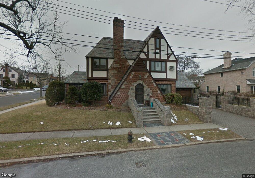
10-54 Totten St Whitestone, NY 11357
Whitestone NeighborhoodEstimated Value: $1,449,000 - $1,878,000
4
Beds
5
Baths
2,090
Sq Ft
$768/Sq Ft
Est. Value
About This Home
This home is located at 10-54 Totten St, Whitestone, NY 11357 and is currently estimated at $1,604,584, approximately $767 per square foot. 10-54 Totten St is a home located in Queens County with nearby schools including J.H.S. 194 William Carr, Bayside High School, and Circle Academy - Whitestone.
Ownership History
Date
Name
Owned For
Owner Type
Purchase Details
Closed on
Nov 7, 2018
Sold by
Strax Lisa
Bought by
Licastri Michael J
Current Estimated Value
Purchase Details
Closed on
Apr 7, 1998
Sold by
Joyce Michael A and Joyce Eileen H
Bought by
Strax Lisa
Home Financials for this Owner
Home Financials are based on the most recent Mortgage that was taken out on this home.
Original Mortgage
$225,000
Interest Rate
7.08%
Create a Home Valuation Report for This Property
The Home Valuation Report is an in-depth analysis detailing your home's value as well as a comparison with similar homes in the area
Home Values in the Area
Average Home Value in this Area
Purchase History
| Date | Buyer | Sale Price | Title Company |
|---|---|---|---|
| Licastri Michael J | $1,165,000 | -- | |
| Strax Lisa | $550,000 | -- |
Source: Public Records
Mortgage History
| Date | Status | Borrower | Loan Amount |
|---|---|---|---|
| Previous Owner | Strax Lisa | $225,000 |
Source: Public Records
Tax History Compared to Growth
Tax History
| Year | Tax Paid | Tax Assessment Tax Assessment Total Assessment is a certain percentage of the fair market value that is determined by local assessors to be the total taxable value of land and additions on the property. | Land | Improvement |
|---|---|---|---|---|
| 2025 | $13,817 | $69,653 | $12,832 | $56,821 |
| 2024 | $13,817 | $68,794 | $15,172 | $53,622 |
| 2023 | $13,040 | $64,924 | $12,215 | $52,709 |
| 2022 | $12,239 | $77,580 | $17,520 | $60,060 |
| 2021 | $12,215 | $67,500 | $17,520 | $49,980 |
| 2020 | $12,286 | $74,220 | $17,520 | $56,700 |
| 2019 | $11,992 | $81,780 | $17,520 | $64,260 |
| 2018 | $5,217 | $54,103 | $11,582 | $42,521 |
| 2017 | $7,512 | $51,092 | $14,484 | $36,608 |
| 2016 | $4,525 | $51,092 | $14,484 | $36,608 |
| 2015 | $3,913 | $48,370 | $16,851 | $31,519 |
| 2014 | $3,913 | $47,774 | $15,908 | $31,866 |
Source: Public Records
Map
Nearby Homes
- 16801 12th Ave Unit 3A
- 168-01 12th Ave Unit 7B
- 168-11 12th Ave Unit 3D
- 1009 166th St
- 10-24 166th St Unit 5D
- 166-31 9th Ave Unit 6A
- 7-25 166th St Unit 2B
- 162-40 9th Ave Unit 7A
- 162-40 9th Ave Unit 3B
- 162-40 9th Ave Unit 8B
- 162-49 13th Ave
- 10-21 162 St Unit 3A
- 7-24 166th St Unit 7A
- 16803 Cryders Ln
- 724 166th St Unit 5D
- 162-11 12th Ave
- 166-40 Powells Cove Blvd Unit 9B
- 166-40 Powells Cove Blvd Unit 2A
- 166-26 Powells Cove Blvd Unit 9A
- 166-10 Powells Cove Blvd Unit 2C
- 1044 Totten St
- 10-44 Totten St
- 1048 Totten St
- 1038 Totten St
- 1032 Totten St
- 1049 Burton St
- 1054 Totten St
- 10-45 Totten St
- 16711 12th Rd
- 1053 Burton St
- 1043 Burton St
- 10-37 Totten St
- 1037 Totten St
- 16715 12th Ave Unit 4A
- 16715 12th Ave Unit 4B
- 16715 12th Ave Unit 2C
- 16715 12th Ave
- 16715 12th Ave Unit 3C
- 16715 12th Ave Unit 3B
- 16715 12th Ave Unit 6B