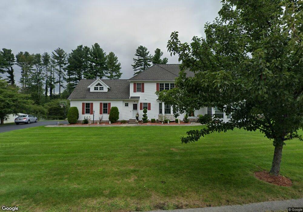
10 Abbey Rd Boylston, MA 01505
Estimated Value: $836,000 - $1,046,000
5
Beds
3
Baths
3,794
Sq Ft
$249/Sq Ft
Est. Value
About This Home
This home is located at 10 Abbey Rd, Boylston, MA 01505 and is currently estimated at $945,283, approximately $249 per square foot. 10 Abbey Rd is a home located in Worcester County with nearby schools including Tahanto Regional High School, St Mary Elementary School, and Gateways Academy.
Ownership History
Date
Name
Owned For
Owner Type
Purchase Details
Closed on
Jan 29, 2024
Sold by
Khatra Anup S and Khatra Alep K
Bought by
A S & Alep K Khatra Ret and Khatra
Current Estimated Value
Purchase Details
Closed on
May 21, 2002
Sold by
Shrewsbury Homes Inc
Bought by
Khatra Anup S and Khatra Alep K
Home Financials for this Owner
Home Financials are based on the most recent Mortgage that was taken out on this home.
Original Mortgage
$380,000
Interest Rate
7.15%
Mortgage Type
Purchase Money Mortgage
Create a Home Valuation Report for This Property
The Home Valuation Report is an in-depth analysis detailing your home's value as well as a comparison with similar homes in the area
Home Values in the Area
Average Home Value in this Area
Purchase History
| Date | Buyer | Sale Price | Title Company |
|---|---|---|---|
| A S & Alep K Khatra Ret | -- | None Available | |
| Khatra Anup S | $114,500 | -- |
Source: Public Records
Mortgage History
| Date | Status | Borrower | Loan Amount |
|---|---|---|---|
| Previous Owner | Khatra Anup S | $230,000 | |
| Previous Owner | Khatra Anup S | $150,000 | |
| Previous Owner | Khatra Anup S | $270,000 | |
| Previous Owner | Khatra Anup S | $380,000 |
Source: Public Records
Tax History
| Year | Tax Paid | Tax Assessment Tax Assessment Total Assessment is a certain percentage of the fair market value that is determined by local assessors to be the total taxable value of land and additions on the property. | Land | Improvement |
|---|---|---|---|---|
| 2025 | $12,580 | $909,600 | $176,200 | $733,400 |
| 2024 | $11,176 | $809,300 | $176,200 | $633,100 |
| 2023 | $11,555 | $802,400 | $176,200 | $626,200 |
| 2022 | $10,798 | $681,700 | $176,200 | $505,500 |
| 2021 | $11,606 | $683,500 | $176,200 | $507,300 |
| 2020 | $10,731 | $648,800 | $173,700 | $475,100 |
| 2019 | $5,061 | $622,100 | $171,900 | $450,200 |
| 2018 | $4,250 | $600,700 | $171,900 | $428,800 |
| 2017 | $8,890 | $551,500 | $171,900 | $379,600 |
| 2016 | $8,776 | $536,100 | $159,600 | $376,500 |
| 2015 | $9,334 | $536,100 | $159,600 | $376,500 |
| 2014 | $8,798 | $505,900 | $147,300 | $358,600 |
Source: Public Records
Map
Nearby Homes
- 291 Sewall St Unit 291
- 289 Sewall St Unit 289
- 281 Sewall St Unit 281
- 279 Sewall St Unit 279
- 5 Barnard Hill Rd
- 28 Sewall St
- 4 Poe Ave Unit 1
- 2 Poe Ave Unit 1
- 230A Gulf St
- 5 Ridge Rd
- 7 Conifer Cir Unit 7
- 2 Clover Glen Cir
- 52 Barnard Hill Rd
- 49 Barnard Hill Rd
- 505 Cross St
- 156 Hillside Village Dr
- 13 Fatima Ln
- 71 Hillside Village Dr
- 12 Erie Ave
- 39 Bullard Ave
Your Personal Tour Guide
Ask me questions while you tour the home.