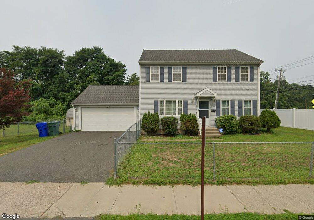
10 Allen Park Rd Springfield, MA 01118
Sixteen Acres NeighborhoodEstimated Value: $363,000 - $385,000
3
Beds
2
Baths
1,600
Sq Ft
$233/Sq Ft
Est. Value
About This Home
This home is located at 10 Allen Park Rd, Springfield, MA 01118 and is currently estimated at $372,411, approximately $232 per square foot. 10 Allen Park Rd is a home located in Hampden County with nearby schools including Arthur T Talmadge Elementary School, M Marcus Kiley Middle, and Springfield High School of Science and Technology.
Ownership History
Date
Name
Owned For
Owner Type
Purchase Details
Closed on
Jan 15, 2015
Sold by
Huynh Na
Bought by
Huynh Na and Duong B
Current Estimated Value
Purchase Details
Closed on
Jan 25, 2008
Sold by
Agass Nt and Mitchell
Bought by
Huynh
Home Financials for this Owner
Home Financials are based on the most recent Mortgage that was taken out on this home.
Original Mortgage
$170,000
Interest Rate
6.17%
Mortgage Type
Purchase Money Mortgage
Purchase Details
Closed on
Apr 10, 2007
Sold by
Henshon Thomas J
Bought by
Agass Nt and Mitchell Donald A
Home Financials for this Owner
Home Financials are based on the most recent Mortgage that was taken out on this home.
Original Mortgage
$164,000
Interest Rate
6.25%
Mortgage Type
Purchase Money Mortgage
Create a Home Valuation Report for This Property
The Home Valuation Report is an in-depth analysis detailing your home's value as well as a comparison with similar homes in the area
Home Values in the Area
Average Home Value in this Area
Purchase History
| Date | Buyer | Sale Price | Title Company |
|---|---|---|---|
| Huynh Na | -- | -- | |
| Huynh | $200,000 | -- | |
| Agass Nt | $40,000 | -- | |
| Huynh Na | -- | -- | |
| Huynh | $200,000 | -- | |
| Agass Nt | $40,000 | -- |
Source: Public Records
Mortgage History
| Date | Status | Borrower | Loan Amount |
|---|---|---|---|
| Previous Owner | Huynh | $170,000 | |
| Previous Owner | Agass Nt | $164,000 | |
| Previous Owner | Agass Nt | $20,000 |
Source: Public Records
Tax History
| Year | Tax Paid | Tax Assessment Tax Assessment Total Assessment is a certain percentage of the fair market value that is determined by local assessors to be the total taxable value of land and additions on the property. | Land | Improvement |
|---|---|---|---|---|
| 2025 | $4,387 | $279,800 | $57,300 | $222,500 |
| 2024 | $4,579 | $285,100 | $57,300 | $227,800 |
| 2023 | $4,245 | $249,000 | $54,500 | $194,500 |
| 2022 | $3,819 | $202,900 | $54,500 | $148,400 |
| 2021 | $3,557 | $188,200 | $49,600 | $138,600 |
| 2020 | $3,015 | $183,900 | $49,600 | $134,300 |
| 2019 | $3,304 | $167,900 | $49,600 | $118,300 |
| 2018 | $2,902 | $160,900 | $49,600 | $111,300 |
| 2017 | $3,812 | $193,900 | $49,600 | $144,300 |
| 2016 | $3,421 | $174,000 | $49,600 | $124,400 |
| 2015 | $3,198 | $162,600 | $49,600 | $113,000 |
Source: Public Records
Map
Nearby Homes
- 41 Hillside Dr
- 25 Laurelwood Ln
- 86 Wildwood Ave
- 24 Wands St
- 81 W Crystal Brook Dr
- 85 Talmadge Dr
- 86 Talmadge Dr
- 1962 Allen St
- 17 Pebble Mill Rd
- 49 Corcoran Blvd
- 55 Allen St
- 17 Skyridge Ln
- 206 Treetop Ave
- 101 Regal St
- 19 Manor Ct Unit 19
- 125 Manor Ct Unit 125
- 55 Old Farm Rd
- 647 Plumtree Rd
- 119 Acrebrook Rd
- 0 Apple Blossom Ln
- 9 Allen Park Rd
- 25 Allen Park Rd
- 1644 Allen St
- 5 Wilshire Rd
- 15 Wilshire Rd
- 25 Wilshire Rd
- 35 Wilshire Rd
- 6 Wilshire Rd
- 16 Wilshire Rd
- 45 Wilshire Rd
- 21 Ramblewood Dr
- 26 Wilshire Rd
- 36 Wilshire Rd
- 31 Ramblewood Dr
- 55 Wilshire Rd
- 46 Wilshire Rd
- 5 Trail Cir
- 39 Ramblewood Dr
- 15 Trail Cir
- 56 Wilshire Rd
Your Personal Tour Guide
Ask me questions while you tour the home.