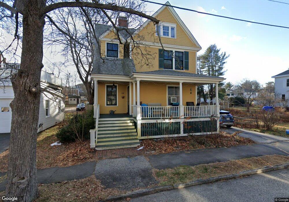
10 Amherst St Portland, ME 04103
Deering Center NeighborhoodEstimated Value: $845,000 - $1,031,000
3
Beds
3
Baths
2,293
Sq Ft
$411/Sq Ft
Est. Value
About This Home
This home is located at 10 Amherst St, Portland, ME 04103 and is currently estimated at $941,388, approximately $410 per square foot. 10 Amherst St is a home located in Cumberland County with nearby schools including Longfellow School-Portland, Lincoln Middle School, and Levey Day School.
Ownership History
Date
Name
Owned For
Owner Type
Purchase Details
Closed on
Jul 23, 2012
Sold by
Gross Laurence W and Colby Barbara E
Bought by
Blum Kristin M and Levine Jeffrey R
Current Estimated Value
Home Financials for this Owner
Home Financials are based on the most recent Mortgage that was taken out on this home.
Original Mortgage
$300,000
Outstanding Balance
$207,380
Interest Rate
3.7%
Mortgage Type
Purchase Money Mortgage
Estimated Equity
$734,008
Create a Home Valuation Report for This Property
The Home Valuation Report is an in-depth analysis detailing your home's value as well as a comparison with similar homes in the area
Home Values in the Area
Average Home Value in this Area
Purchase History
| Date | Buyer | Sale Price | Title Company |
|---|---|---|---|
| Blum Kristin M | -- | -- |
Source: Public Records
Mortgage History
| Date | Status | Borrower | Loan Amount |
|---|---|---|---|
| Open | Blum Kristin M | $300,000 |
Source: Public Records
Tax History Compared to Growth
Tax History
| Year | Tax Paid | Tax Assessment Tax Assessment Total Assessment is a certain percentage of the fair market value that is determined by local assessors to be the total taxable value of land and additions on the property. | Land | Improvement |
|---|---|---|---|---|
| 2024 | $7,975 | $531,300 | $96,000 | $435,300 |
| 2023 | $7,656 | $531,300 | $96,000 | $435,300 |
| 2022 | $7,231 | $531,300 | $96,000 | $435,300 |
| 2021 | $6,902 | $531,300 | $96,000 | $435,300 |
| 2020 | $8,005 | $343,400 | $90,500 | $252,900 |
| 2019 | $8,005 | $343,400 | $90,500 | $252,900 |
| 2018 | $7,720 | $343,400 | $90,500 | $252,900 |
| 2017 | $7,435 | $343,400 | $90,500 | $252,900 |
| 2016 | $7,249 | $343,400 | $90,500 | $252,900 |
| 2015 | $7,084 | $343,400 | $90,500 | $252,900 |
| 2014 | $6,868 | $343,400 | $90,500 | $252,900 |
Source: Public Records
Map
Nearby Homes
- 44 Pleasant Ave
- 25 Pleasant Ave
- 736 Forest Ave
- 89 Clinton St
- 147 Pleasant Ave Unit 2
- 37 Tremont St
- 42 Sawyer St
- 44 Hersey St
- 33 Mayland St
- 33 Bay View Dr
- 48 Ashmont St
- 6 Highland St
- 65 Mcauley Way Unit 506
- 296 Brighton Ave
- 75 Mcauley Way Unit 307
- 75 Mcauley Way Unit 206
- 75 Mcauley Way Unit 401
- 75 Mcauley Way Unit 207
- 75 Mcauley Way Unit 502
- 75 Mcauley Way Unit 304
- 32 Norwood St
- 28 Norwood St
- 40 Norwood St Unit C
- 40 Norwood St Unit B
- 40 Norwood St Unit A
- 33 Norwood St
- 11 Amherst St
- 37 Norwood St
- 22 Norwood St
- 46 Norwood St
- 18 Amherst St
- 27 Norwood St
- 41 Norwood St
- 15 Amherst St
- 18 Norwood St
- 19 Norwood St
- 19 Amherst St
- 74 Concord St
- 82 Concord St
- 23 Amherst St