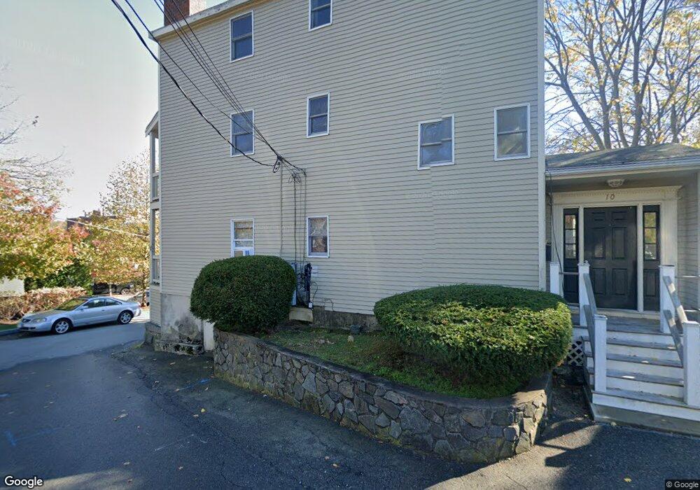
10 Anderson St Unit 12 Marblehead, MA 01945
Estimated Value: $739,000 - $930,000
3
Beds
2
Baths
1,193
Sq Ft
$666/Sq Ft
Est. Value
About This Home
This home is located at 10 Anderson St Unit 12, Marblehead, MA 01945 and is currently estimated at $794,342, approximately $665 per square foot. 10 Anderson St Unit 12 is a home located in Essex County with nearby schools including Marblehead High School, Marblehead Community Charter Public School, and Devereux School.
Ownership History
Date
Name
Owned For
Owner Type
Purchase Details
Closed on
Oct 16, 2009
Sold by
Anderson Street Rt
Bought by
10 Anderson Street Llc
Current Estimated Value
Create a Home Valuation Report for This Property
The Home Valuation Report is an in-depth analysis detailing your home's value as well as a comparison with similar homes in the area
Home Values in the Area
Average Home Value in this Area
Purchase History
| Date | Buyer | Sale Price | Title Company |
|---|---|---|---|
| 10 Anderson Street Llc | -- | -- | |
| 10 Anderson Street Llc | -- | -- |
Source: Public Records
Mortgage History
| Date | Status | Borrower | Loan Amount |
|---|---|---|---|
| Previous Owner | 10 Anderson Street Llc | $8,200,000 | |
| Previous Owner | 10 Anderson Street Llc | $7,500,000 |
Source: Public Records
Tax History Compared to Growth
Tax History
| Year | Tax Paid | Tax Assessment Tax Assessment Total Assessment is a certain percentage of the fair market value that is determined by local assessors to be the total taxable value of land and additions on the property. | Land | Improvement |
|---|---|---|---|---|
| 2025 | $5,981 | $660,900 | $480,100 | $180,800 |
| 2024 | $5,604 | $625,500 | $458,800 | $166,700 |
| 2023 | $5,990 | $599,000 | $437,400 | $161,600 |
| 2022 | $5,415 | $514,700 | $357,400 | $157,300 |
| 2021 | $5,196 | $498,700 | $341,400 | $157,300 |
| 2020 | $4,950 | $476,400 | $341,400 | $135,000 |
| 2019 | $4,193 | $390,400 | $309,400 | $81,000 |
| 2018 | $4,067 | $369,100 | $288,100 | $81,000 |
| 2017 | $3,711 | $337,100 | $256,100 | $81,000 |
| 2016 | $3,324 | $299,500 | $245,400 | $54,100 |
| 2015 | $3,200 | $288,800 | $234,700 | $54,100 |
| 2014 | $2,248 | $202,700 | $202,700 | $0 |
Source: Public Records
Map
Nearby Homes
- 290 Washington St Unit 3
- 290 Washington St Unit 2
- 290 Washington St Unit 1
- 19 Linden St
- 12 Heritage Way Unit 12
- 29 Village St Unit 1
- 41 Atlantic Ave Unit 1
- 41 Rowland St
- 2 Lindsey St
- 134 Elm St
- 132 Elm St
- 132 Elm St Unit 132
- 15 Lindsey St
- 25 Curtis St
- 66 Jersey St
- 33 Waldron St
- 60 Gregory St Unit 3
- 45 Pleasant St
- 9 Skinner's Path Unit 9
- 10 Shepard St
- 10 Anderson St Unit 3
- 10 Anderson St Unit 1
- 10 Anderson St Unit 2
- 12 Anderson St
- 14 Anderson St
- 16 Anderson St Unit 206
- 16 Anderson St Unit 107
- 16 Anderson St Unit 106
- 16 Anderson St Unit 104
- 16 Anderson St Unit 105
- 16 Anderson St Unit A
- 16 Anderson St
- 16 Anderson St Unit 204
- 16 Anderson St Unit 210
- 16 Anderson St Unit 208
- 16 Anderson St Unit 207
- 16 Anderson St Unit 205
- 129 Pleasant St
- 38 Sewall St
- 18 Anderson St