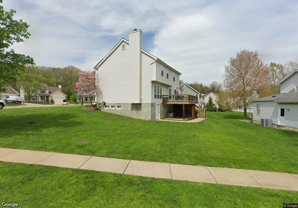
10 Autumn Peak Ct Fenton, MO 63026
Estimated Value: $434,211 - $482,000
4
Beds
3
Baths
2,142
Sq Ft
$213/Sq Ft
Est. Value
About This Home
This home is located at 10 Autumn Peak Ct, Fenton, MO 63026 and is currently estimated at $457,053, approximately $213 per square foot. 10 Autumn Peak Ct is a home located in St. Louis County with nearby schools including Concord Elementary School, Sperreng Middle School, and Lindbergh High School.
Ownership History
Date
Name
Owned For
Owner Type
Purchase Details
Closed on
Dec 6, 2021
Sold by
Schwent Mark C and Schwent Amy S
Bought by
Schwent Revocable Trust
Current Estimated Value
Purchase Details
Closed on
Apr 22, 2005
Sold by
Pentrex Development Corp
Bought by
Eaker Lloyd E and Eaker Mary F
Home Financials for this Owner
Home Financials are based on the most recent Mortgage that was taken out on this home.
Original Mortgage
$215,800
Interest Rate
5.89%
Mortgage Type
Purchase Money Mortgage
Create a Home Valuation Report for This Property
The Home Valuation Report is an in-depth analysis detailing your home's value as well as a comparison with similar homes in the area
Home Values in the Area
Average Home Value in this Area
Purchase History
| Date | Buyer | Sale Price | Title Company |
|---|---|---|---|
| Schwent Revocable Trust | -- | Husch Blackwell Llp | |
| Eaker Lloyd E | -- | -- |
Source: Public Records
Mortgage History
| Date | Status | Borrower | Loan Amount |
|---|---|---|---|
| Previous Owner | Eaker Lloyd E | $215,800 |
Source: Public Records
Tax History Compared to Growth
Tax History
| Year | Tax Paid | Tax Assessment Tax Assessment Total Assessment is a certain percentage of the fair market value that is determined by local assessors to be the total taxable value of land and additions on the property. | Land | Improvement |
|---|---|---|---|---|
| 2025 | $4,962 | $75,580 | $32,830 | $42,750 |
| 2024 | $4,962 | $69,430 | $18,240 | $51,190 |
| 2023 | $4,952 | $69,430 | $18,240 | $51,190 |
| 2022 | $4,299 | $57,920 | $16,420 | $41,500 |
| 2021 | $4,277 | $57,920 | $16,420 | $41,500 |
| 2020 | $4,189 | $54,760 | $14,590 | $40,170 |
| 2019 | $4,178 | $54,760 | $14,590 | $40,170 |
| 2018 | $3,978 | $48,740 | $12,770 | $35,970 |
| 2017 | $3,936 | $48,740 | $12,770 | $35,970 |
| 2016 | $3,935 | $48,790 | $12,770 | $36,020 |
| 2015 | $3,882 | $48,790 | $12,770 | $36,020 |
| 2014 | $3,459 | $42,810 | $8,800 | $34,010 |
Source: Public Records
Map
Nearby Homes
- 840 Fall Crown Ln
- 927 Gravois Rd
- 1248 Green Knoll Dr
- 901 Oak Dr
- 732 Deer Vue Ln
- 695 New Smizer Mill Rd
- 260 Trueman Heritage Pkwy
- 818 Mary Lee Ct
- 82 May Valley Ln
- The Westhampton Plan at Bowles Crossing
- The Rockport Plan at Bowles Crossing
- The Richmond Plan at Bowles Crossing
- The Liberty Plan at Bowles Crossing
- The Brookfield Plan at Bowles Crossing
- The Arlington Plan at Bowles Crossing
- 35 Pansy Dr Unit 35
- 683 Greenholme Ct
- 678 Greensleeves Dr
- 811 Mary Lee Ct
- The Westhampton Plan at Hawkins Point
- 337 Autumn Peak Dr
- 6 Autumn Peak Ct
- 333 Autumn Peak Dr
- 13 Autumn Peak Ct
- 340 Autumn Peak Dr
- 2 Autumn Peak Ct
- 344 Autumn Peak Dr
- 336 Autumn Peak Dr
- 8 Fall Crown Ct
- 9 Autumn Peak Ct
- 329 Autumn Peak Dr
- 402 Autumn Peak Dr
- 1 Autumn Peak Ct
- 332 Autumn Peak Dr
- 12 Fall Crown Ct
- 406 Autumn Peak Dr
- 4 Fall Crown Ct
- 328 Autumn Peak Dr
- 411 Autumn Peak Dr
- 873 Fall Crown Ln