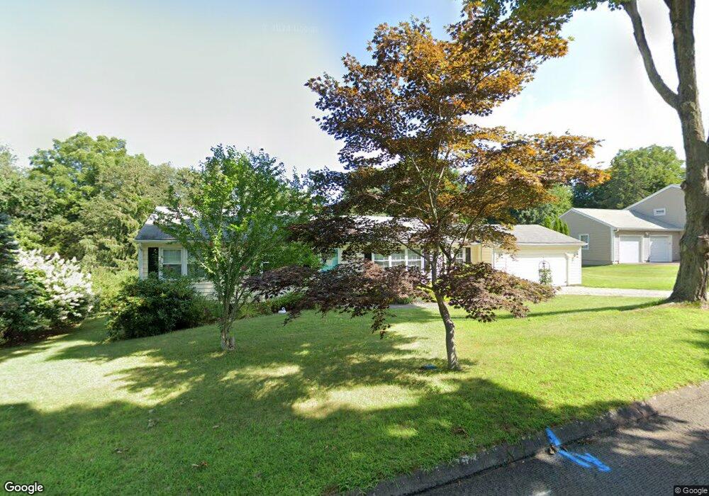
10 Bargate Rd Clinton, CT 06413
Estimated Value: $448,961 - $496,000
3
Beds
2
Baths
1,620
Sq Ft
$286/Sq Ft
Est. Value
About This Home
This home is located at 10 Bargate Rd, Clinton, CT 06413 and is currently estimated at $463,740, approximately $286 per square foot. 10 Bargate Rd is a home located in Middlesex County with nearby schools including Lewin G. Joel Jr. School and The Morgan School.
Ownership History
Date
Name
Owned For
Owner Type
Purchase Details
Closed on
Jun 19, 1987
Sold by
Flanigan John C
Bought by
Kinney James M
Current Estimated Value
Home Financials for this Owner
Home Financials are based on the most recent Mortgage that was taken out on this home.
Original Mortgage
$67,000
Interest Rate
10.54%
Mortgage Type
Purchase Money Mortgage
Create a Home Valuation Report for This Property
The Home Valuation Report is an in-depth analysis detailing your home's value as well as a comparison with similar homes in the area
Home Values in the Area
Average Home Value in this Area
Purchase History
| Date | Buyer | Sale Price | Title Company |
|---|---|---|---|
| Kinney James M | $178,000 | -- |
Source: Public Records
Mortgage History
| Date | Status | Borrower | Loan Amount |
|---|---|---|---|
| Closed | Kinney James M | $73,000 | |
| Closed | Kinney James M | $67,000 |
Source: Public Records
Tax History
| Year | Tax Paid | Tax Assessment Tax Assessment Total Assessment is a certain percentage of the fair market value that is determined by local assessors to be the total taxable value of land and additions on the property. | Land | Improvement |
|---|---|---|---|---|
| 2025 | $5,425 | $174,200 | $52,500 | $121,700 |
| 2024 | $5,271 | $174,200 | $52,500 | $121,700 |
| 2023 | $5,196 | $174,200 | $52,500 | $121,700 |
| 2022 | $5,196 | $174,200 | $52,500 | $121,700 |
| 2021 | $5,122 | $171,700 | $57,500 | $114,200 |
| 2020 | $5,366 | $171,700 | $57,500 | $114,200 |
| 2019 | $5,366 | $171,700 | $57,500 | $114,200 |
| 2018 | $5,244 | $171,700 | $57,500 | $114,200 |
| 2017 | $5,136 | $171,700 | $57,500 | $114,200 |
| 2016 | $4,660 | $171,700 | $57,500 | $114,200 |
| 2015 | $4,594 | $171,600 | $60,000 | $111,600 |
| 2014 | $4,508 | $171,600 | $60,000 | $111,600 |
Source: Public Records
Map
Nearby Homes
- 16 Silverbrook Ln
- 110 E Main St
- 13 Waterside Ln
- 144 E Main St Unit 5
- 151 E Main St Unit 12
- 0 151 - 153 East Main St Unit 15
- 0 151 - 153 East Main St Unit 14
- 0 151 - 153 East Main St Unit 17
- 0 151 - 153 East Main St Unit 16
- 0 151 - 153 East Main St Unit 18
- 153 E Main St Unit 10
- 153 E Main St Unit 13
- 153 E Main St Unit 31
- 153 E Main St Unit 8
- 153 E Main St Unit 9
- 153 E Main St Unit 6
- 153 E Main St Unit 7
- 153 E Main St Unit 11
- 153 E Main St Unit 32
- 153 E Main St Unit 5
- 8 Bargate Rd
- 12 Bargate Rd
- 9 Joshua Ln
- 5 Joshua Ln
- 6 Bargate Rd
- 11 Joshua Lane Aka 15-L & 15-R Ln
- 9 Bargate Rd
- 15 Joshua Ln
- 14 Bargate Rd
- 7 Bargate Rd
- 11 Bargate Rd
- 4 Bargate Rd
- 1 Joshua Ln
- 5 Bargate Rd
- 10 Joshua Ln Unit 12
- 13 Bargate Rd
- 10 Liberty Ridge
- 8 Liberty Ridge
- 5 Meadowview Estate
- 5 Meadowview Est Estates Unit 5B
Your Personal Tour Guide
Ask me questions while you tour the home.