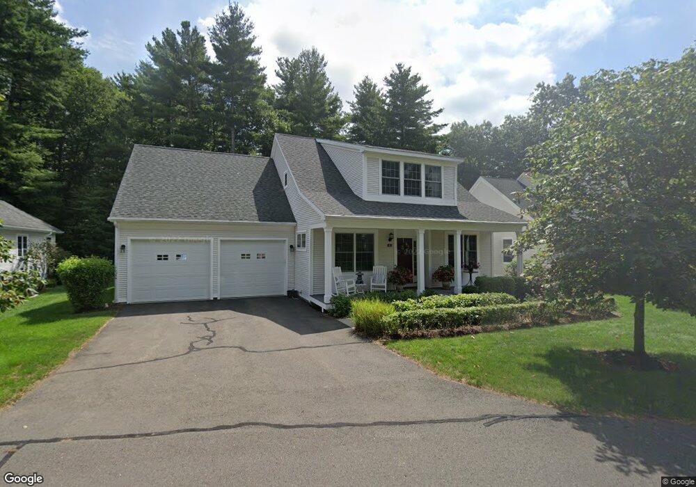
10 Barons Ct Simsbury, CT 06070
Estimated Value: $636,000 - $739,000
2
Beds
3
Baths
1,843
Sq Ft
$379/Sq Ft
Est. Value
About This Home
This home is located at 10 Barons Ct, Simsbury, CT 06070 and is currently estimated at $699,279, approximately $379 per square foot. 10 Barons Ct is a home located in Hartford County with nearby schools including Central School, Henry James Memorial School, and Simsbury High School.
Ownership History
Date
Name
Owned For
Owner Type
Purchase Details
Closed on
Mar 17, 2025
Sold by
Kew James T
Bought by
Kantor Dennis and Kantor Linda
Current Estimated Value
Purchase Details
Closed on
Jan 28, 2020
Sold by
Tannen Richard H and Tannen Carole A
Bought by
Kew James T
Home Financials for this Owner
Home Financials are based on the most recent Mortgage that was taken out on this home.
Original Mortgage
$256,500
Interest Rate
3.7%
Mortgage Type
Purchase Money Mortgage
Purchase Details
Closed on
Oct 15, 2010
Sold by
Peter F Wright Ret and Wright Peter F
Bought by
Tannen Richard H and Tannen Carole A
Create a Home Valuation Report for This Property
The Home Valuation Report is an in-depth analysis detailing your home's value as well as a comparison with similar homes in the area
Home Values in the Area
Average Home Value in this Area
Purchase History
| Date | Buyer | Sale Price | Title Company |
|---|---|---|---|
| Kantor Dennis | $735,000 | None Available | |
| Kantor Dennis | $735,000 | None Available | |
| Kew James T | $427,500 | None Available | |
| Kew James T | $427,500 | None Available | |
| Tannen Richard H | $455,000 | -- | |
| Tannen Richard H | $455,000 | -- |
Source: Public Records
Mortgage History
| Date | Status | Borrower | Loan Amount |
|---|---|---|---|
| Previous Owner | Kew James T | $256,500 |
Source: Public Records
Tax History Compared to Growth
Tax History
| Year | Tax Paid | Tax Assessment Tax Assessment Total Assessment is a certain percentage of the fair market value that is determined by local assessors to be the total taxable value of land and additions on the property. | Land | Improvement |
|---|---|---|---|---|
| 2025 | $11,040 | $323,190 | $0 | $323,190 |
| 2024 | $10,765 | $323,190 | $0 | $323,190 |
| 2023 | $10,284 | $323,190 | $0 | $323,190 |
| 2022 | $9,296 | $240,640 | $0 | $240,640 |
| 2021 | $9,296 | $240,640 | $0 | $240,640 |
| 2020 | $8,925 | $240,640 | $0 | $240,640 |
| 2019 | $11,826 | $240,640 | $0 | $240,640 |
| 2018 | $9,046 | $240,640 | $0 | $240,640 |
| 2017 | $12,167 | $279,470 | $0 | $279,470 |
| 2016 | $10,374 | $279,470 | $0 | $279,470 |
| 2015 | $10,374 | $279,470 | $0 | $279,470 |
| 2014 | $10,380 | $279,470 | $0 | $279,470 |
Source: Public Records
Map
Nearby Homes
- 16 Stratton Forest Way
- 3 Stebbins Brook Ln
- 4 Stebbins Brook Ln
- 15 Sand Hill Rd
- 1 West St Unit 206
- 40 Firetown Rd Unit 39
- 47 Long View Dr
- 44 Simsbury Manor Dr
- 308 Hopmeadow St
- 48 Library Ln Unit 48
- 18 Meadowlark Rd
- 301 Bushy Hill Rd
- 3 Cobtail Way
- 9 Cobtail Way
- 3 Minister Brook Dr
- 25 Barry Ln
- 15 Pinnacle Mountain Rd
- 10 Sachems Trail
- 8 Crane Place
- 8 Quorn Hunt Rd
- 10 Barons Ct Unit 22
- 12 Barons Ct
- 6 Barons Ct
- 14 Barons Ct
- 4 Barons Ct
- 21 Ashton Cir
- 21 Ashton Cir Unit 21
- 22 Ashton Cir
- 20 Ashton Cir
- 20 Ashton Cir Unit 20
- 28 Ashton Cir
- 28 Ashton Cir Unit 28
- 29 Ashton Cir
- 18 Ashton Cir
- 18 Ashton Cir Unit 18
- 17 Ashton Cir
- 30 Ashton Cir
- 30 Ashton Cir Unit 30
- 19 Ashton Cir
- 31 Ashton Cir