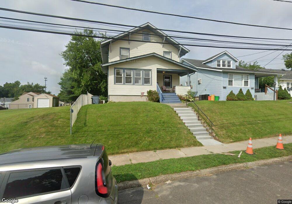
10 Barrington Ave Barrington, NJ 08007
Estimated Value: $330,000 - $353,197
--
Bed
--
Bath
1,456
Sq Ft
$233/Sq Ft
Est. Value
About This Home
This home is located at 10 Barrington Ave, Barrington, NJ 08007 and is currently estimated at $339,299, approximately $233 per square foot. 10 Barrington Ave is a home located in Camden County with nearby schools including Avon Elementary School, Woodland Elementary School, and Saint Rose of Lima Catholic School.
Ownership History
Date
Name
Owned For
Owner Type
Purchase Details
Closed on
Jun 1, 2007
Sold by
Vogt Christopher and Vogt Tina
Bought by
Gibson Alan P and Miley Darla Jean D
Current Estimated Value
Home Financials for this Owner
Home Financials are based on the most recent Mortgage that was taken out on this home.
Original Mortgage
$34,350
Outstanding Balance
$21,019
Interest Rate
6.19%
Mortgage Type
Stand Alone Second
Estimated Equity
$318,280
Create a Home Valuation Report for This Property
The Home Valuation Report is an in-depth analysis detailing your home's value as well as a comparison with similar homes in the area
Home Values in the Area
Average Home Value in this Area
Purchase History
| Date | Buyer | Sale Price | Title Company |
|---|---|---|---|
| Gibson Alan P | $229,000 | -- |
Source: Public Records
Mortgage History
| Date | Status | Borrower | Loan Amount |
|---|---|---|---|
| Open | Gibson Alan P | $34,350 | |
| Open | Gibson Alan P | $183,200 |
Source: Public Records
Tax History Compared to Growth
Tax History
| Year | Tax Paid | Tax Assessment Tax Assessment Total Assessment is a certain percentage of the fair market value that is determined by local assessors to be the total taxable value of land and additions on the property. | Land | Improvement |
|---|---|---|---|---|
| 2025 | $8,226 | $171,800 | $47,200 | $124,600 |
| 2024 | $7,942 | $171,800 | $47,200 | $124,600 |
| 2023 | $7,942 | $171,800 | $47,200 | $124,600 |
| 2022 | $7,772 | $171,800 | $47,200 | $124,600 |
| 2021 | $7,375 | $171,800 | $47,200 | $124,600 |
| 2020 | $7,559 | $171,800 | $47,200 | $124,600 |
| 2019 | $7,527 | $171,800 | $47,200 | $124,600 |
| 2018 | $7,381 | $171,800 | $47,200 | $124,600 |
| 2017 | $7,197 | $171,800 | $47,200 | $124,600 |
| 2016 | $7,097 | $189,200 | $63,900 | $125,300 |
| 2015 | $6,864 | $189,200 | $63,900 | $125,300 |
| 2014 | $6,575 | $189,200 | $63,900 | $125,300 |
Source: Public Records
Map
Nearby Homes
- 233 Haines Ave
- 115 Woodland Ave
- 0 Bell Ave
- 330 Haines Ave
- 325 Reading Ave
- 300 Austin Ave
- 325 Albany Ave
- 407 Kingston Ave
- 406 Austin Ave
- 425 White Horse Pike
- 411 Albany Ave
- 401 E Atlantic Ave Unit U217
- 134 Kent Rd
- 413 Company St
- 204 Adams Ave
- 499 Austin Ave
- 318 White Horse Pike
- 0 Thomas Ave S
- 226 Adams Ave
- 225 9th Ave
- 8 Barrington Ave
- 6 Barrington Ave
- 116 Haines Ave
- 118 Haines Ave
- 4 Barrington Ave
- 118 Clements Bridge Rd
- 113 Trenton Ave
- 112 Clements Bridge Rd
- 116 Clements Bridge Rd
- 2 Barrington Ave
- 1 E Haines Ave
- 108 Clements Bridge Rd
- 110 Trenton Ave Unit 4
- 110 Trenton Ave
- 110 Trenton Ave Unit 3
- 110 Trenton Ave Unit 3 & 4
- 106 Clements Bridge Rd
- 102 Clements Bridge Rd
- 3 E Haines Ave
- 7 Atlantic Ave