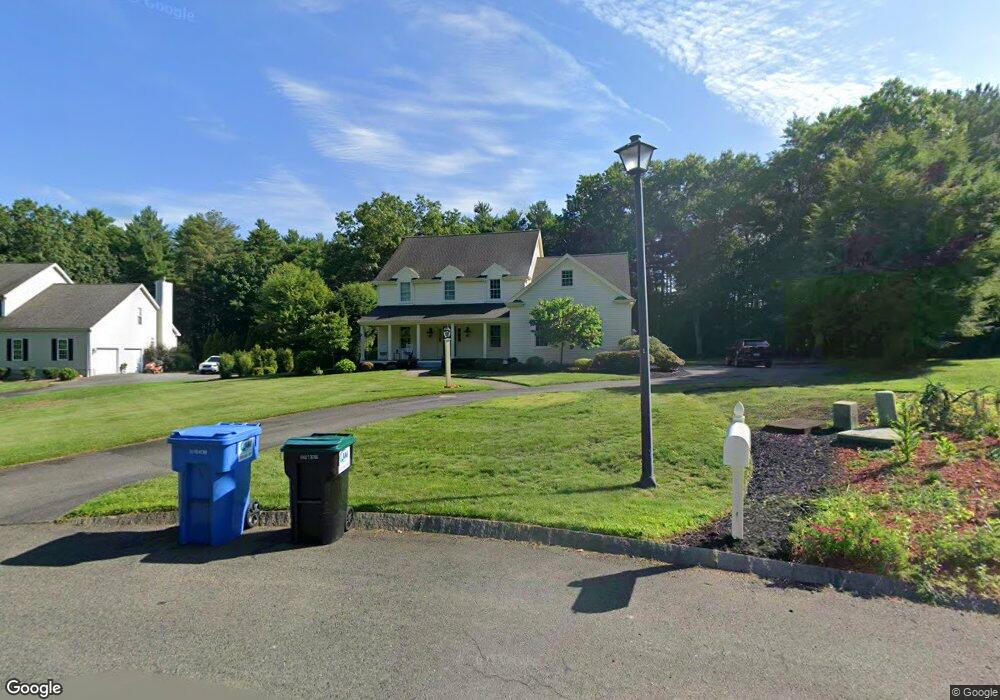
10 Bartley Dr Norton, MA 02766
Estimated Value: $902,000 - $1,104,000
4
Beds
4
Baths
3,684
Sq Ft
$271/Sq Ft
Est. Value
About This Home
This home is located at 10 Bartley Dr, Norton, MA 02766 and is currently estimated at $998,314, approximately $270 per square foot. 10 Bartley Dr is a home located in Bristol County with nearby schools including L.G. Nourse Elementary School, Henri A. Yelle Elementary School, and Norton Middle School.
Create a Home Valuation Report for This Property
The Home Valuation Report is an in-depth analysis detailing your home's value as well as a comparison with similar homes in the area
Home Values in the Area
Average Home Value in this Area
Tax History
| Year | Tax Paid | Tax Assessment Tax Assessment Total Assessment is a certain percentage of the fair market value that is determined by local assessors to be the total taxable value of land and additions on the property. | Land | Improvement |
|---|---|---|---|---|
| 2025 | $109 | $837,300 | $207,800 | $629,500 |
| 2024 | $10,451 | $807,000 | $197,800 | $609,200 |
| 2023 | $9,902 | $762,300 | $186,600 | $575,700 |
| 2022 | $9,631 | $675,400 | $169,600 | $505,800 |
| 2021 | $9,467 | $634,100 | $161,600 | $472,500 |
| 2020 | $9,212 | $622,400 | $156,800 | $465,600 |
| 2019 | $9,464 | $635,200 | $150,900 | $484,300 |
| 2018 | $9,364 | $617,700 | $150,900 | $466,800 |
| 2017 | $9,316 | $606,100 | $150,900 | $455,200 |
| 2016 | $8,930 | $572,100 | $150,900 | $421,200 |
| 2015 | $8,685 | $564,300 | $147,900 | $416,400 |
| 2014 | $8,355 | $543,600 | $140,900 | $402,700 |
Source: Public Records
Map
Nearby Homes
- 195 E Main St
- 0 S Washington St Unit 73437419
- O Leonard St
- 17 Lloyd Cir Unit 36
- 24 Lloyd Cir Unit 34
- 4 Stanley Rd
- 9 Winnecunnet Dr Unit 9
- 103 King Philip Rd
- 90 Pine St
- 11 Lloyd Cir Unit 39
- 35 Owen Rd
- 29 Germain Way Unit 3
- Lot 3B Hill St
- 152 Pine St Unit 23
- 1 Wilbur Terrace Unit 6
- 30 Samoset St
- 46 Newland St
- 20 Lloyd Cir Unit 32
- 14 Lloyd Cir Unit 29
- 3 Patlena Dr
Your Personal Tour Guide
Ask me questions while you tour the home.