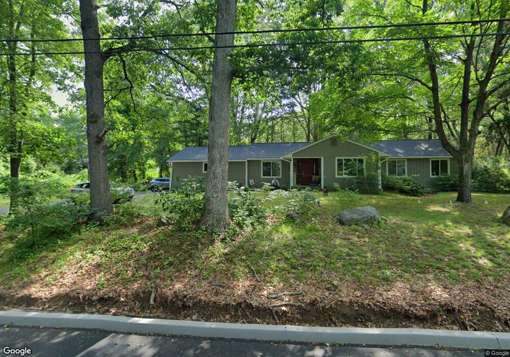
10 Bayne Ct Norwalk, CT 06851
Cranbury NeighborhoodEstimated Value: $841,000 - $978,705
3
Beds
2
Baths
2,177
Sq Ft
$422/Sq Ft
Est. Value
About This Home
This home is located at 10 Bayne Ct, Norwalk, CT 06851 and is currently estimated at $917,926, approximately $421 per square foot. 10 Bayne Ct is a home located in Fairfield County with nearby schools including Cranbury Elementary School, West Rocks Middle School, and Norwalk High School.
Ownership History
Date
Name
Owned For
Owner Type
Purchase Details
Closed on
Oct 1, 2004
Sold by
Mcgrath Kevin
Bought by
Grimmer Scott and Grimmer Arlene
Current Estimated Value
Home Financials for this Owner
Home Financials are based on the most recent Mortgage that was taken out on this home.
Original Mortgage
$333,700
Interest Rate
5.81%
Purchase Details
Closed on
May 4, 2000
Sold by
Lehn Robert G and Lehn Karen
Bought by
Mcgrath Kevin
Create a Home Valuation Report for This Property
The Home Valuation Report is an in-depth analysis detailing your home's value as well as a comparison with similar homes in the area
Home Values in the Area
Average Home Value in this Area
Purchase History
| Date | Buyer | Sale Price | Title Company |
|---|---|---|---|
| Grimmer Scott | $650,000 | -- | |
| Grimmer Scott | $650,000 | -- | |
| Mcgrath Kevin | $450,000 | -- | |
| Mcgrath Kevin | $450,000 | -- |
Source: Public Records
Mortgage History
| Date | Status | Borrower | Loan Amount |
|---|---|---|---|
| Open | Mcgrath Kevin | $95,000 | |
| Open | Mcgrath Kevin | $315,000 | |
| Closed | Mcgrath Kevin | $333,700 |
Source: Public Records
Tax History Compared to Growth
Tax History
| Year | Tax Paid | Tax Assessment Tax Assessment Total Assessment is a certain percentage of the fair market value that is determined by local assessors to be the total taxable value of land and additions on the property. | Land | Improvement |
|---|---|---|---|---|
| 2025 | $13,462 | $567,040 | $242,660 | $324,380 |
| 2024 | $13,255 | $567,040 | $242,660 | $324,380 |
| 2023 | $10,932 | $437,860 | $194,130 | $243,730 |
| 2022 | $10,760 | $437,860 | $194,130 | $243,730 |
| 2021 | $9,156 | $437,860 | $194,130 | $243,730 |
| 2020 | $10,336 | $437,860 | $194,130 | $243,730 |
| 2019 | $9,982 | $437,860 | $194,130 | $243,730 |
| 2018 | $10,539 | $406,430 | $209,220 | $197,210 |
| 2017 | $10,170 | $406,420 | $209,220 | $197,200 |
| 2016 | $10,340 | $406,430 | $209,220 | $197,210 |
| 2015 | $9,287 | $406,430 | $209,220 | $197,210 |
| 2014 | $10,177 | $406,430 | $209,220 | $197,210 |
Source: Public Records
Map
Nearby Homes
- 510 Foxboro Dr
- 29 Grumman Ave
- 41 Mohawk Dr
- 123 Old Belden Hill Rd Unit 40
- 28 Village Ct
- 27 Stonecrop Rd
- 180 E Rocks Rd
- 32 Thistle Rd
- 57 Creeping Hemlock Dr
- 442 Main Ave Unit A5
- 105 Danbury Rd
- 8 Stonecrop Rd
- 8 Caddy Rd
- 36 Donohue Dr
- 515 Belden Hill Rd
- 4 Frank St
- 56 Partrick Rd
- 57 Partrick Rd
- 71 Aiken St Unit P12
- 9 Allen Ct