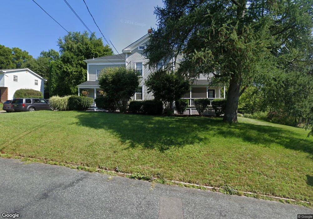
10 Beavers St High Bridge, NJ 08829
Estimated Value: $596,000 - $650,000
--
Bed
--
Bath
2,944
Sq Ft
$214/Sq Ft
Est. Value
About This Home
This home is located at 10 Beavers St, High Bridge, NJ 08829 and is currently estimated at $629,662, approximately $213 per square foot. 10 Beavers St is a home located in Hunterdon County with nearby schools including High Bridge Elementary School, High Bridge Middle School, and Voorhees High School.
Ownership History
Date
Name
Owned For
Owner Type
Purchase Details
Closed on
Sep 18, 2004
Sold by
Wentworth Kevin F and Wentworth Debra
Bought by
Kearney John and Kearney Jennifer
Current Estimated Value
Home Financials for this Owner
Home Financials are based on the most recent Mortgage that was taken out on this home.
Original Mortgage
$332,500
Outstanding Balance
$172,797
Interest Rate
6.62%
Mortgage Type
Purchase Money Mortgage
Estimated Equity
$456,865
Create a Home Valuation Report for This Property
The Home Valuation Report is an in-depth analysis detailing your home's value as well as a comparison with similar homes in the area
Home Values in the Area
Average Home Value in this Area
Purchase History
| Date | Buyer | Sale Price | Title Company |
|---|---|---|---|
| Kearney John | $350,000 | United General Title Ins Co |
Source: Public Records
Mortgage History
| Date | Status | Borrower | Loan Amount |
|---|---|---|---|
| Open | Kearney John | $332,500 |
Source: Public Records
Tax History Compared to Growth
Tax History
| Year | Tax Paid | Tax Assessment Tax Assessment Total Assessment is a certain percentage of the fair market value that is determined by local assessors to be the total taxable value of land and additions on the property. | Land | Improvement |
|---|---|---|---|---|
| 2025 | $16,049 | $455,900 | $109,300 | $346,600 |
| 2024 | $16,267 | $491,700 | $149,600 | $342,100 |
| 2023 | $16,267 | $411,400 | $113,900 | $297,500 |
| 2022 | $13,088 | $307,600 | $99,400 | $208,200 |
| 2021 | $12,666 | $306,600 | $99,400 | $207,200 |
| 2020 | $12,571 | $306,600 | $99,400 | $207,200 |
| 2019 | $12,666 | $306,600 | $99,400 | $207,200 |
| 2018 | $12,048 | $304,000 | $96,800 | $207,200 |
| 2017 | $12,082 | $313,500 | $106,300 | $207,200 |
| 2016 | $11,941 | $313,500 | $106,300 | $207,200 |
| 2015 | $11,618 | $313,500 | $106,300 | $207,200 |
| 2014 | $11,953 | $348,600 | $140,500 | $208,100 |
Source: Public Records
Map
Nearby Homes