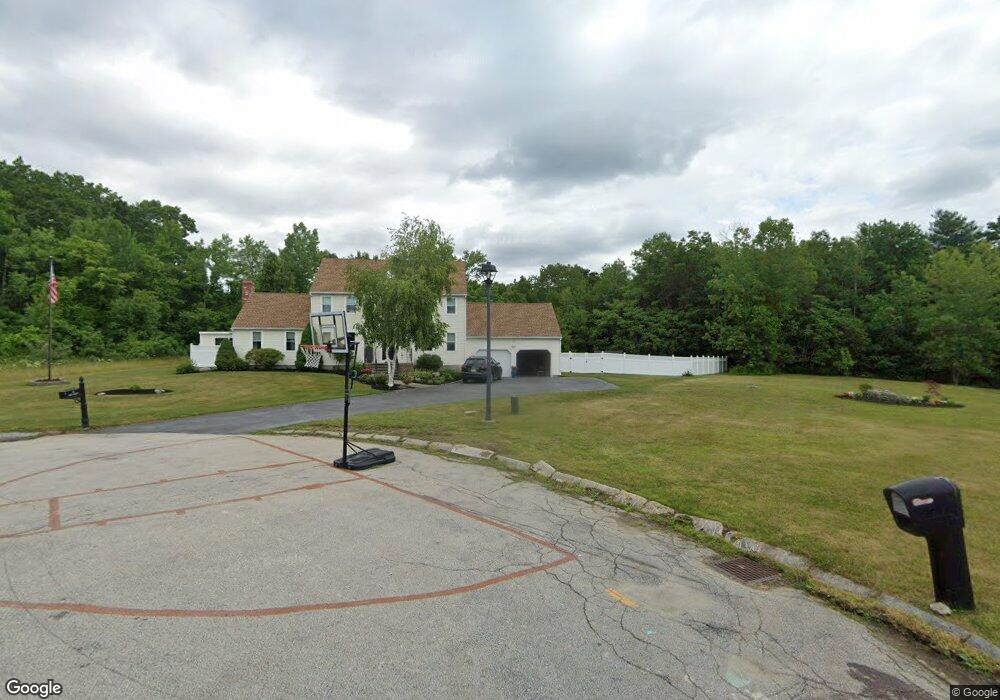
10 Bill Graham Ln Millbury, MA 01527
Estimated Value: $701,230 - $797,000
4
Beds
4
Baths
3,480
Sq Ft
$213/Sq Ft
Est. Value
About This Home
This home is located at 10 Bill Graham Ln, Millbury, MA 01527 and is currently estimated at $742,058, approximately $213 per square foot. 10 Bill Graham Ln is a home located in Worcester County with nearby schools including Elmwood Street Elementary School, Raymond E. Shaw Elementary School, and Millbury Junior/Senior High School.
Ownership History
Date
Name
Owned For
Owner Type
Purchase Details
Closed on
Nov 28, 2016
Sold by
Kazmierczak Justin R and Kazmierczak Karen M
Bought by
Kazmierczak Karen M
Current Estimated Value
Purchase Details
Closed on
Sep 26, 2007
Sold by
Ragaini Angela M and Ragaini Christopher J
Bought by
Kazmierczak Justin R and Kazmierczak Karen M
Home Financials for this Owner
Home Financials are based on the most recent Mortgage that was taken out on this home.
Original Mortgage
$348,700
Interest Rate
6.65%
Mortgage Type
Purchase Money Mortgage
Purchase Details
Closed on
Jul 26, 2001
Sold by
Rollie Shepard Rt and Miles John Todd
Bought by
Ragaini Christopher J and Ragaini Angela M
Create a Home Valuation Report for This Property
The Home Valuation Report is an in-depth analysis detailing your home's value as well as a comparison with similar homes in the area
Home Values in the Area
Average Home Value in this Area
Purchase History
| Date | Buyer | Sale Price | Title Company |
|---|---|---|---|
| Kazmierczak Karen M | -- | -- | |
| Kazmierczak Karen M | -- | -- | |
| Kazmierczak Justin R | $465,000 | -- | |
| Kazmierczak Justin R | $465,000 | -- | |
| Ragaini Christopher J | $300,000 | -- |
Source: Public Records
Mortgage History
| Date | Status | Borrower | Loan Amount |
|---|---|---|---|
| Previous Owner | Kazmierczak Justin R | $348,700 | |
| Previous Owner | Ragaini Christopher J | $318,750 | |
| Previous Owner | Ragaini Christopher J | $255,000 |
Source: Public Records
Tax History Compared to Growth
Tax History
| Year | Tax Paid | Tax Assessment Tax Assessment Total Assessment is a certain percentage of the fair market value that is determined by local assessors to be the total taxable value of land and additions on the property. | Land | Improvement |
|---|---|---|---|---|
| 2025 | $7,632 | $570,000 | $121,300 | $448,700 |
| 2024 | $7,003 | $529,300 | $112,400 | $416,900 |
| 2023 | $6,383 | $441,700 | $78,800 | $362,900 |
| 2022 | $5,750 | $383,300 | $78,800 | $304,500 |
| 2021 | $4,147 | $367,300 | $78,800 | $288,500 |
| 2020 | $5,549 | $362,000 | $78,800 | $283,200 |
| 2019 | $5,557 | $350,600 | $78,400 | $272,200 |
| 2018 | $5,510 | $337,200 | $78,400 | $258,800 |
| 2017 | $5,171 | $314,700 | $81,800 | $232,900 |
| 2016 | $5,213 | $316,700 | $81,800 | $234,900 |
| 2015 | $5,112 | $310,600 | $87,000 | $223,600 |
| 2014 | $4,737 | $277,000 | $87,000 | $190,000 |
Source: Public Records
Map
Nearby Homes
- 3 May St
- 90 Macarthur Dr
- 86 Wheelock Ave
- 2 Diane St
- 12 Irene Ct
- 11 Westview Ave
- 46 John Dr Unit 46
- 5 Edward Dr
- 1 Pineland Ave
- 21 Lordvale Blvd Unit 406
- 28 Lincoln Ln
- 5 Lincoln Ln Unit 5
- 1 Broadmeadow Ave
- 76 Samuel Dr
- 12 Alstead Path
- 11 Maplewood Rd
- 27 A-B Grafton St
- 330 Millbury Ave
- 3 Stidsen Way
- 123 Riverlin St
- 8 Bill Graham Ln
- 7 Bill Graham Ln
- 6 Bill Graham Ln
- 5 Bill Graham Ln
- 4 Bill Graham Ln
- 3 Bill Graham Ln
- 2 Bill Graham Ln
- 15 Rollie Shepard Dr
- 1 Bill Graham Ln
- 13 Rollie Shepard Dr
- 17 Rollie Shepard Dr
- 11 Rollie Shepard Dr
- 19 Rollie Shepard Dr
- 9 Rollie Shepard Dr
- 16 Rollie Shepard Dr
- 14 Rollie Shepard Dr
- 18 Rollie Shepard Dr
- 21 Rollie Shepard Dr
- 12 Rollie Shepard Dr
- 10 Rollie Shepard Dr