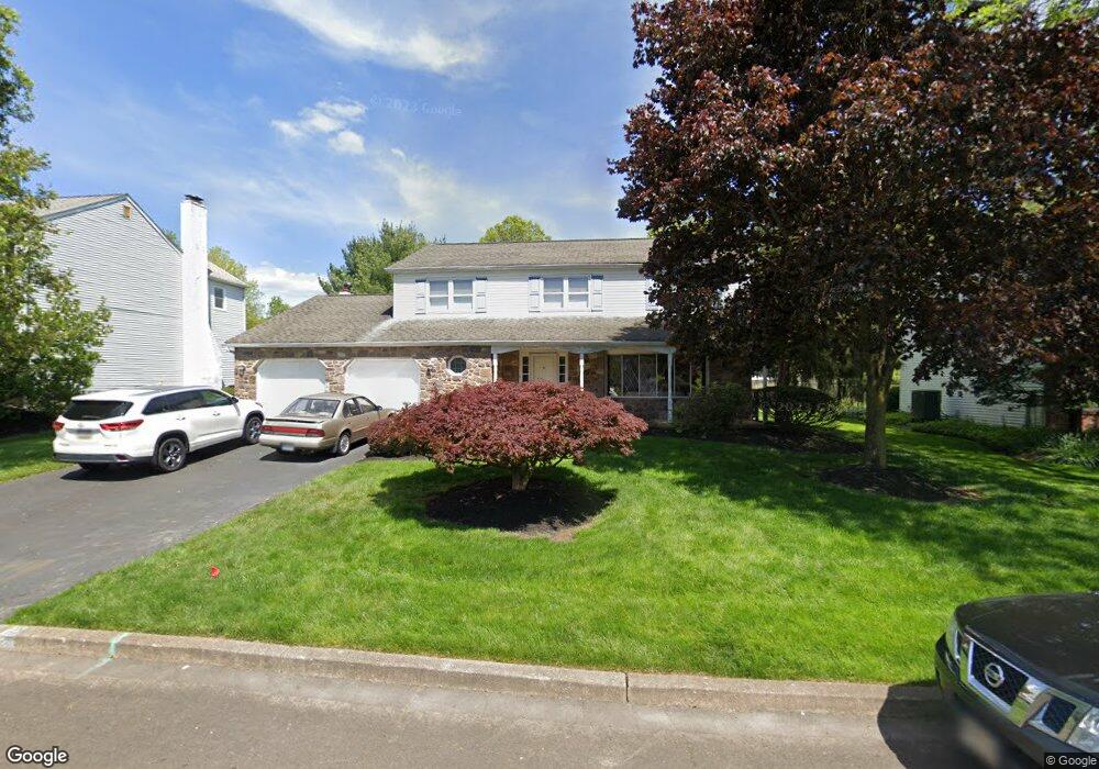
10 Black Pine Rd Southampton, PA 18966
Estimated Value: $720,360 - $770,000
4
Beds
3
Baths
2,645
Sq Ft
$282/Sq Ft
Est. Value
About This Home
This home is located at 10 Black Pine Rd, Southampton, PA 18966 and is currently estimated at $745,340, approximately $281 per square foot. 10 Black Pine Rd is a home located in Bucks County with nearby schools including Hillcrest El School, Holland Middle School, and Council Rock High School - South.
Ownership History
Date
Name
Owned For
Owner Type
Purchase Details
Closed on
Dec 6, 2005
Sold by
Derr Robert A and Derr Alice S
Bought by
Derr Robert A
Current Estimated Value
Home Financials for this Owner
Home Financials are based on the most recent Mortgage that was taken out on this home.
Original Mortgage
$300,000
Outstanding Balance
$168,350
Interest Rate
6.34%
Mortgage Type
Balloon
Estimated Equity
$576,990
Purchase Details
Closed on
Jul 22, 1980
Bought by
Derr Robert A and Derr Alice S
Create a Home Valuation Report for This Property
The Home Valuation Report is an in-depth analysis detailing your home's value as well as a comparison with similar homes in the area
Home Values in the Area
Average Home Value in this Area
Purchase History
| Date | Buyer | Sale Price | Title Company |
|---|---|---|---|
| Derr Robert A | $400,000 | None Available | |
| Derr Robert A | $99,200 | -- |
Source: Public Records
Mortgage History
| Date | Status | Borrower | Loan Amount |
|---|---|---|---|
| Open | Derr Robert A | $300,000 |
Source: Public Records
Tax History Compared to Growth
Tax History
| Year | Tax Paid | Tax Assessment Tax Assessment Total Assessment is a certain percentage of the fair market value that is determined by local assessors to be the total taxable value of land and additions on the property. | Land | Improvement |
|---|---|---|---|---|
| 2025 | $7,751 | $40,240 | $7,840 | $32,400 |
| 2024 | $7,751 | $40,240 | $7,840 | $32,400 |
| 2023 | $7,305 | $40,240 | $7,840 | $32,400 |
| 2022 | $7,238 | $40,240 | $7,840 | $32,400 |
| 2021 | $7,009 | $40,240 | $7,840 | $32,400 |
| 2020 | $6,851 | $40,240 | $7,840 | $32,400 |
| 2019 | $6,558 | $40,240 | $7,840 | $32,400 |
| 2018 | $6,441 | $40,240 | $7,840 | $32,400 |
| 2017 | $6,193 | $40,240 | $7,840 | $32,400 |
| 2016 | $6,193 | $40,240 | $7,840 | $32,400 |
| 2015 | -- | $40,240 | $7,840 | $32,400 |
| 2014 | -- | $40,240 | $7,840 | $32,400 |
Source: Public Records
Map
Nearby Homes
- 258 Woodlake Dr
- 6 Rolling Hills Dr
- 41 Grant Dr
- 27 Rocking Horse Way
- 270 Rocksville Rd
- 7 Bennett Place
- 21019 Bennett Place Unit 7
- 29 Langhorne Ave
- 147 Watergate Dr
- 52 Dalton Way
- 527 Ashton Cir
- 537 Ashton Cir
- 6 Springwood Place
- 6 Windy Knoll Dr
- 151 Knox Ct
- 518 Pebble Ridge Ct
- 15 Dover Place
- 98 Twigkenham Dr
- 65 Witherington Dr
- 105 Hopkins Ct Unit 744A
- 14 Black Pine Rd
- 6 Black Pine Rd
- 40 Forrest Dr
- 18 Black Pine Rd
- 4 Black Pine Rd
- 32 Balsam Ct
- 30 Balsam Ct
- 11 Black Pine Rd
- 22 Black Pine Rd
- 15 Black Pine Rd
- 34 Balsam Ct
- 7 Black Pine Rd
- 19 Black Pine Rd
- 52 Forrest Dr
- 23 Black Pine Rd
- 26 Black Pine Rd
- 28 Balsam Ct
- 43 Forrest Dr
- 39 Forrest Dr
- 35 Forrest Dr