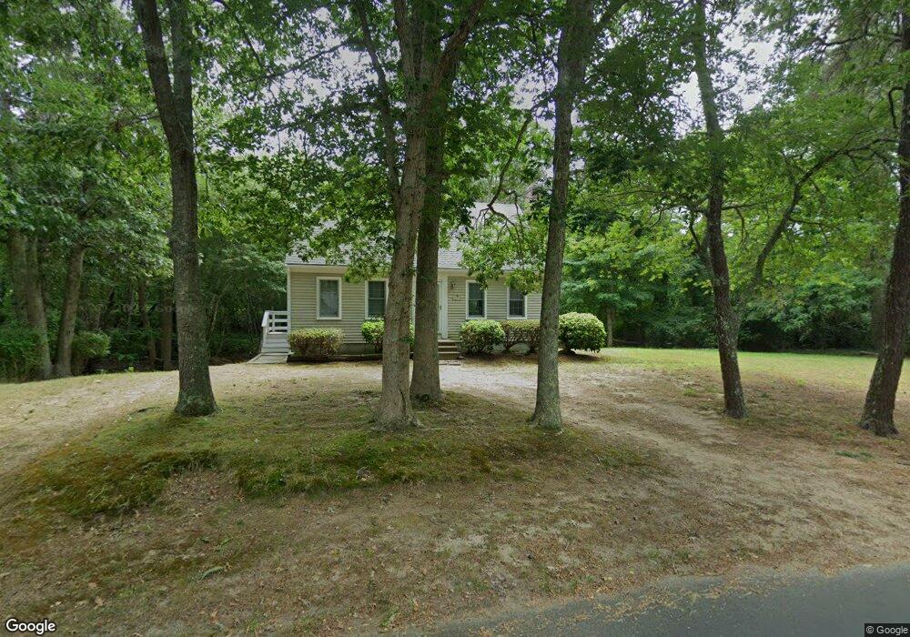
10 Blue Heron Way Eastham, MA 02642
Estimated Value: $641,072 - $785,000
3
Beds
2
Baths
1,265
Sq Ft
$560/Sq Ft
Est. Value
About This Home
This home is located at 10 Blue Heron Way, Eastham, MA 02642 and is currently estimated at $708,018, approximately $559 per square foot. 10 Blue Heron Way is a home located in Barnstable County with nearby schools including Eastham Elementary School, Nauset Regional Middle School, and Nauset Regional High School.
Ownership History
Date
Name
Owned For
Owner Type
Purchase Details
Closed on
Sep 8, 2010
Sold by
Petro Theodore and Petro Maureen C
Bought by
Petro Theodore and Petro Maureen C
Current Estimated Value
Purchase Details
Closed on
Nov 2, 2000
Sold by
Bab Rt and Bharwani Joan C
Bought by
Petro Theodore and Petro Maureen C
Purchase Details
Closed on
Mar 21, 1991
Sold by
Higgins Leonard F
Bought by
Bob Real Est T
Create a Home Valuation Report for This Property
The Home Valuation Report is an in-depth analysis detailing your home's value as well as a comparison with similar homes in the area
Home Values in the Area
Average Home Value in this Area
Purchase History
| Date | Buyer | Sale Price | Title Company |
|---|---|---|---|
| Petro Theodore | -- | -- | |
| Petro Theodore | $219,000 | -- | |
| Bob Real Est T | $125,000 | -- |
Source: Public Records
Mortgage History
| Date | Status | Borrower | Loan Amount |
|---|---|---|---|
| Previous Owner | Bob Real Est T | $92,000 |
Source: Public Records
Tax History Compared to Growth
Tax History
| Year | Tax Paid | Tax Assessment Tax Assessment Total Assessment is a certain percentage of the fair market value that is determined by local assessors to be the total taxable value of land and additions on the property. | Land | Improvement |
|---|---|---|---|---|
| 2025 | $4,482 | $581,300 | $256,300 | $325,000 |
| 2024 | $3,956 | $564,400 | $248,800 | $315,600 |
| 2023 | $3,658 | $505,200 | $230,400 | $274,800 |
| 2022 | $3,465 | $403,900 | $205,700 | $198,200 |
| 2021 | $3,370 | $367,100 | $187,000 | $180,100 |
| 2020 | $3,134 | $359,400 | $190,800 | $168,600 |
| 2019 | $2,897 | $351,200 | $185,300 | $165,900 |
| 2018 | $2,847 | $341,000 | $179,900 | $161,100 |
| 2017 | $2,641 | $334,300 | $176,400 | $157,900 |
| 2016 | $2,481 | $333,500 | $176,400 | $157,100 |
| 2015 | $2,311 | $325,500 | $172,900 | $152,600 |
Source: Public Records
Map
Nearby Homes
- 330 Hay Rd
- 1061 State Hwy Unit 4
- 993 Intonti Way
- 995 Intonti Way
- 785 State Hwy Unit 9
- 30 Cove Rd
- 25 Twin Rocks Dr
- 180 Country Ln
- 20 White Pines Dr
- 60 Smith Heights Way
- 20 Kittiwake Ln
- 1875 State Hwy
- 1975 State Hwy Unit 3
- 1975 State Hwy Unit 5
- 6 Snow Way
- 46 Freeman Ln
- 320 State Hwy
- 150 Old State Hwy Unit Compound
- 10 Cartway N
- 385 Bridge Rd