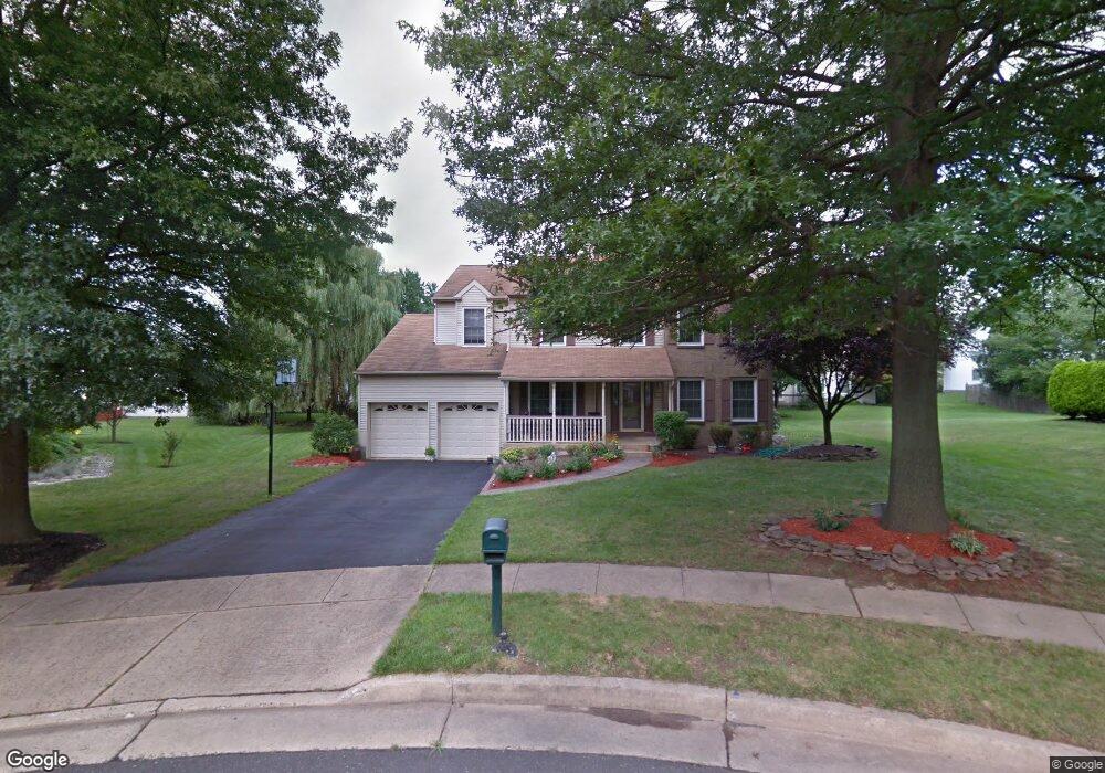
10 Bolton Cir Newtown, PA 18940
Estimated Value: $788,000 - $865,000
4
Beds
3
Baths
2,927
Sq Ft
$284/Sq Ft
Est. Value
About This Home
This home is located at 10 Bolton Cir, Newtown, PA 18940 and is currently estimated at $830,282, approximately $283 per square foot. 10 Bolton Cir is a home located in Bucks County with nearby schools including Goodnoe Elementary School, Newtown Middle School, and Council Rock High School North.
Ownership History
Date
Name
Owned For
Owner Type
Purchase Details
Closed on
Jun 20, 1995
Sold by
Bogus George and Bogus Rita
Bought by
Shevlin Barry R and Klemow Shevlin Sherri
Current Estimated Value
Home Financials for this Owner
Home Financials are based on the most recent Mortgage that was taken out on this home.
Original Mortgage
$160,000
Interest Rate
7.84%
Purchase Details
Closed on
Jun 6, 1989
Bought by
Bogus George
Create a Home Valuation Report for This Property
The Home Valuation Report is an in-depth analysis detailing your home's value as well as a comparison with similar homes in the area
Home Values in the Area
Average Home Value in this Area
Purchase History
| Date | Buyer | Sale Price | Title Company |
|---|---|---|---|
| Shevlin Barry R | $238,600 | -- | |
| Bogus George | $226,900 | -- |
Source: Public Records
Mortgage History
| Date | Status | Borrower | Loan Amount |
|---|---|---|---|
| Closed | Shevlin Barry R | $160,000 |
Source: Public Records
Tax History Compared to Growth
Tax History
| Year | Tax Paid | Tax Assessment Tax Assessment Total Assessment is a certain percentage of the fair market value that is determined by local assessors to be the total taxable value of land and additions on the property. | Land | Improvement |
|---|---|---|---|---|
| 2025 | $8,317 | $46,800 | $8,920 | $37,880 |
| 2024 | $8,317 | $46,800 | $8,920 | $37,880 |
| 2023 | $1,664 | $46,800 | $8,920 | $37,880 |
| 2022 | $7,804 | $46,800 | $8,920 | $37,880 |
| 2021 | $7,683 | $46,800 | $8,920 | $37,880 |
| 2020 | $7,313 | $46,800 | $8,920 | $37,880 |
| 2019 | $7,140 | $46,800 | $8,920 | $37,880 |
| 2018 | $7,004 | $46,800 | $8,920 | $37,880 |
| 2017 | $6,761 | $46,800 | $8,920 | $37,880 |
| 2016 | $6,714 | $46,800 | $8,920 | $37,880 |
| 2015 | -- | $46,800 | $8,920 | $37,880 |
| 2014 | -- | $46,800 | $8,920 | $37,880 |
Source: Public Records
Map
Nearby Homes
- 41 Nathan Ct
- 54 Kanon Ct
- 532 Penn St
- 337 S Lincoln Ave
- 349 S Lincoln Ave
- 440 S State St Unit D3
- 7 Dunham Ln
- 8 Dunham Ln
- 106 Hicks Alley
- 113 Penn St
- 113 Thorton Ln
- 101 N Norwood Ave
- 22 Penn St
- 313 Washington Ave
- 226 Court St
- 206 Paxon Alley Unit 51
- 204 Ezra Rd Unit HOMESITE 2
- Melody Elite Plan at Regency at Stone Meadows Farm - Villas Collection
- Eleanor Elite Plan at Regency at Stone Meadows Farm - Villas Collection
- Adaline Elite Plan at Regency at Stone Meadows Farm - Carriages Collection