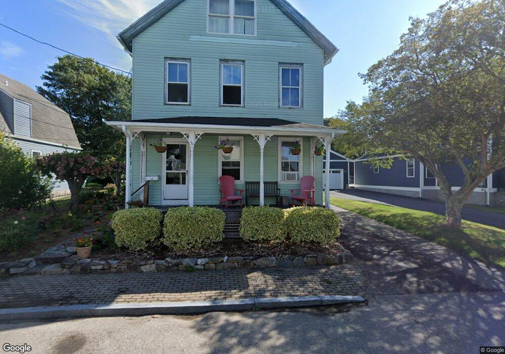
10 Bradley St Stonington, CT 06378
Estimated Value: $703,000 - $789,000
2
Beds
3
Baths
2,160
Sq Ft
$352/Sq Ft
Est. Value
About This Home
This home is located at 10 Bradley St, Stonington, CT 06378 and is currently estimated at $759,659, approximately $351 per square foot. 10 Bradley St is a home located in New London County with nearby schools including Stonington Middle School, Stonington High School, and Pine Point School.
Ownership History
Date
Name
Owned For
Owner Type
Purchase Details
Closed on
Feb 13, 2023
Sold by
Jette Edwin L and Jette Mary E
Bought by
Jette Lt T and Jette J
Current Estimated Value
Purchase Details
Closed on
Apr 26, 2010
Sold by
Mauser William
Bought by
Mauser Edith
Create a Home Valuation Report for This Property
The Home Valuation Report is an in-depth analysis detailing your home's value as well as a comparison with similar homes in the area
Home Values in the Area
Average Home Value in this Area
Purchase History
| Date | Buyer | Sale Price | Title Company |
|---|---|---|---|
| Jette Lt T | -- | None Available | |
| Mauser Edith | -- | -- | |
| Mauser Edith | -- | -- |
Source: Public Records
Mortgage History
| Date | Status | Borrower | Loan Amount |
|---|---|---|---|
| Previous Owner | Mauser Edith | $121,000 | |
| Previous Owner | Mauser Edith | $110,000 | |
| Previous Owner | Mauser Edith | $75,000 |
Source: Public Records
Tax History Compared to Growth
Tax History
| Year | Tax Paid | Tax Assessment Tax Assessment Total Assessment is a certain percentage of the fair market value that is determined by local assessors to be the total taxable value of land and additions on the property. | Land | Improvement |
|---|---|---|---|---|
| 2025 | $7,984 | $399,600 | $110,300 | $289,300 |
| 2024 | $7,631 | $399,600 | $110,300 | $289,300 |
| 2023 | $7,678 | $399,600 | $110,300 | $289,300 |
| 2022 | $6,355 | $250,300 | $77,400 | $172,900 |
| 2021 | $6,390 | $250,300 | $77,400 | $172,900 |
| 2020 | $6,290 | $250,300 | $77,400 | $172,900 |
| 2019 | $6,285 | $250,300 | $77,400 | $172,900 |
| 2018 | $6,117 | $250,300 | $77,400 | $172,900 |
| 2017 | $5,778 | $233,000 | $77,400 | $155,600 |
| 2016 | $5,627 | $233,000 | $77,400 | $155,600 |
| 2015 | $5,392 | $233,000 | $77,400 | $155,600 |
| 2014 | $5,184 | $233,000 | $77,400 | $155,600 |
Source: Public Records
Map
Nearby Homes
- 43 Broad St
- 103 Main St Unit 1103
- 32 Broadway Ave
- 259 N Main St
- 8 Richmond Ln
- 1 Harmony St
- 92 Water St
- 11 Main St
- 88 Water St
- 4 Northwest St Unit 34
- 218 N Water St
- 20 Omega St
- 12 Water St
- 45 Quanaduck Rd
- 4 Quanaduck Cove Ct
- 258 Palmer Neck Rd
- 2 Coveside Ln Unit 2
- 12 North St
- 455 Stonington Rd
- 71 Wolcott Ave