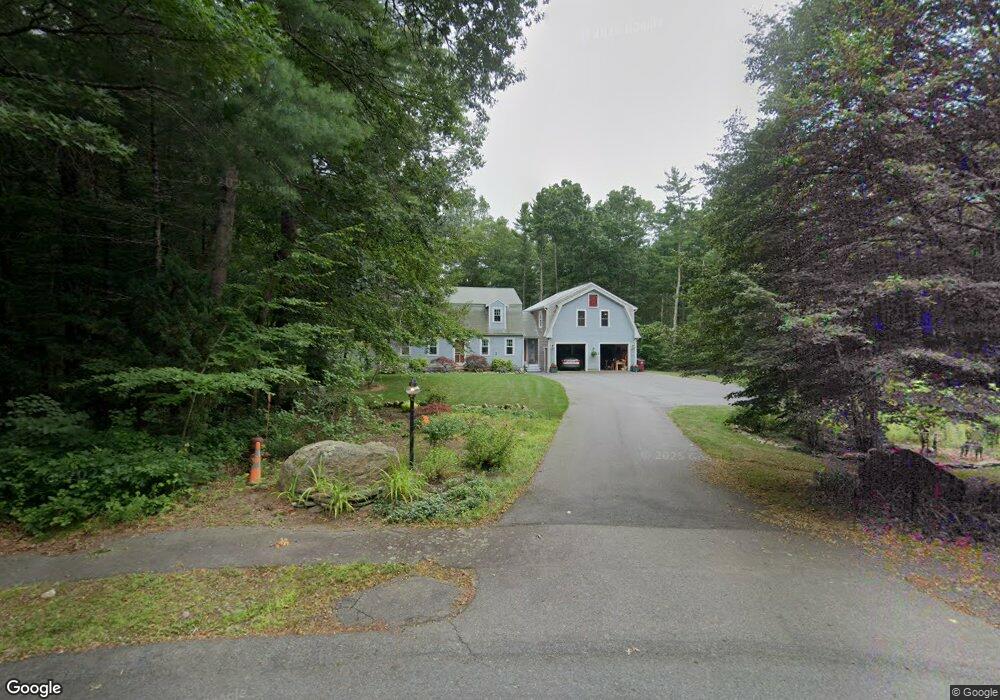
10 Brenrae Dr Middleboro, MA 02346
Estimated Value: $753,847 - $834,000
4
Beds
4
Baths
2,588
Sq Ft
$301/Sq Ft
Est. Value
About This Home
This home is located at 10 Brenrae Dr, Middleboro, MA 02346 and is currently estimated at $778,212, approximately $300 per square foot. 10 Brenrae Dr is a home located in Plymouth County with nearby schools including Mary K. Goode Elementary School.
Ownership History
Date
Name
Owned For
Owner Type
Purchase Details
Closed on
Jan 5, 2012
Sold by
Bell Michael F and Bell Christine F
Bought by
Bell Christine F
Current Estimated Value
Home Financials for this Owner
Home Financials are based on the most recent Mortgage that was taken out on this home.
Original Mortgage
$284,000
Outstanding Balance
$194,702
Interest Rate
3.98%
Mortgage Type
New Conventional
Estimated Equity
$583,510
Purchase Details
Closed on
Aug 15, 2008
Sold by
Butler Richard and Butler Jean M
Bought by
Bell Michael F and Bell Christine F
Home Financials for this Owner
Home Financials are based on the most recent Mortgage that was taken out on this home.
Original Mortgage
$288,000
Interest Rate
6.4%
Mortgage Type
Purchase Money Mortgage
Purchase Details
Closed on
May 7, 2003
Sold by
Butler Jean M and Winters Jean M
Bought by
Butler Richard and Butler Jean M
Create a Home Valuation Report for This Property
The Home Valuation Report is an in-depth analysis detailing your home's value as well as a comparison with similar homes in the area
Home Values in the Area
Average Home Value in this Area
Purchase History
| Date | Buyer | Sale Price | Title Company |
|---|---|---|---|
| Bell Christine F | -- | -- | |
| Bell Michael F | $360,000 | -- | |
| Butler Richard | -- | -- |
Source: Public Records
Mortgage History
| Date | Status | Borrower | Loan Amount |
|---|---|---|---|
| Open | Butler Richard | $284,000 | |
| Previous Owner | Butler Richard | $288,000 | |
| Previous Owner | Butler Richard | $211,000 |
Source: Public Records
Tax History Compared to Growth
Tax History
| Year | Tax Paid | Tax Assessment Tax Assessment Total Assessment is a certain percentage of the fair market value that is determined by local assessors to be the total taxable value of land and additions on the property. | Land | Improvement |
|---|---|---|---|---|
| 2025 | $8,125 | $605,900 | $179,600 | $426,300 |
| 2024 | $8,086 | $597,200 | $179,800 | $417,400 |
| 2023 | $8,366 | $587,500 | $179,800 | $407,700 |
| 2022 | $7,784 | $506,100 | $171,400 | $334,700 |
| 2021 | $7,714 | $474,100 | $151,100 | $323,000 |
| 2020 | $7,295 | $459,400 | $151,100 | $308,300 |
| 2019 | $6,653 | $429,800 | $151,100 | $278,700 |
| 2018 | $6,354 | $407,300 | $138,600 | $268,700 |
| 2017 | $5,710 | $362,100 | $133,600 | $228,500 |
| 2016 | $5,669 | $356,100 | $126,400 | $229,700 |
| 2015 | $5,780 | $366,300 | $126,400 | $239,900 |
Source: Public Records
Map
Nearby Homes
- 38 John Perkins Way
- 562 North Ave
- 558 Wareham St
- 571 Wareham St
- 3 Sarah Reed Hunt Way
- 30 Ridge Dr
- 28 Wareham St
- 31 Sarah Reed Hunt Way
- 146 Miller St
- 21 Bennett Rd
- 167 Old Miller St
- 664 Wareham St
- 709 Walnut Plain Rd
- 663 Wareham St Unit 8
- 714 Snipatuit Rd
- 150 Ryder Rd
- 480 Wareham St
- Rear Wareham St
- 441 Wareham St
- 386 Wareham St