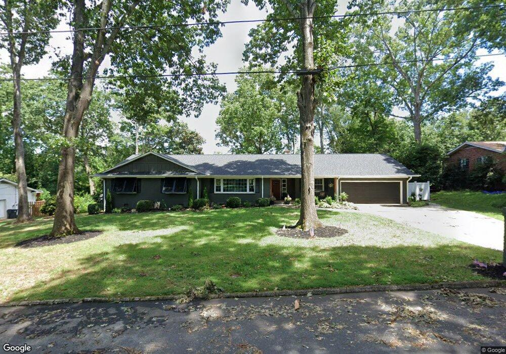
10 Brittany Dr Greenville, SC 29615
Eastside NeighborhoodEstimated Value: $485,000 - $553,436
3
Beds
3
Baths
2,520
Sq Ft
$206/Sq Ft
Est. Value
About This Home
This home is located at 10 Brittany Dr, Greenville, SC 29615 and is currently estimated at $518,359, approximately $205 per square foot. 10 Brittany Dr is a home located in Greenville County with nearby schools including Lake Forest Elementary, League Academy, and Wade Hampton High.
Ownership History
Date
Name
Owned For
Owner Type
Purchase Details
Closed on
Mar 28, 2019
Sold by
Maddox Roberta Martin
Bought by
Lester Farrah J
Current Estimated Value
Purchase Details
Closed on
Jan 5, 2012
Sold by
Goodwin Claudia Gayle
Bought by
Maddox Roberta Martin
Purchase Details
Closed on
Sep 19, 2007
Sold by
Maddox J R and Maddox R
Bought by
The John Robert & Roberta Martin Maddox
Create a Home Valuation Report for This Property
The Home Valuation Report is an in-depth analysis detailing your home's value as well as a comparison with similar homes in the area
Home Values in the Area
Average Home Value in this Area
Purchase History
| Date | Buyer | Sale Price | Title Company |
|---|---|---|---|
| Lester Farrah J | $300,000 | None Available | |
| Maddox Roberta Martin | -- | -- | |
| The John Robert & Roberta Martin Maddox | -- | None Available |
Source: Public Records
Tax History Compared to Growth
Tax History
| Year | Tax Paid | Tax Assessment Tax Assessment Total Assessment is a certain percentage of the fair market value that is determined by local assessors to be the total taxable value of land and additions on the property. | Land | Improvement |
|---|---|---|---|---|
| 2024 | $7,097 | $19,860 | $3,450 | $16,410 |
| 2023 | $7,097 | $19,860 | $3,450 | $16,410 |
| 2022 | $6,797 | $19,860 | $3,450 | $16,410 |
| 2021 | $6,650 | $19,860 | $3,450 | $16,410 |
| 2020 | $8,441 | $23,110 | $3,450 | $19,660 |
| 2019 | $1,942 | $10,320 | $1,900 | $8,420 |
| 2018 | $1,853 | $10,320 | $1,900 | $8,420 |
| 2017 | $1,835 | $10,320 | $1,900 | $8,420 |
| 2016 | $1,737 | $257,980 | $47,500 | $210,480 |
| 2015 | $1,728 | $257,980 | $47,500 | $210,480 |
| 2014 | $1,596 | $244,010 | $47,500 | $196,510 |
Source: Public Records
Map
Nearby Homes
- 305 Botany Rd
- 9 Forestdale Dr
- 505 Heswall Ct
- 503 Heswall Ct
- 501 Heswall Ct
- 407 Heswall Ct
- 401 Heswall Ct
- 305 Heswall Ct
- 307 Heswall Ct
- 303 Heswall Ct
- 301 Heswall Ct
- 105 Windemere Dr
- 25 Forestdale Dr
- 2 Melbourne Ln
- 10 Pembroke Ln
- 1 Heritage Ct
- 105 Bridges Ave
- 221 Elaine Ave
- 815 Edwards Rd Unit 89
- 815 Edwards Rd Unit 2
- 100 Brittany Dr
- 8 Brittany Dr
- 312 Chantilly Dr
- 5 Brittany Dr
- 102 Brittany Dr
- 1201 Edwards Rd
- 309 Chantilly Dr
- 1205 Edwards Rd
- 308 Chantilly Dr
- 1129 Edwards Rd
- 1209 Edwards Rd
- 107 Brittany Dr
- 1127 Edwards Rd
- 305 Chantilly Dr
- 306 Chantilly Dr
- 120 Stonybrook Dr
- 1123 Edwards Rd
- 111 Brittany Dr
- 111 Brittany Dr Unit (Lot 71)
- 1204 Edwards Rd