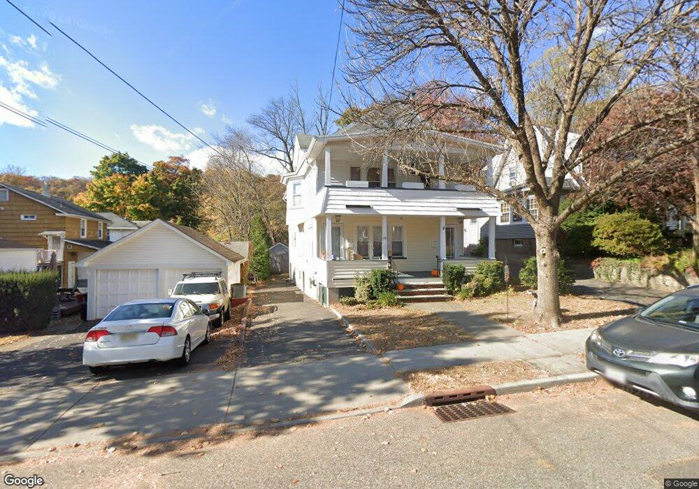
10 Brookside Ave Unit 2 Hawthorne, NJ 07506
Estimated Value: $720,905 - $789,000
2
Beds
1
Bath
2,334
Sq Ft
$322/Sq Ft
Est. Value
About This Home
This home is located at 10 Brookside Ave Unit 2, Hawthorne, NJ 07506 and is currently estimated at $751,226, approximately $321 per square foot. 10 Brookside Ave Unit 2 is a home located in Passaic County with nearby schools including Hawthorne High School, St Anthony School, and Al-Hikmah Elementary School.
Ownership History
Date
Name
Owned For
Owner Type
Purchase Details
Closed on
Apr 24, 2013
Sold by
Bertelli Joshua and Bertelli Lindsay S
Bought by
Stern Lance and Stern Marijke
Current Estimated Value
Home Financials for this Owner
Home Financials are based on the most recent Mortgage that was taken out on this home.
Original Mortgage
$257,500
Outstanding Balance
$52,323
Interest Rate
2.78%
Mortgage Type
New Conventional
Estimated Equity
$698,903
Purchase Details
Closed on
May 8, 2007
Sold by
Gutierrez Alberto German and Gimenez Lydia Veronica
Bought by
Wayne Township
Purchase Details
Closed on
Aug 4, 2006
Sold by
Vanheest Richard B
Bought by
Sieck Lindsay and Bertelli Joshua
Home Financials for this Owner
Home Financials are based on the most recent Mortgage that was taken out on this home.
Original Mortgage
$340,000
Interest Rate
6.88%
Mortgage Type
New Conventional
Create a Home Valuation Report for This Property
The Home Valuation Report is an in-depth analysis detailing your home's value as well as a comparison with similar homes in the area
Home Values in the Area
Average Home Value in this Area
Purchase History
| Date | Buyer | Sale Price | Title Company |
|---|---|---|---|
| Stern Lance | $427,500 | None Available | |
| Wayne Township | $151,000 | -- | |
| Sieck Lindsay | $520,000 | -- |
Source: Public Records
Mortgage History
| Date | Status | Borrower | Loan Amount |
|---|---|---|---|
| Open | Stern Lance | $257,500 | |
| Previous Owner | Sieck Lindsay | $340,000 |
Source: Public Records
Tax History Compared to Growth
Tax History
| Year | Tax Paid | Tax Assessment Tax Assessment Total Assessment is a certain percentage of the fair market value that is determined by local assessors to be the total taxable value of land and additions on the property. | Land | Improvement |
|---|---|---|---|---|
| 2025 | $14,075 | $462,700 | $166,500 | $296,200 |
| 2024 | $13,881 | $462,700 | $166,500 | $296,200 |
| 2022 | $13,651 | $462,700 | $166,500 | $296,200 |
| 2021 | $13,381 | $462,700 | $166,500 | $296,200 |
| 2020 | $14,916 | $523,200 | $166,500 | $356,700 |
| 2019 | $10,597 | $177,300 | $81,000 | $96,300 |
| 2018 | $10,367 | $177,300 | $81,000 | $96,300 |
| 2017 | $10,197 | $177,300 | $81,000 | $96,300 |
| 2016 | $10,055 | $177,300 | $81,000 | $96,300 |
| 2015 | $9,936 | $177,300 | $81,000 | $96,300 |
| 2014 | $9,528 | $177,300 | $81,000 | $96,300 |
Source: Public Records
Map
Nearby Homes
- 34 Brookside Ave
- 23 Brookside Ave
- 510 Goffle Rd
- 75 Mazur Place
- 105 Brookside Ave
- 164 Diamond Bridge Ave Unit 18
- 151 South Ave
- 185 South Ave
- 118 May St
- 63 MacFarlan Ave
- 63 Disepo Ave
- 40 N 19th St
- 274 Goffle Rd
- 72 Franklin Ave
- 80 Elberon Ave
- 5 Carla Ct
- 84 Washington Ave
- 155 Washington Ave
- 106 Spruce Ln
- 10 Brookside Ave
- 14 Brookside Ave
- 47 Diamond Bridge Ave
- 43 Diamond Bridge Ave
- 18 Brookside Ave
- 39 Diamond Bridge Ave
- 45 Diamond Bridge Ave
- 20 Brookside Ave
- 22 Brookside Ave
- 55 Diamond Bridge Ave
- 9 Brookside Ave
- 13 Brookside Ave
- 26 Brookside Ave
- 17 Brookside Ave
- 59 Diamond Bridge Ave
- 21 Brookside Ave
- 30 Brookside Ave
- 65 Diamond Bridge Ave
- 25 Brookside Ave
- 29 Brookside Ave