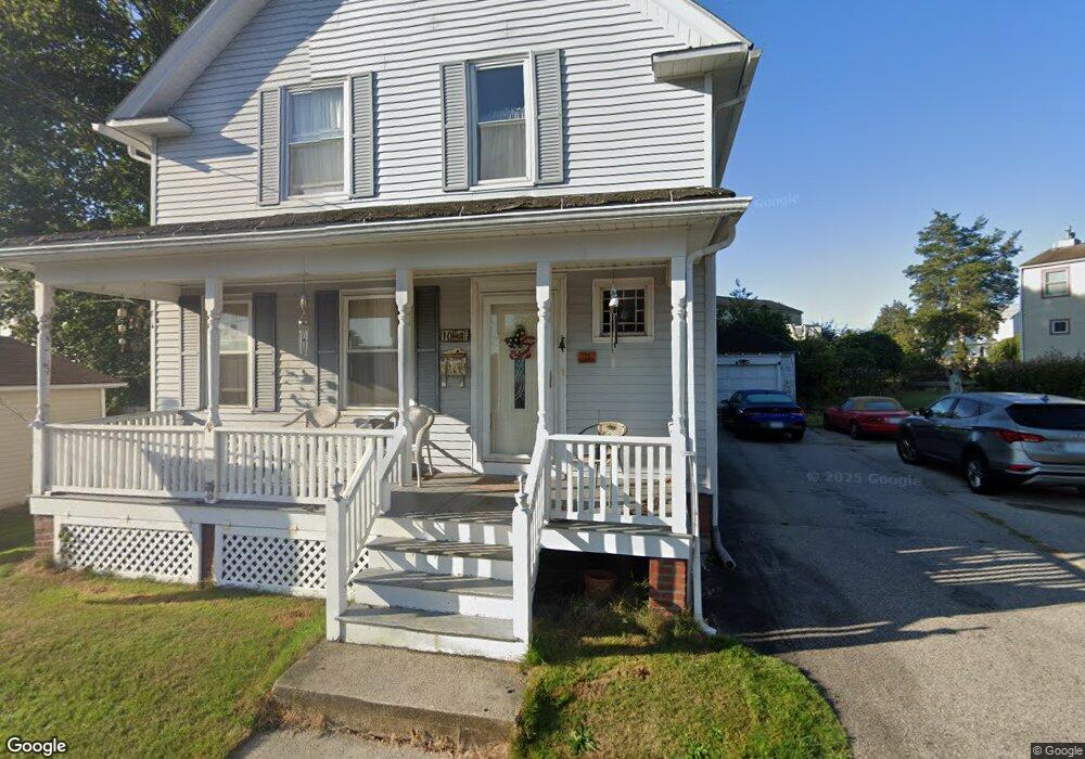
10 Burns St West Warwick, RI 02893
Natick NeighborhoodEstimated Value: $401,000 - $436,000
4
Beds
2
Baths
1,750
Sq Ft
$242/Sq Ft
Est. Value
About This Home
This home is located at 10 Burns St, West Warwick, RI 02893 and is currently estimated at $424,367, approximately $242 per square foot. 10 Burns St is a home located in Kent County with nearby schools including West Warwick High School, Islamic School of Rhode Island, and St Joseph School.
Create a Home Valuation Report for This Property
The Home Valuation Report is an in-depth analysis detailing your home's value as well as a comparison with similar homes in the area
Home Values in the Area
Average Home Value in this Area
Tax History Compared to Growth
Tax History
| Year | Tax Paid | Tax Assessment Tax Assessment Total Assessment is a certain percentage of the fair market value that is determined by local assessors to be the total taxable value of land and additions on the property. | Land | Improvement |
|---|---|---|---|---|
| 2025 | $4,854 | $339,700 | $60,900 | $278,800 |
| 2024 | $4,375 | $234,100 | $43,500 | $190,600 |
| 2023 | $4,289 | $234,100 | $43,500 | $190,600 |
| 2022 | $4,223 | $234,100 | $43,500 | $190,600 |
| 2021 | $3,862 | $167,900 | $43,500 | $124,400 |
| 2020 | $3,862 | $167,900 | $43,500 | $124,400 |
| 2019 | $4,923 | $167,900 | $43,500 | $124,400 |
| 2018 | $3,435 | $139,500 | $43,500 | $96,000 |
| 2017 | $3,670 | $139,500 | $43,500 | $96,000 |
| 2016 | $3,605 | $139,500 | $43,500 | $96,000 |
| 2015 | $3,629 | $139,800 | $43,500 | $96,300 |
| 2014 | $3,550 | $139,800 | $43,500 | $96,300 |
Source: Public Records
Map
Nearby Homes
- 81 W Valley Cir
- 8 Carr's Ln
- 5 Carr's Ln
- 7 Carr's Ln
- 9 Carr's Ln
- 1 Penta St
- 61 Lafayette St
- 2 Jambray Ave
- 202 River Farms Dr
- 1008 Toll Gate Rd
- 744 Providence St
- 132 Prospect Hill Ave
- 780 Providence St
- 11 College Hill Rd Unit 5B
- 11 College Hill Rd Unit 4A
- 237 Commonwealth Ave
- 81 W Pontiac St
- 25 Wilson St
- 3 Apple Blossom Way
- 54 River St Unit 4
- 8 Burns St
- 548 Providence St
- 11 Burns St
- 9 Blossom St
- 542 Providence St
- 13 Burns St
- 11 Blossom St
- 1 Blossom St
- 562 Providence St
- 6 Blossom St
- 564 Providence St
- 8 Blossom St
- 4 Brayton Ave
- 561 Providence St
- 10 Blossom St
- 563 Providence St
- 545 Providence St
- 17 Blossom St
- 12 Blossom St
- 526 Providence St