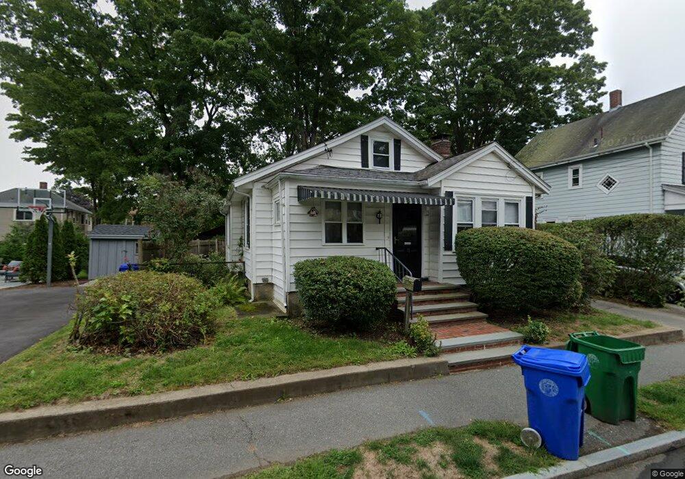
10 Camden Rd Auburndale, MA 02466
Auburndale NeighborhoodEstimated Value: $837,000 - $1,052,000
2
Beds
2
Baths
1,119
Sq Ft
$838/Sq Ft
Est. Value
About This Home
This home is located at 10 Camden Rd, Auburndale, MA 02466 and is currently estimated at $937,923, approximately $838 per square foot. 10 Camden Rd is a home located in Middlesex County with nearby schools including C.C. Burr, F.A. Day Middle School, and Newton North High School.
Ownership History
Date
Name
Owned For
Owner Type
Purchase Details
Closed on
Oct 1, 2021
Sold by
Schriever Marilyn G
Bought by
M G Schriever 2017 T
Current Estimated Value
Purchase Details
Closed on
Aug 14, 1991
Sold by
Beckett Hope R and Burke Dorthy
Bought by
Schriever Marilyn G
Create a Home Valuation Report for This Property
The Home Valuation Report is an in-depth analysis detailing your home's value as well as a comparison with similar homes in the area
Home Values in the Area
Average Home Value in this Area
Purchase History
| Date | Buyer | Sale Price | Title Company |
|---|---|---|---|
| M G Schriever 2017 T | -- | None Available | |
| Schriever Marilyn G | $178,000 | -- |
Source: Public Records
Mortgage History
| Date | Status | Borrower | Loan Amount |
|---|---|---|---|
| Previous Owner | Schriever Marilyn G | $120,000 | |
| Previous Owner | Schriever Marilyn G | $30,000 |
Source: Public Records
Tax History
| Year | Tax Paid | Tax Assessment Tax Assessment Total Assessment is a certain percentage of the fair market value that is determined by local assessors to be the total taxable value of land and additions on the property. | Land | Improvement |
|---|---|---|---|---|
| 2025 | $7,377 | $752,800 | $0 | $0 |
| 2024 | $7,134 | $0 | $0 | $0 |
| 2023 | $6,666 | $654,800 | $606,200 | $48,600 |
| 2022 | $6,378 | $606,300 | $561,300 | $45,000 |
| 2021 | $6,155 | $572,000 | $529,500 | $42,500 |
| 2020 | $5,972 | $572,000 | $529,500 | $42,500 |
| 2019 | $6,554 | $627,200 | $514,100 | $113,100 |
| 2018 | $6,066 | $560,600 | $464,300 | $96,300 |
| 2017 | $5,881 | $528,900 | $438,000 | $90,900 |
| 2016 | $5,625 | $494,300 | $409,300 | $85,000 |
| 2015 | $5,364 | $462,000 | $382,500 | $79,500 |
Source: Public Records
Map
Nearby Homes
- 305 Webster St Unit 2
- 160 Pine St Unit 15
- 160 Pine St Unit 12
- 1919 Commonwealth Ave Unit 1919
- 1917 Commonwealth Ave Unit 1917
- 7 Sharon Ave Unit 7
- 194 Auburn St
- 226 Auburn St Unit 226
- 232 Melrose St Unit 2
- 0 Duncan Rd Unit 72925240
- 10 Higgins St
- 283 Melrose St
- 49 Staniford St
- 214 River St Unit 214
- 101-103 Lexington St
- 2202 Commonwealth Ave Unit 1
- 24 Mague Ave Unit 24
- 8 Elm St Unit 8
- 6 Elm St Unit 6
- 16 Elm St Unit 16
- 14 Camden Rd
- 242 Auburndale Ave
- 18 Camden Rd
- 29 Rowe St
- 236 Auburndale Ave
- 248 Auburndale Ave
- 25 Rowe St
- 25 Rowe St
- 25 Rowe St Unit 1
- 25 Rowe St Unit 2
- 15 Camden Rd
- 37 Rowe St Unit 37
- 35 Rowe St
- 35 Rowe St Unit 2&3
- 19 Rowe St
- 19 Rowe St
- 19 Rowe St Unit 1
- 19 Rowe St Unit 2
- 335 Wolcott St
- 341 Wolcott St
Your Personal Tour Guide
Ask me questions while you tour the home.