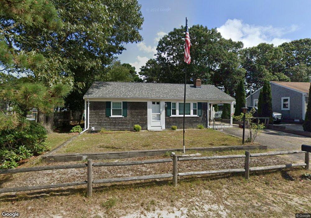
10 Captain Chase Rd Dennis Port, MA 02639
Dennis Port NeighborhoodEstimated Value: $459,000 - $584,000
2
Beds
1
Bath
828
Sq Ft
$664/Sq Ft
Est. Value
About This Home
This home is located at 10 Captain Chase Rd, Dennis Port, MA 02639 and is currently estimated at $550,123, approximately $664 per square foot. 10 Captain Chase Rd is a home located in Barnstable County with nearby schools including Dennis-Yarmouth Regional High School and St. Pius X. School.
Ownership History
Date
Name
Owned For
Owner Type
Purchase Details
Closed on
Mar 14, 2014
Sold by
Oday Michael J and Sampson Jennifer E
Bought by
Sampson Jennifer E
Current Estimated Value
Purchase Details
Closed on
Jan 12, 2009
Sold by
Oday James P
Bought by
Sampson Jennifer E and Oday Michael J
Purchase Details
Closed on
Sep 1, 2006
Sold by
M & V Llc
Bought by
Mann Jancie F
Create a Home Valuation Report for This Property
The Home Valuation Report is an in-depth analysis detailing your home's value as well as a comparison with similar homes in the area
Home Values in the Area
Average Home Value in this Area
Purchase History
| Date | Buyer | Sale Price | Title Company |
|---|---|---|---|
| Sampson Jennifer E | $100,000 | -- | |
| Sampson Jennifer E | $100,000 | -- | |
| Sampson Jennifer E | -- | -- | |
| Sampson Jennifer E | -- | -- | |
| Mann Jancie F | $87,900 | -- | |
| Mann Jancie F | $87,900 | -- |
Source: Public Records
Mortgage History
| Date | Status | Borrower | Loan Amount |
|---|---|---|---|
| Previous Owner | Mann Jancie F | $30,000 | |
| Closed | Sampson Jennifer E | $0 |
Source: Public Records
Tax History Compared to Growth
Tax History
| Year | Tax Paid | Tax Assessment Tax Assessment Total Assessment is a certain percentage of the fair market value that is determined by local assessors to be the total taxable value of land and additions on the property. | Land | Improvement |
|---|---|---|---|---|
| 2025 | $2,245 | $518,500 | $195,300 | $323,200 |
| 2024 | $2,075 | $472,700 | $187,800 | $284,900 |
| 2023 | $2,007 | $429,700 | $170,700 | $259,000 |
| 2022 | $1,990 | $355,400 | $153,800 | $201,600 |
| 2021 | $2,038 | $338,000 | $172,300 | $165,700 |
| 2020 | $1,837 | $301,200 | $150,800 | $150,400 |
| 2019 | $1,737 | $281,600 | $147,800 | $133,800 |
| 2018 | $1,671 | $263,500 | $140,700 | $122,800 |
| 2017 | $1,535 | $249,600 | $130,700 | $118,900 |
| 2016 | $1,579 | $241,800 | $140,700 | $101,100 |
| 2015 | $1,548 | $241,800 | $140,700 | $101,100 |
| 2014 | $1,408 | $221,700 | $120,600 | $101,100 |
Source: Public Records
Map
Nearby Homes
- 31 Easy St
- 22 Wixon Rd
- 19 Standish Way
- 72 Bassett Ln
- 4 Coffey Ln
- 268 Main St
- 125 Main St Unit 3
- 80 Michaels Ave
- 71 Main St
- 22 Ferncliff Rd
- 37 Beach Hills Rd
- 37-A Beach Hills Rd
- 102 Sea St
- 262 Old Wharf Rd Unit 67
- 262 Old Wharf Rd Unit 5
- 262 Old Wharf Rd Unit 5
- 262 Old Wharf Rd Unit 20
- 262 Old Wharf Rd Unit 87
- 12 Spoonbill Rd
- 12 Captain Chase Rd
- 8 Captain Chase Rd
- 5 Ezras Path
- 105 Shad Hole Rd
- 9 Ezra's Path
- 16 Captain Chase Rd
- 115 Shad Hole Rd
- 13 Captain Chase Rd
- 20 Captain Chase Rd
- 15 Ezra's Path
- 9 Captain Chase Rd
- 9 Captain Chase Rd
- 8 Ezras
- 5 Wixon Rd
- 8 Ezras Path
- 3 Easy St
- 4 Wixon Rd
- 22 Captain Chase Rd
- 75 Chase Unit 17
- 36 Belmont U #Sw 24