Estimated Value: $979,615 - $1,082,000
4
Beds
3
Baths
2,600
Sq Ft
$395/Sq Ft
Est. Value
About This Home
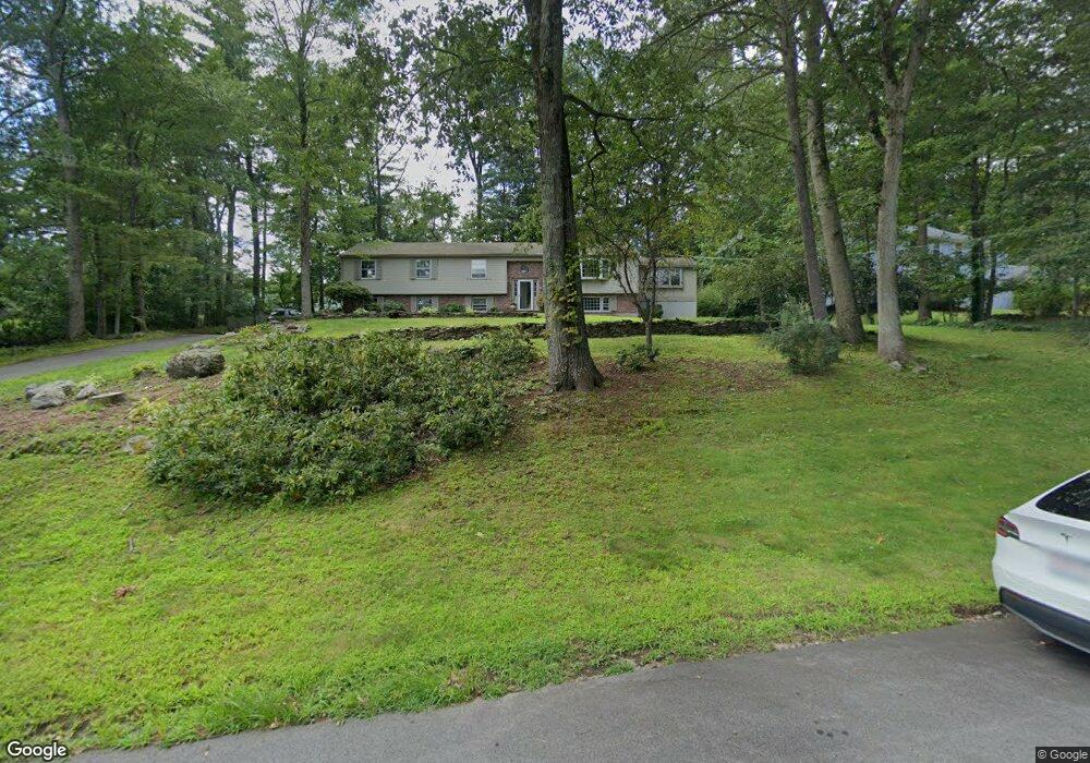
This home is located at 10 Captain Forbush Ln, Acton, MA 01720 and is currently estimated at $1,025,904, approximately $394 per square foot. 10 Captain Forbush Ln is a home located in Middlesex County with nearby schools including Acton-Boxborough Regional High School and The Imago School.
Ownership History
Date
Name
Owned For
Owner Type
Purchase Details
Closed on
Oct 11, 2000
Sold by
Sager Matthew and Sager Carolyn
Bought by
Hoggard John M and Hoggard Cynthia D
Current Estimated Value
Purchase Details
Closed on
Mar 26, 1998
Sold by
Summers Philip W and Summers Cathleen H
Bought by
Sager Matthew and Sager Carolyn
Purchase Details
Closed on
Sep 1, 1995
Sold by
Conte William A and Conte Sharon C
Bought by
Summers Philip W and Summers Cathleen H
Purchase Details
Closed on
Oct 28, 1992
Sold by
S&J Leasing Corp
Bought by
Conte William A and Conte Sharon C
Purchase Details
Closed on
Jul 24, 1990
Sold by
Nagog Rt
Bought by
S&J Leasing Corp
Create a Home Valuation Report for This Property
The Home Valuation Report is an in-depth analysis detailing your home's value as well as a comparison with similar homes in the area
Home Values in the Area
Average Home Value in this Area
Purchase History
| Date | Buyer | Sale Price | Title Company |
|---|---|---|---|
| Hoggard John M | $438,000 | -- | |
| Sager Matthew | $295,000 | -- | |
| Summers Philip W | $273,000 | -- | |
| Conte William A | $251,500 | -- | |
| S&J Leasing Corp | $280,000 | -- |
Source: Public Records
Mortgage History
| Date | Status | Borrower | Loan Amount |
|---|---|---|---|
| Open | S&J Leasing Corp | $261,632 | |
| Closed | S&J Leasing Corp | $275,000 |
Source: Public Records
Tax History Compared to Growth
Tax History
| Year | Tax Paid | Tax Assessment Tax Assessment Total Assessment is a certain percentage of the fair market value that is determined by local assessors to be the total taxable value of land and additions on the property. | Land | Improvement |
|---|---|---|---|---|
| 2025 | $14,691 | $856,600 | $368,000 | $488,600 |
| 2024 | $13,934 | $835,900 | $368,000 | $467,900 |
| 2023 | $13,707 | $780,600 | $334,600 | $446,000 |
| 2022 | $13,508 | $694,500 | $290,700 | $403,800 |
| 2021 | $12,648 | $625,200 | $269,100 | $356,100 |
| 2020 | $12,029 | $625,200 | $269,100 | $356,100 |
| 2019 | $11,455 | $591,400 | $269,100 | $322,300 |
| 2018 | $10,773 | $555,900 | $269,100 | $286,800 |
| 2017 | $10,498 | $550,800 | $269,100 | $281,700 |
| 2016 | $10,140 | $527,300 | $269,100 | $258,200 |
| 2015 | $9,775 | $513,100 | $269,100 | $244,000 |
| 2014 | $9,478 | $487,300 | $269,100 | $218,200 |
Source: Public Records
Map
Nearby Homes
- 285 Central St Unit 285
- 9 Elm St Unit 1
- 5 Elm St Unit 1
- 89 Windsor Ave
- 31 Mohawk Dr
- 4,7,8 Crestwood Ln
- 4 Huron Rd
- 92 Willow St Unit 3
- 92 Willow St Unit 2
- 169 Main St
- 90 Willow St Unit 1
- 19 Railroad St Unit C2
- 23 John Swift Rd
- 129 Main St Unit 129
- 129 Main St
- 131 Main St
- 5 Oakwood Rd
- 68 Macintosh Ln
- 8 Laurel Ct
- 86 School St
- 8 Capt Forbush La
- 8 Captain Forbush Ln
- 12 Captain Forbush Ln
- 7 Captain Forbush Ln
- 9 Captain Forbush Ln
- 17 Deacon Hunt Dr
- 19 Deacon Hunt Dr
- 15 Deacon Hunt Dr
- 5 Captain Forbush Ln
- 14 Captain Forbush Ln
- 6 Captain Forbush Ln
- 11 Captain Forbush Ln
- 16 Captain Browns Ln
- 16 Captain Brown's Ln
- 14 Captain Browns Ln
- 16 Deacon Hunt Dr
- 20 Captain Brown's Ln
- 21 Deacon Hunt Dr
- 20 Captain Browns Ln
- 3 Captain Forbush Ln