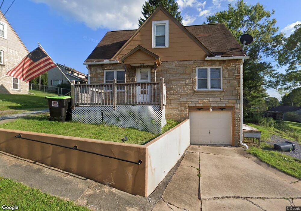
10 Carmalt St Brookville, PA 15825
Estimated Value: $92,318 - $151,000
--
Bed
--
Bath
660
Sq Ft
$172/Sq Ft
Est. Value
About This Home
This home is located at 10 Carmalt St, Brookville, PA 15825 and is currently estimated at $113,830, approximately $172 per square foot. 10 Carmalt St is a home located in Jefferson County with nearby schools including Northside Elementary School, Hickory Grove Elementary School, and Pinecreek Elementary School.
Ownership History
Date
Name
Owned For
Owner Type
Purchase Details
Closed on
Mar 30, 2020
Sold by
Confer Lewis Eugene and Confer Betty J
Bought by
Brennan Michael J
Current Estimated Value
Home Financials for this Owner
Home Financials are based on the most recent Mortgage that was taken out on this home.
Original Mortgage
$53,600
Outstanding Balance
$47,572
Interest Rate
3.5%
Mortgage Type
New Conventional
Estimated Equity
$66,258
Purchase Details
Closed on
Sep 12, 2011
Sold by
Garvey Raymond J
Bought by
Confer Lewis Eugene and Confer Betty J
Home Financials for this Owner
Home Financials are based on the most recent Mortgage that was taken out on this home.
Original Mortgage
$40,000
Interest Rate
4.33%
Mortgage Type
Purchase Money Mortgage
Create a Home Valuation Report for This Property
The Home Valuation Report is an in-depth analysis detailing your home's value as well as a comparison with similar homes in the area
Home Values in the Area
Average Home Value in this Area
Purchase History
| Date | Buyer | Sale Price | Title Company |
|---|---|---|---|
| Brennan Michael J | $67,000 | None Available | |
| Confer Lewis Eugene | $50,000 | None Available |
Source: Public Records
Mortgage History
| Date | Status | Borrower | Loan Amount |
|---|---|---|---|
| Open | Brennan Michael J | $53,600 | |
| Previous Owner | Confer Lewis Eugene | $40,000 |
Source: Public Records
Tax History Compared to Growth
Tax History
| Year | Tax Paid | Tax Assessment Tax Assessment Total Assessment is a certain percentage of the fair market value that is determined by local assessors to be the total taxable value of land and additions on the property. | Land | Improvement |
|---|---|---|---|---|
| 2025 | $1,657 | $24,970 | $1,470 | $23,500 |
| 2024 | $1,607 | $24,970 | $1,470 | $23,500 |
| 2023 | $1,557 | $24,970 | $1,470 | $23,500 |
| 2022 | $1,557 | $24,970 | $1,470 | $23,500 |
| 2021 | $1,510 | $24,970 | $1,470 | $23,500 |
| 2020 | $1,510 | $24,970 | $1,470 | $23,500 |
| 2019 | $1,488 | $24,970 | $1,470 | $23,500 |
| 2018 | $1,455 | $24,970 | $1,470 | $23,500 |
| 2017 | $1,430 | $24,970 | $1,470 | $23,500 |
| 2016 | $1,292 | $24,470 | $1,470 | $23,000 |
| 2015 | -- | $24,470 | $1,470 | $23,000 |
| 2012 | -- | $24,270 | $1,270 | $23,000 |
Source: Public Records
Map
Nearby Homes
- 4 Geist Way
- 00 B St
- 206 Euclid Ave
- 0 Alexander H Lindsay Memorial Hwy
- 146 Western Ave
- 271 Jefferson St
- 70 Summit St
- 480 Belgiumtown Rd
- 00 Mccullough Dr
- 416 N Pickering St
- 70 Tunnel Hill Rd
- 457 Main St
- 560 Pennsylvania 28
- 13 Elm Dr
- 10 Sphere St
- 73 Acres +/- Along Kunselman Rd
- 105 Laurel Ave
- 405 Butler Cemetery Rd
- 85 Hughey Rd
- 227 Old Route 322
- 104 Geist Way
- 102 Hastings St
- 102 1/2 Hastings St
- 106 Geist Way
- 104 Hastings St
- 108 Geist Way
- 100 Roosevelt St
- 101 Roosevelt St Unit 103
- 104 Roosevelt St
- 100 Hastings St
- 110 Hastings St
- 106 Roosevelt St
- 107 Geist Way
- 120 Hastings St
- 78 Hastings St
- 105 Roosevelt St
- 115 Roosevelt St
- 74 Hastings St
- 136 Hastings St
- 155 Central Avenue Extension