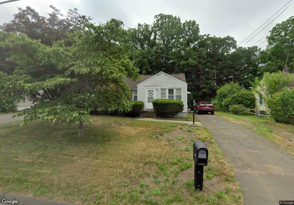
10 Carol Dr East Haven, CT 06512
Estimated Value: $287,062 - $336,000
3
Beds
1
Bath
880
Sq Ft
$357/Sq Ft
Est. Value
About This Home
This home is located at 10 Carol Dr, East Haven, CT 06512 and is currently estimated at $314,266, approximately $357 per square foot. 10 Carol Dr is a home located in New Haven County with nearby schools including Deer Run School and East Haven High School.
Ownership History
Date
Name
Owned For
Owner Type
Purchase Details
Closed on
Jul 29, 1999
Sold by
Montada Felix and Montada Ofelia
Bought by
Pina Jose T and Pina Laura A
Current Estimated Value
Home Financials for this Owner
Home Financials are based on the most recent Mortgage that was taken out on this home.
Original Mortgage
$198,265
Interest Rate
7.61%
Mortgage Type
Purchase Money Mortgage
Purchase Details
Closed on
Jul 30, 1997
Sold by
Garibaldi Salvatore and Garibaldi Lillian
Bought by
Thompson Kevin P and Fowler Lori A
Home Financials for this Owner
Home Financials are based on the most recent Mortgage that was taken out on this home.
Original Mortgage
$97,239
Interest Rate
7.55%
Mortgage Type
Purchase Money Mortgage
Create a Home Valuation Report for This Property
The Home Valuation Report is an in-depth analysis detailing your home's value as well as a comparison with similar homes in the area
Home Values in the Area
Average Home Value in this Area
Purchase History
| Date | Buyer | Sale Price | Title Company |
|---|---|---|---|
| Pina Jose T | $199,900 | -- | |
| Thompson Kevin P | $98,000 | -- |
Source: Public Records
Mortgage History
| Date | Status | Borrower | Loan Amount |
|---|---|---|---|
| Open | Thompson Kevin P | $131,000 | |
| Closed | Thompson Kevin P | $60,438 | |
| Closed | Thompson Kevin P | $198,265 | |
| Previous Owner | Thompson Kevin P | $97,239 |
Source: Public Records
Tax History Compared to Growth
Tax History
| Year | Tax Paid | Tax Assessment Tax Assessment Total Assessment is a certain percentage of the fair market value that is determined by local assessors to be the total taxable value of land and additions on the property. | Land | Improvement |
|---|---|---|---|---|
| 2025 | $4,490 | $134,260 | $50,960 | $83,300 |
| 2024 | $4,490 | $134,260 | $50,960 | $83,300 |
| 2023 | $4,189 | $134,260 | $50,960 | $83,300 |
| 2022 | $4,189 | $134,260 | $50,960 | $83,300 |
| 2021 | $3,772 | $110,130 | $49,690 | $60,440 |
| 2020 | $3,772 | $110,130 | $49,690 | $60,440 |
| 2019 | $3,570 | $110,130 | $49,690 | $60,440 |
| 2018 | $3,574 | $110,130 | $49,690 | $60,440 |
| 2017 | $3,475 | $110,130 | $49,690 | $60,440 |
| 2016 | $3,360 | $106,500 | $46,180 | $60,320 |
| 2015 | $3,360 | $106,500 | $46,180 | $60,320 |
| 2014 | $3,413 | $106,500 | $46,180 | $60,320 |
Source: Public Records
Map
Nearby Homes
- 9 Warwick Ln
- 75 Redwood Dr Unit 609
- 12 Corbin Rd
- 30 Thompson St
- 15 Cedar Ct Unit G
- 118 Hellstrom Rd
- 9 Birch Ln Unit K
- 8 Birch Ln Unit A
- 8 Circle Dr
- 7 Jeffrey Rd
- 983 N High St
- 91 Angela Dr
- 965 N High St
- 173 Russo Ave Unit 409
- 173 Russo Ave Unit 609
- 173 Russo Ave Unit 410
- 24 Laura Cir
- 7 Oak Hill Dr
- 90 Foxon Blvd
- 72 Gene St