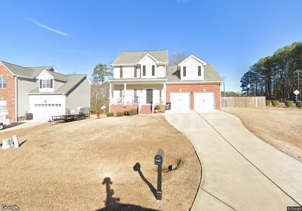
10 Carter Dr Sanford, NC 27332
Estimated Value: $292,139 - $314,000
3
Beds
3
Baths
1,901
Sq Ft
$160/Sq Ft
Est. Value
About This Home
This home is located at 10 Carter Dr, Sanford, NC 27332 and is currently estimated at $303,785, approximately $159 per square foot. 10 Carter Dr is a home located in Harnett County with nearby schools including Benhaven Elementary School, Highland Middle School, and Western Harnett High School.
Ownership History
Date
Name
Owned For
Owner Type
Purchase Details
Closed on
Sep 14, 2010
Sold by
Signature Home Builders Inc
Bought by
Matthews Bobby K and Matthews Yvette M
Current Estimated Value
Home Financials for this Owner
Home Financials are based on the most recent Mortgage that was taken out on this home.
Original Mortgage
$167,641
Outstanding Balance
$110,699
Interest Rate
4.44%
Mortgage Type
FHA
Estimated Equity
$193,086
Purchase Details
Closed on
Oct 25, 2007
Sold by
D & R Developments Llc
Bought by
Signature Home Builders Inc
Create a Home Valuation Report for This Property
The Home Valuation Report is an in-depth analysis detailing your home's value as well as a comparison with similar homes in the area
Home Values in the Area
Average Home Value in this Area
Purchase History
| Date | Buyer | Sale Price | Title Company |
|---|---|---|---|
| Matthews Bobby K | $170,000 | -- | |
| Signature Home Builders Inc | -- | None Available | |
| D & R Developments Llc | -- | None Available |
Source: Public Records
Mortgage History
| Date | Status | Borrower | Loan Amount |
|---|---|---|---|
| Open | Matthews Bobby K | $167,641 |
Source: Public Records
Tax History Compared to Growth
Tax History
| Year | Tax Paid | Tax Assessment Tax Assessment Total Assessment is a certain percentage of the fair market value that is determined by local assessors to be the total taxable value of land and additions on the property. | Land | Improvement |
|---|---|---|---|---|
| 2025 | $1,634 | $217,863 | $0 | $0 |
| 2024 | $1,634 | $217,863 | $0 | $0 |
| 2023 | $1,634 | $217,863 | $0 | $0 |
| 2022 | $1,589 | $217,863 | $0 | $0 |
| 2021 | $1,589 | $174,830 | $0 | $0 |
| 2020 | $1,571 | $174,830 | $0 | $0 |
| 2019 | $1,556 | $174,830 | $0 | $0 |
| 2018 | $1,539 | $174,830 | $0 | $0 |
| 2017 | $1,539 | $174,830 | $0 | $0 |
| 2016 | $1,613 | $183,690 | $0 | $0 |
| 2015 | $1,613 | $183,690 | $0 | $0 |
| 2014 | $1,613 | $183,690 | $0 | $0 |
Source: Public Records
Map
Nearby Homes
- 24 Carter Dr
- 92 Carter Dr
- 65 Country Walk Ln
- 41 Andrea Ct
- 2 Christopher Dr
- 739 Nicole Dr
- 20 Bluebird Ct
- 19 Ribbon Oak Ct
- 50 Ridgeway Ct
- 806 Roberts Rd
- 136 Wedgewood Ct
- 119 Pinevalley Ln
- 642 Pinevalley Ln
- 305 Cresthaven Dr
- 208 Appleton Way
- 515 Pinevalley Ln
- 144 Vail Ct
- 48 Appleton Way
- 56 Briarwood Place
- 38 Carter Dr
- 15 Reece Dr
- 54 Carter Dr
- 54 Carter (L4) Dr
- 16 Reece Dr
- 51 Blanchard Rd
- 31 Reece Dr
- 70 Carter Dr
- 130 & 146 Carter Dr
- 92 Carter Dr Unit 6
- 83 Carter Dr Unit 14
- 83 Carter Dr
- 44 Reece Dr
- 57 Reece Dr
- 91 Blanchard Rd
- 117 Carter Dr Unit 13
- 117 Carter Dr
- 70 Reece Dr
- 111 Blanchard Rd
- 114 Carter Dr Unit 7