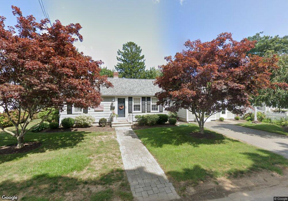
10 Cedar Island Ave Clinton, CT 06413
Estimated Value: $420,156 - $695,000
2
Beds
1
Bath
1,140
Sq Ft
$470/Sq Ft
Est. Value
About This Home
This home is located at 10 Cedar Island Ave, Clinton, CT 06413 and is currently estimated at $536,289, approximately $470 per square foot. 10 Cedar Island Ave is a home located in Middlesex County with nearby schools including Lewin G. Joel Jr. School, The Morgan School, and Our Lady of Mercy Preparatory Academy.
Ownership History
Date
Name
Owned For
Owner Type
Purchase Details
Closed on
Aug 1, 1994
Sold by
Schillinger Frederick and Schillinger Allyson
Bought by
Hoffman Barbara A
Current Estimated Value
Purchase Details
Closed on
Nov 24, 1987
Sold by
Landon Dorothy E
Bought by
Schillinger Fred A
Create a Home Valuation Report for This Property
The Home Valuation Report is an in-depth analysis detailing your home's value as well as a comparison with similar homes in the area
Home Values in the Area
Average Home Value in this Area
Purchase History
| Date | Buyer | Sale Price | Title Company |
|---|---|---|---|
| Hoffman Barbara A | $130,000 | -- | |
| Hoffman Barbara A | $130,000 | -- | |
| Schillinger Fred A | $142,000 | -- |
Source: Public Records
Mortgage History
| Date | Status | Borrower | Loan Amount |
|---|---|---|---|
| Open | Schillinger Fred A | $250,000 | |
| Closed | Schillinger Fred A | $220,000 | |
| Closed | Schillinger Fred A | $195,000 |
Source: Public Records
Tax History Compared to Growth
Tax History
| Year | Tax Paid | Tax Assessment Tax Assessment Total Assessment is a certain percentage of the fair market value that is determined by local assessors to be the total taxable value of land and additions on the property. | Land | Improvement |
|---|---|---|---|---|
| 2025 | $5,232 | $168,000 | $79,000 | $89,000 |
| 2024 | $5,084 | $168,000 | $79,000 | $89,000 |
| 2023 | $5,011 | $168,000 | $79,000 | $89,000 |
| 2022 | $5,011 | $168,000 | $79,000 | $89,000 |
| 2021 | $5,253 | $176,100 | $92,500 | $83,600 |
| 2020 | $5,503 | $176,100 | $92,500 | $83,600 |
| 2019 | $5,503 | $176,100 | $92,500 | $83,600 |
| 2018 | $5,378 | $176,100 | $92,500 | $83,600 |
| 2017 | $5,267 | $176,100 | $92,500 | $83,600 |
| 2016 | $4,779 | $176,100 | $92,500 | $83,600 |
| 2015 | $4,139 | $154,600 | $68,800 | $85,800 |
| 2014 | $4,061 | $154,600 | $68,800 | $85,800 |
Source: Public Records
Map
Nearby Homes
- 26 Cedar Island Ave
- 27 Maplewood Dr
- 28 Maple Ave
- 62 Cedar Island Ave
- 0 Cow Hill Rd
- 64 W Main St
- 19 Riverside Dr
- 129 W Main St
- 13 Waterside Ln
- 52 High St
- 42 Central Ave
- 133 W Main St Unit TRLR A9
- 133 W Main St Unit MV1
- 133 W Main St Unit TRLR C6
- 24 College St Unit 5
- 41 Cow Hill Rd
- 82 N High St
- 153 E Main St Unit 8
- 153 E Main St Unit 31
- 153 E Main St Unit 13
- 12 Cedar Island Ave
- 68 Cedar Island Ave
- 77 Grove St
- 11 Cedar Island Ave
- 5 Cedar Island Ave
- 14 Cedar Island Ave
- 75 Grove St
- 79 Grove St
- 73 Grove St
- 6 Cedar Island Ave
- 71 Grove St
- 15 Cedar Island Ave
- 10 Neck Rd
- 16 Neck Rd
- 85 Grove St
- 20 Cedar Island Ave
- 6 Maplewood Dr
- 67 Grove St
- 8 Maplewood Dr
- 20 Neck Rd