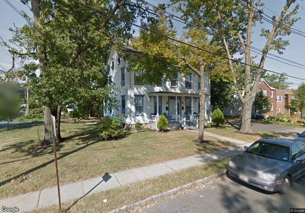
10 Cedar St South Bound Brook, NJ 08880
Estimated Value: $528,000 - $657,848
--
Bed
--
Bath
2,716
Sq Ft
$214/Sq Ft
Est. Value
About This Home
This home is located at 10 Cedar St, South Bound Brook, NJ 08880 and is currently estimated at $580,962, approximately $213 per square foot. 10 Cedar St is a home located in Somerset County with nearby schools including Robert Morris School and Green Brook Academy.
Ownership History
Date
Name
Owned For
Owner Type
Purchase Details
Closed on
Feb 25, 2008
Sold by
Salter Raymond T and Salter Jacquelyn L
Bought by
Klement Llc
Current Estimated Value
Home Financials for this Owner
Home Financials are based on the most recent Mortgage that was taken out on this home.
Original Mortgage
$120,000
Interest Rate
10%
Mortgage Type
Purchase Money Mortgage
Purchase Details
Closed on
Nov 12, 2001
Sold by
Salter Raymond T and Salter Jacquelyn
Bought by
Salter Raymond T
Home Financials for this Owner
Home Financials are based on the most recent Mortgage that was taken out on this home.
Original Mortgage
$115,625
Interest Rate
6.3%
Mortgage Type
New Conventional
Purchase Details
Closed on
Nov 27, 1991
Sold by
Vannostrand Howard W and Vannostrand Elizabeth
Bought by
Salter Raymond T and Salter Nancy L
Purchase Details
Closed on
Sep 4, 1990
Sold by
Vannostrand Howard W Executor
Bought by
Vannostrand Howard W
Create a Home Valuation Report for This Property
The Home Valuation Report is an in-depth analysis detailing your home's value as well as a comparison with similar homes in the area
Home Values in the Area
Average Home Value in this Area
Purchase History
| Date | Buyer | Sale Price | Title Company |
|---|---|---|---|
| Klement Llc | $180,000 | Fidelity National Title Ins | |
| Salter Raymond T | -- | Title Source Inc | |
| Salter Raymond T | $152,500 | -- | |
| Vannostrand Howard W | -- | -- |
Source: Public Records
Mortgage History
| Date | Status | Borrower | Loan Amount |
|---|---|---|---|
| Previous Owner | Klement Llc | $120,000 | |
| Previous Owner | Salter Raymond T | $115,625 |
Source: Public Records
Tax History Compared to Growth
Tax History
| Year | Tax Paid | Tax Assessment Tax Assessment Total Assessment is a certain percentage of the fair market value that is determined by local assessors to be the total taxable value of land and additions on the property. | Land | Improvement |
|---|---|---|---|---|
| 2025 | $13,025 | $340,800 | $113,100 | $227,700 |
| 2024 | $13,025 | $340,800 | $113,100 | $227,700 |
| 2023 | $12,903 | $340,800 | $113,100 | $227,700 |
| 2022 | $12,058 | $340,800 | $113,100 | $227,700 |
| 2021 | $11,884 | $340,800 | $113,100 | $227,700 |
| 2020 | $11,304 | $340,800 | $113,100 | $227,700 |
| 2019 | $11,597 | $340,800 | $113,100 | $227,700 |
| 2018 | $11,533 | $340,800 | $113,100 | $227,700 |
| 2017 | $11,492 | $340,800 | $113,100 | $227,700 |
| 2016 | $11,233 | $340,800 | $113,100 | $227,700 |
| 2015 | $10,936 | $340,800 | $113,100 | $227,700 |
| 2014 | $10,674 | $340,800 | $113,100 | $227,700 |
Source: Public Records
Map
Nearby Homes
- 20 Patriots Path
- 165 Prospect St
- 123 Elizabeth St
- 3 Edgewood Terrace
- 8 Von Steuben Ln
- 71 Remsen St
- 112 East St
- 206 Bathgate Ave
- 231 Beck Ave
- 2 Drake St
- 535 Madison Ave
- 285 Maple Ave
- 112-114 E Union Ave
- 112 E Union Ave
- 320 Church St
- 208 Sanders Ave
- 34 van Keuren Ave Unit 38
- 40 van Keuren Ave Unit 42
- 126 W High St
- 102 W Franklin St
- 8 Cedar St
- 108 Prospect St
- 22 Cedar St Unit 22A
- 22 Cedar St Unit 22B
- 22 Cedar St Unit B
- 112 Prospect St
- 20 Cedar St Unit 22
- 20 Cedar St Unit B
- 107 Prospect St
- 32 Main St
- 34 Main St Unit 3
- 34 Main St
- 41 Bell St
- 113 Clinton St
- 113 Clinton St Unit 113
- 114 Prospect St
- 47 Bell St
- 27 Cedar St
- 118 Prospect St
- 30 Cedar St