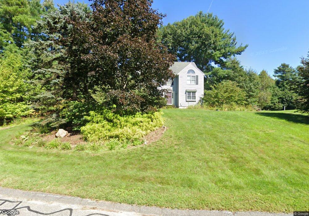
10 Charles Samuel Way Wrentham, MA 02093
Estimated Value: $827,152 - $993,000
4
Beds
3
Baths
2,369
Sq Ft
$398/Sq Ft
Est. Value
About This Home
This home is located at 10 Charles Samuel Way, Wrentham, MA 02093 and is currently estimated at $941,788, approximately $397 per square foot. 10 Charles Samuel Way is a home located in Norfolk County with nearby schools including Delaney Elementary School, Charles E Roderick, and Foxborough Regional Charter School.
Create a Home Valuation Report for This Property
The Home Valuation Report is an in-depth analysis detailing your home's value as well as a comparison with similar homes in the area
Home Values in the Area
Average Home Value in this Area
Tax History Compared to Growth
Tax History
| Year | Tax Paid | Tax Assessment Tax Assessment Total Assessment is a certain percentage of the fair market value that is determined by local assessors to be the total taxable value of land and additions on the property. | Land | Improvement |
|---|---|---|---|---|
| 2025 | $8,646 | $746,000 | $305,200 | $440,800 |
| 2024 | $8,351 | $695,900 | $305,200 | $390,700 |
| 2023 | $8,034 | $636,600 | $277,600 | $359,000 |
| 2022 | $7,681 | $561,900 | $259,100 | $302,800 |
| 2021 | $7,108 | $505,200 | $226,500 | $278,700 |
| 2020 | $7,344 | $515,400 | $201,700 | $313,700 |
| 2019 | $7,076 | $501,100 | $201,700 | $299,400 |
| 2018 | $6,862 | $481,900 | $201,900 | $280,000 |
| 2017 | $6,680 | $468,800 | $198,100 | $270,700 |
| 2016 | $6,583 | $461,000 | $192,300 | $268,700 |
| 2015 | $6,567 | $438,400 | $184,900 | $253,500 |
| 2014 | $6,501 | $424,600 | $177,800 | $246,800 |
Source: Public Records
Map
Nearby Homes