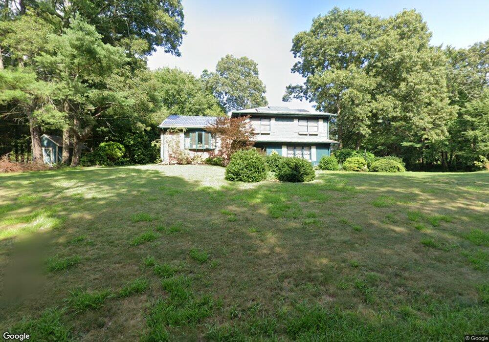
10 Christopher Cir Westport, MA 02790
North Westport NeighborhoodEstimated Value: $510,000 - $614,000
3
Beds
--
Bath
1,644
Sq Ft
$340/Sq Ft
Est. Value
About This Home
This home is located at 10 Christopher Cir, Westport, MA 02790 and is currently estimated at $559,024, approximately $340 per square foot. 10 Christopher Cir is a home located in Bristol County with nearby schools including Alice A. Macomber Primary School, Westport Elementary School, and Westport Middle-High School.
Ownership History
Date
Name
Owned For
Owner Type
Purchase Details
Closed on
Sep 26, 2013
Sold by
Pelletier Ronald A and Pelletier Carolyn E
Bought by
R A & C E Pelletier Irt
Current Estimated Value
Purchase Details
Closed on
Oct 27, 1970
Bought by
Pelletier Ronald A and Pelletier Carolyn E
Create a Home Valuation Report for This Property
The Home Valuation Report is an in-depth analysis detailing your home's value as well as a comparison with similar homes in the area
Home Values in the Area
Average Home Value in this Area
Purchase History
| Date | Buyer | Sale Price | Title Company |
|---|---|---|---|
| R A & C E Pelletier Irt | -- | -- | |
| Pelletier Ronald A | -- | -- |
Source: Public Records
Mortgage History
| Date | Status | Borrower | Loan Amount |
|---|---|---|---|
| Previous Owner | Pelletier Ronald A | $25,000 | |
| Previous Owner | Pelletier Ronald A | $30,000 | |
| Previous Owner | Pelletier Ronald A | $37,000 | |
| Previous Owner | Pelletier Ronald A | $10,070 |
Source: Public Records
Tax History Compared to Growth
Tax History
| Year | Tax Paid | Tax Assessment Tax Assessment Total Assessment is a certain percentage of the fair market value that is determined by local assessors to be the total taxable value of land and additions on the property. | Land | Improvement |
|---|---|---|---|---|
| 2025 | $3,011 | $404,200 | $158,000 | $246,200 |
| 2024 | $2,816 | $364,300 | $146,400 | $217,900 |
| 2023 | $2,780 | $340,700 | $133,100 | $207,600 |
| 2022 | $2,679 | $315,900 | $133,100 | $182,800 |
| 2021 | $53 | $339,600 | $121,000 | $218,600 |
| 2020 | $1,606 | $298,900 | $116,100 | $182,800 |
| 2019 | $1,556 | $276,400 | $116,100 | $160,300 |
| 2018 | $2,284 | $279,500 | $118,800 | $160,700 |
| 2017 | $55 | $281,700 | $118,800 | $162,900 |
| 2016 | $2,232 | $282,200 | $118,800 | $163,400 |
| 2015 | $2,066 | $260,500 | $118,800 | $141,700 |
Source: Public Records
Map
Nearby Homes
- 4 Holly Hill Ave
- 142 Christopher Cir
- 1 Holly Hill Ave
- 30 Tickle Rd
- 40 Tickle Rd
- 8 Holly Hill Ave
- 138 Christopher Cir
- 5 Holly Hill Ave
- 26 Tickle Rd
- 44 Tickle Rd
- 90 Christopher Cir
- 20 Christopher Cir
- 9 Holly Hill Ave
- 134 Christopher Cir
- 35 Tickle Rd
- 100 Christopher Cir
- 34 Christopher Cir
- 80 Christopher Cir
- 39 Tickle Rd
- 3 Buttercup Ln