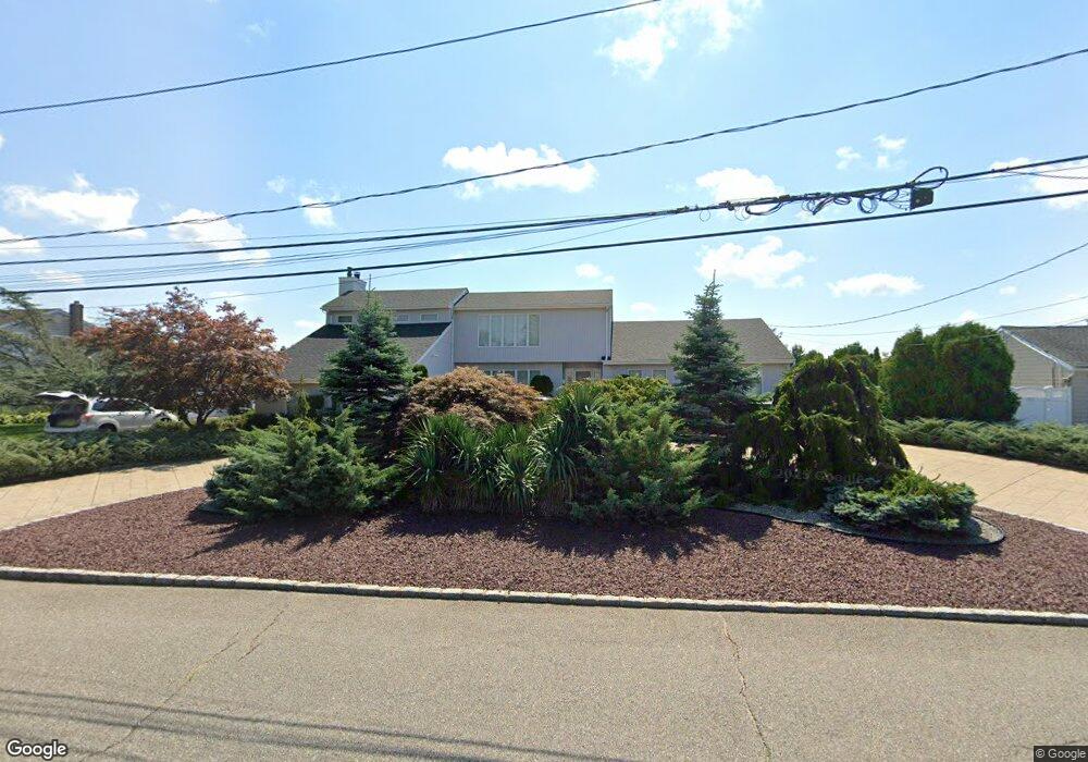
10 Christopher Ct Babylon, NY 11702
Estimated Value: $1,185,796 - $1,711,000
Studio
1
Bath
3,767
Sq Ft
$387/Sq Ft
Est. Value
About This Home
This home is located at 10 Christopher Ct, Babylon, NY 11702 and is currently estimated at $1,458,949, approximately $387 per square foot. 10 Christopher Ct is a home located in Suffolk County with nearby schools including Babylon Memorial Grade School, Babylon Elementary School, and Babylon High School.
Ownership History
Date
Name
Owned For
Owner Type
Purchase Details
Closed on
Feb 26, 2020
Sold by
Loeber Robert and Loeber Marybeth
Bought by
Lewis Bradley A and Lewis Shakira
Current Estimated Value
Purchase Details
Closed on
Jan 4, 2011
Sold by
Marino Vincent and Marino Ida
Bought by
Yasso Michael A and Yasso Carleen
Home Financials for this Owner
Home Financials are based on the most recent Mortgage that was taken out on this home.
Original Mortgage
$700,000
Interest Rate
4.62%
Mortgage Type
Purchase Money Mortgage
Create a Home Valuation Report for This Property
The Home Valuation Report is an in-depth analysis detailing your home's value as well as a comparison with similar homes in the area
Home Values in the Area
Average Home Value in this Area
Purchase History
| Date | Buyer | Sale Price | Title Company |
|---|---|---|---|
| Lewis Bradley A | -- | None Available | |
| Yasso Michael A | $940,000 | -- | |
| Yasso Michael A | $940,000 | -- | |
| Yasso Michael A | $940,000 | -- |
Source: Public Records
Mortgage History
| Date | Status | Borrower | Loan Amount |
|---|---|---|---|
| Previous Owner | Yasso Michael A | $700,000 |
Source: Public Records
Tax History
| Year | Tax Paid | Tax Assessment Tax Assessment Total Assessment is a certain percentage of the fair market value that is determined by local assessors to be the total taxable value of land and additions on the property. | Land | Improvement |
|---|---|---|---|---|
| 2024 | $30,581 | $8,620 | $1,110 | $7,510 |
| 2023 | $26,907 | $8,620 | $1,110 | $7,510 |
| 2022 | $23,852 | $8,620 | $1,110 | $7,510 |
| 2021 | $23,852 | $8,620 | $1,110 | $7,510 |
| 2020 | $28,165 | $8,620 | $1,110 | $7,510 |
| 2019 | $28,101 | $0 | $0 | $0 |
| 2018 | $24,066 | $8,620 | $1,110 | $7,510 |
| 2017 | $24,066 | $8,620 | $1,110 | $7,510 |
| 2016 | $23,813 | $8,620 | $1,110 | $7,510 |
| 2015 | -- | $8,620 | $1,110 | $7,510 |
| 2014 | -- | $8,620 | $1,110 | $7,510 |
Source: Public Records
Map
Nearby Homes
- 24 Midway St
- 28 Deeringwood Ln
- 6 White Birch Dr
- 165 Peninsula Dr
- 35 W Jackson Ave
- 66 Cedar Ln
- 10 Stuart Ave
- 33 Robbins Ave
- 20 Westbridge Dr
- 57-61 E Shore Dr
- 40 Alton Rd
- 87 E Shore Dr
- 278 Fire Island Ave
- 19 Gamecock Ln
- 238 W Islip Rd
- 90 Thompson Ave
- 230 W Islip Rd
- 26 Mitchell Ave
- 121 Sequams Ln W
- 230 Sequams Lane Center
- 6 Christopher Ct
- 14 Christopher Ct
- 11 Christopher Ct
- 20 Christopher Ct
- 2 Christopher Ct
- 7 Christopher Ct
- 15 Christopher Ct
- 105 Lucinda Dr
- 109 Lucinda Dr
- 1 Christopher Ct
- 101 Lucinda Dr
- 113 Lucinda Dr
- 19 Christopher Ct
- 24 Christopher Ct
- 117 Lucinda Dr
- 23 Christopher Ct
- 80 Lucinda Dr
- 84 Lucinda Dr
- 76 Lucinda Dr
- 88 Lucinda Dr
Your Personal Tour Guide
Ask me questions while you tour the home.